Principle 2: Shaping thriving public spaces
How can GBI help shape thriving public spaces?
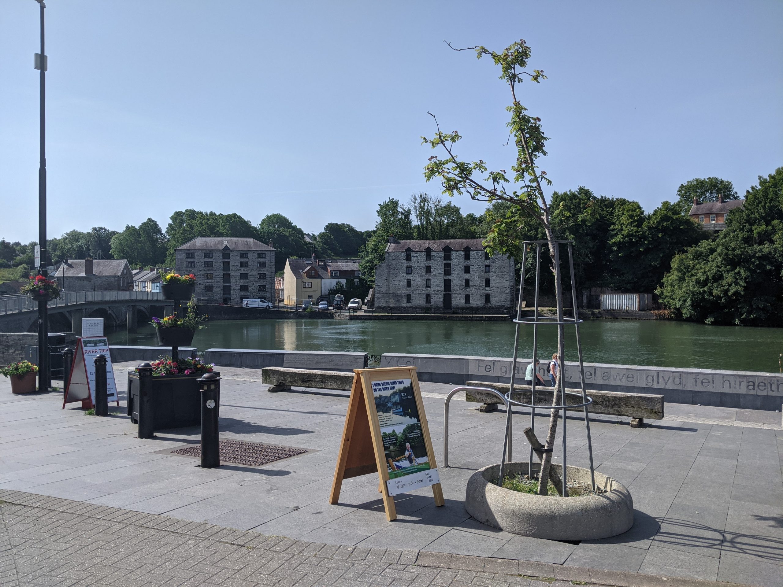
Image: Riverfront area in Cardigan.
Green and blue infrastructure can make an important contribution to improving the quality and sense of place – sometimes called ‘placemaking’.
“Placemaking” entails improving the public space in a settlement through an understanding of what makes a local community unique. It should take into account how people use their existing public spaces and what improvements the community would most benefit from.
In its work on the State of Natural Resources (SoNaRR) report for urban areas, Natural Resource Wales (NRW) places strong emphasis on an in-depth rethinking of urban design, transport and planning so that urban areas can be thought of as ‘urban ecosystems’ at the forefront of addressing the climate and nature emergencies. This would improve quality of life across the board by designing quiet, safe, clean and green urban space.
In Ceredigion, where tourism is an important part of the wider economy, the value of placemaking for boosting the visitor economy is an important consideration.
Heritage features are a key part of any GBI network (see interactive map). They help to tell the story of a place, the landscape that surrounds it and how land use has shifted over time.
The Covid 19 pandemic has accelerated historic trends in the decline of the traditional high street and town centres generally. Wales has one of the highest rates of empty shops in town centres across the UK.
There has been substantial growth in online shopping and home working patterns leading to the closure of shops and re-purposing of office space. Against this backdrop, a GBI-led approach to placemaking is becoming an increasingly attractive option when reconsidering the changing role and function of urban areas.
These trends are forcing local authorities more than ever to rethink the shape and purpose of town centres and how to positively respond to longer term changes. This is likely to focus beyond retail and look to residential, leisure, education and community uses – all of which can benefit from a more GBI-led regeneration focus.
What does national and regional policy say?
‘Future Wales’ The National Plan 2040 sets the direction for future development in Wales. Policy 2 (Shaping Urban Growth and Regeneration – Strategic Placemaking) requires the growth and regeneration of towns to shape sustainable places, integrated with green infrastructure. This should be informed by a planning authority’s Green Infrastructure Assessment (GIA).
Two goals set out in the Well-being of Future Generations (Wales) Act 2015 also have implications for placemaking:
- ‘A Wales of Cohesive Communities’
- ‘A Wales of vibrant culture and thriving Welsh language’.
The Act defines a cohesive community as an attractive, viable, safe and well-connected community. Just as important is promoting what makes Wales unique – a society that promotes and protects culture, heritage and the Welsh language.
Planning Policy Wales (PPW) sets out the land use planning policies of the Welsh Government. It identifies the integration of green infrastructure as a key placemaking outcome and as an integral part of the design process. The process should deliver ‘distinctive and natural places’. It also requires local authorities to secure wider green infrastructure benefits along transport networks.
What does local policy say?
Policy LU24 of Ceredigion’s existing Local Development Plan (Provision of New Open Space) requires the provision of additional open space where appropriate as part of new development. Policy LU17 (Tourism Facilities/Attractions) highlights the importance of including environmentally friendly measures when broadening the tourism base.
Ceredigion’s 2020 Green Infrastructure Assessment (GIA) identified the following objectives related to quality of place:
- To address the geographical disconnect between Ceredigion’s urban areas and the County’s terrestrial designated sites.
- To improve GI assets in and around harbours.
- To improve access to the river network by expanding walking and cycling paths.
- To provide for Ceredigion’s recreational needs through GI assets.
The Green Infrastructure Assessment also highlights major areas where GI can contribute to a sense of place, by:
- Screening out noise pollution.
- Connecting local environments.
- Boosting visual amenities.
A series of additional opportunities are set out within locally based Place Plans for each of Ceredigion’s towns. This is driven by a “bottom up” national approach to community planning in Wales. The plans, once adopted, will act as Supplementary Planning Guidance (SPG) below the Local Development Plan.
These plans provide the local community with an opportunity to collaborate and discuss what needs to happen to make their places the best they can possibly be: including opportunities for enhancing green and blue infrastructure.
What are the challenges and pressures this GBI Strategy needs to address?
Ceredigion’s ‘sense of place’ – and potential for connection to the natural environment – is one of the County’s most valuable assets. The majority of the coast is of high landscape value and is integral to Ceredigion’s wider character and tourist economy. The Ceredigion Wellbeing Assessment illustrated that 94% of residents are “satisfied with their local area” – the highest percentage in Wales.
Important designations include 35 kilometres of Marine Heritage Coast, 4 landscapes of Special Historic Interest, as well as a network of historic gardens, ancient monuments and conservation areas (see interactive map for more detail).
“Civic pride could be built around the local and planet-friendly emphasis of our county.”
– Stakeholder comment (survey)
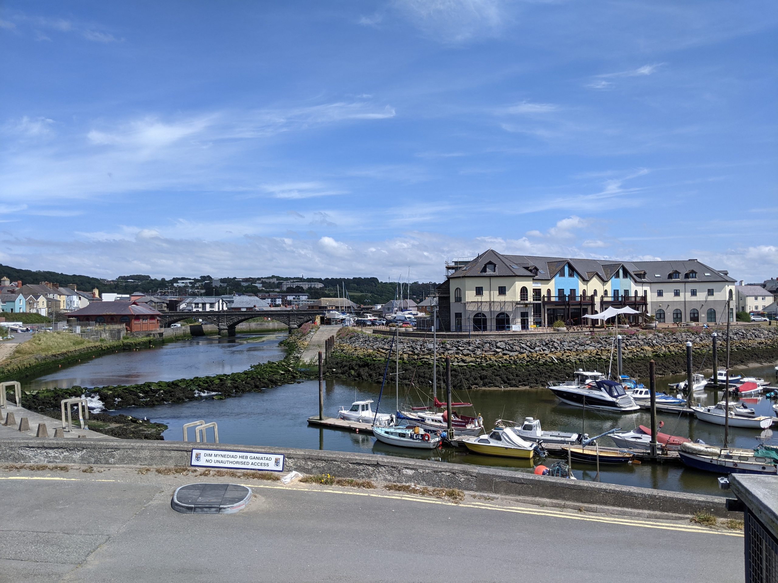
Image: Connection to the water in Aberystwyth.
However, there is significant room for improvement – particularly in helping Ceredigion adapt to longer term trends. Stakeholders engaged during the development of this Strategy highlighted a lack of awareness of what is available within the GBI network to residents and tourists and how to access those features. This includes poor signage in some places and a missed opportunity in using the natural environment to drive sustainable tourism.
‘Green routes’ to connect places by walking and cycling were highlighted as important opportunities, as well as improving the quality and maintenance of coastal areas. However there are concerns about the potential impacts on wildlife from recreation in sensitive locations (where footfall might bring dog disturbance and litter among other impacts).
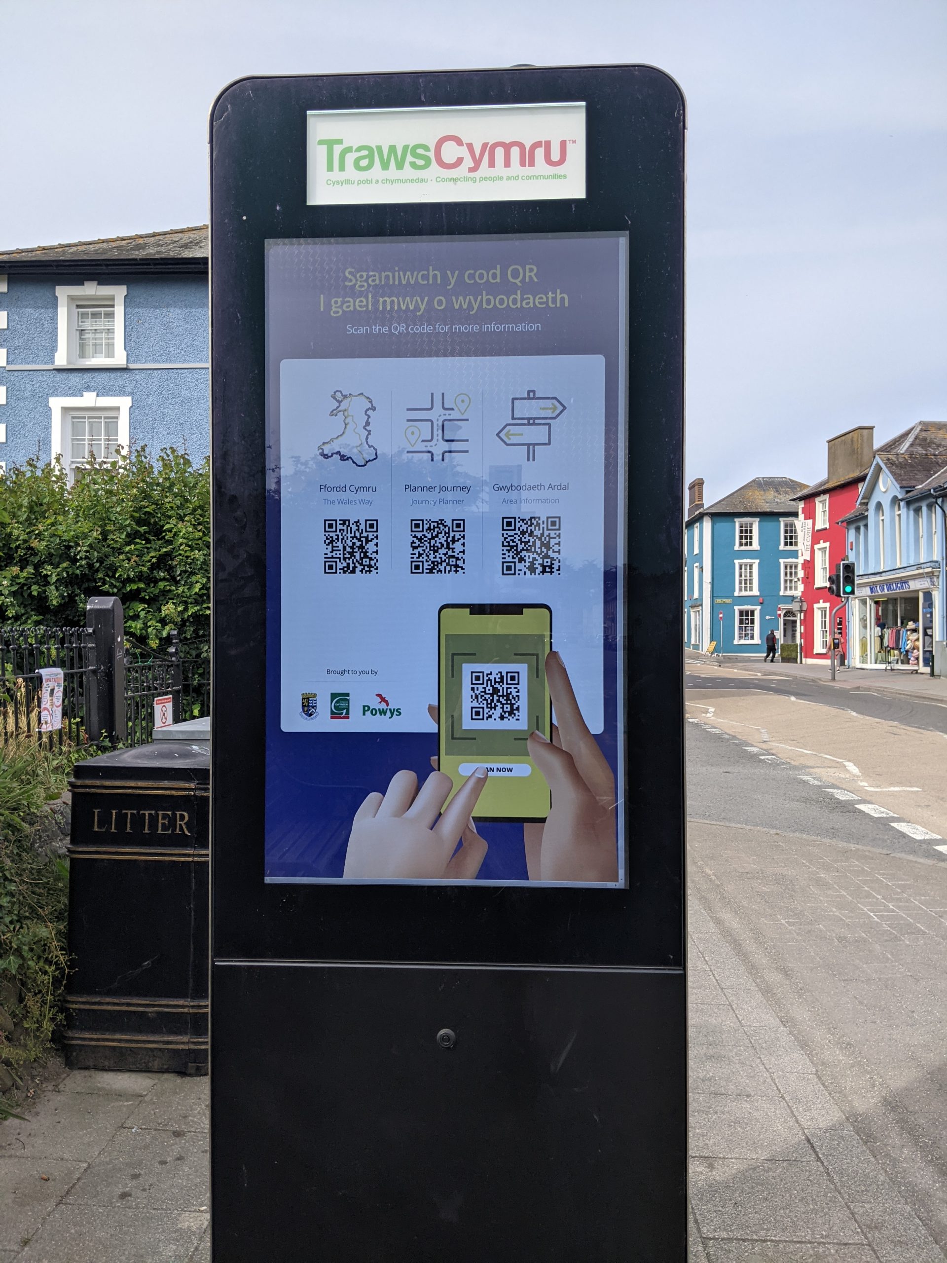
Image: Existing digital wayfinding resources in Ceredigion.
There is also great scope to increase the quality of place within Ceredigion’s towns themselves – increasing their attractiveness as ‘stopping off points’ for those exploring the landscapes which surround them. This would provide a significant boost to local economies which can otherwise struggle in the face of the shifting economics of place – the Ceredigion Wellbeing Assessment highlights how Ceredigion is highly dependent on micro or small businesses, and the Covid pandemic had a significant impact on the tourism and hospitality sectors.
Existing assessments of the GBI network highlight that there appears to be fairly limited GBI assets in Ceredigion’s towns, with the exception of Aberystwyth. Some of these town centres are perceived to be in decline, and poor management of green spaces is a challenge.
Existing work has also highlighted the potential of harbours in creating a focal point in a town and sense of place – helping to engage people, in particular in creating a stronger connection with the “blue” environment.
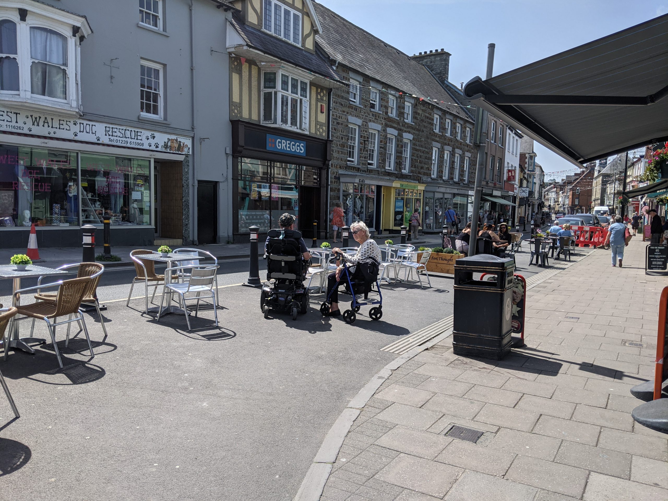
Image: Street scene and cafes in Cardigan town centre
Summary of key issues
- The need to build on the foundation of a strong ‘sense of place’ in Ceredigion by providing better connectivity between Ceredigion’s towns and the highly valued landscapes which surround them.
- Poor quality of place and scarcity of GBI assets within some of Ceredigion’s town centres – exacerbated by poor management and maintenance.
- Importance of ‘green routes’ for walking and cycling to connect places.
- Concerns over balancing place enhancements with any impacts of recreational pressure on Ceredigion’s most sensitive habitats.
- The potential of enhanced and regenerated harbour and coastal areas to strengthen the connection between people and the “blue” environment.