Llandysul Memorial Park and Circular River Walk
Purpose
To introduce a footbridge and riverside walking route to increase footfall between key destinations in Llandysul. The river walk would help to establish a nature-rich corridor, provide opportunities to interact with the town’s river and provide a nature-based solution to manage flood risk.
Key elements
- Creation of an ‘access for all’ riverside walk.
- Riverside tree cover and habitat restoration.
Delivery
Potential partners: Natural Resources Wales, Dŵr Cymru / Welsh Water, Environmental Record Centre for West Wales, Ceredigion Disability Forum, Walking for Wellbeing, “Walkers are Welcome” group, Llandysul Town Council, The Llandysul Paddlers.
Indicative costs: £4 – 4.5 million (see Appendix 3 for details on project cost estimates)
Description
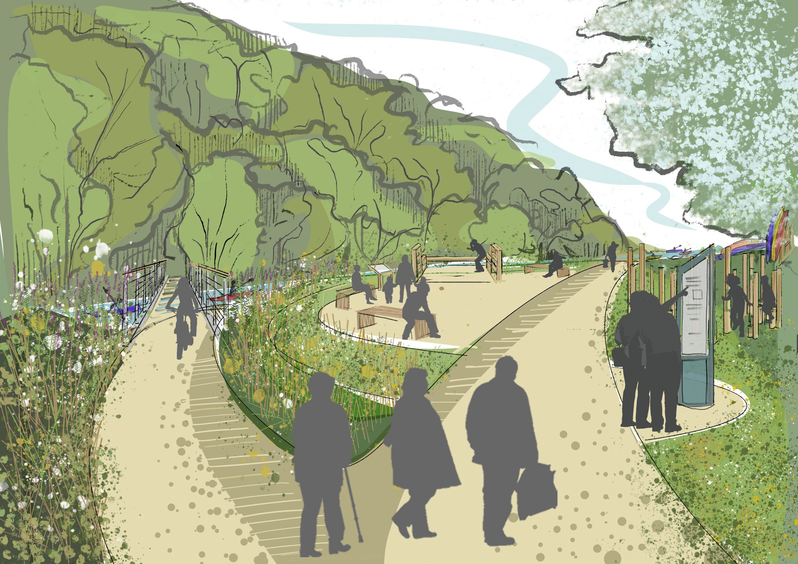
Element 1: Creation of an ‘access for all’ riverside walk
The introduction of a footbridge crossing the Afon Teifi would create a safe, direct, and more attractive walking route that would encourage the thousands of yearly visitors to Llandysul Paddlers to discover the shops, cafes and businesses in Llandysul. The route would connect the Tirdref Playing Fields (in Ceredigion) and Llandysul Paddlers and Canoe centre (in neighbouring Carmarthenshire)
As part of the intervention, the Tirdref playing fields could host events for the community and Llandysul paddlers – this would help to celebrate the town’s culture and beautiful natural assets. Proceeds from events could provide funding for nature restoration and would provide an opportunity to bring volunteers together to maintain the river walk as a community asset. The route would also provide a direct pedestrian crossing between the two neighbouring Counties.
As a circular walk, it could connect the town centre to the existing riverside footpaths in the Memorial Park and Tirdref Fields. This would cross over a new bridge to the Llandysul Paddlers and across Bridge Street to the quarry.
If well designed, a flat and nature-rich riverside walk would be an important and accessible wellbeing resource for the town’s older residents. Introducing informal playful spaces (from stepping stones, to climbing logs or other nature-based play features) would make these natural spaces more interactive for families to explore. Together, this offers the opportunity to create a truly intergenerational community space.
The surfacing on existing and new paved routes should be well maintained, accessible and safe. For those sections of the trail that are on-road, high quality, wide pavements should be introduced to separate pedestrians from traffic. Clear and consistent signage should direct pedestrians safely over Bridge Street.
The scheme should consider signage (ideally using natural materials) to the footpath through the woodland area north from the Quarry path. This would help to connect the route through the former school site and up to residential areas in the Beeches neighbourhood.
A bridge over the river to the Half Moon Inn could also be explored. This would connect the quarry path with the pub and would encourage footfall on Lewis Street.
Links and signage to the town centre should be prioritised as part of the scheme. Local destinations and businesses could be highlighted as part of signs reading ‘Cafes and shops – 5 minutes’.
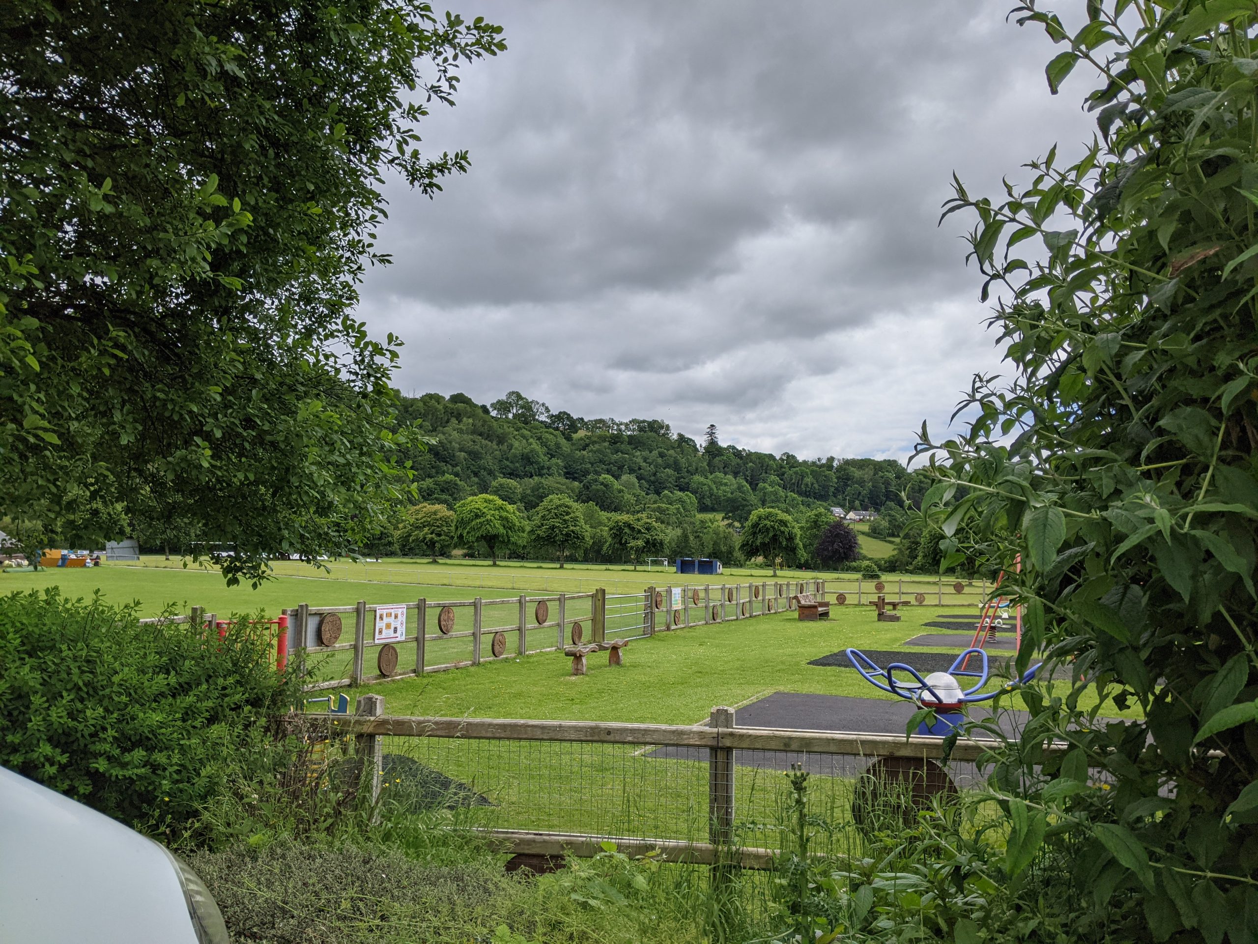
At key nodes, heritage assets and viewpoints, space could be carved out for social spaces. This would provide opportunities for quiet relaxation, picnics, BBQs or pop-up events. Potential locations include the quarry, the riverside at Memorial Park and Tirdref Playing Fields.
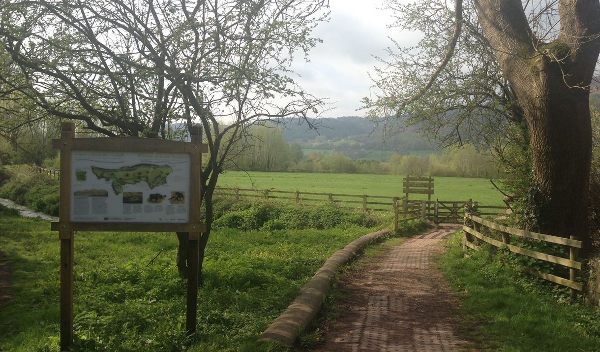
Memorial Park and Tirdref Playing Fields River Teifi, Stallion Valley
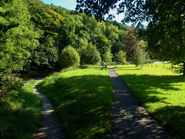
Memorial Park from Church Street Car Park
Element 2: Riverside tree cover and habitat restoration
Extending tree cover and planting local wildflower species along the river walk (and along the boundaries of Memorial Park and Tirdref Fields) would contribute to the County’s ‘carbon sink’, increase biodiversity and support efforts to restore the health of the river. It would also better connect habitats by allowing mammals, birds and bees to move along green corridors between Llandysul’s green spaces.
Riparian (riverside) planting along the Afon Teifi would prevent further erosion of the riverbanks. It would also reduce flood risk and help mitigate against nutrient run off into the river.
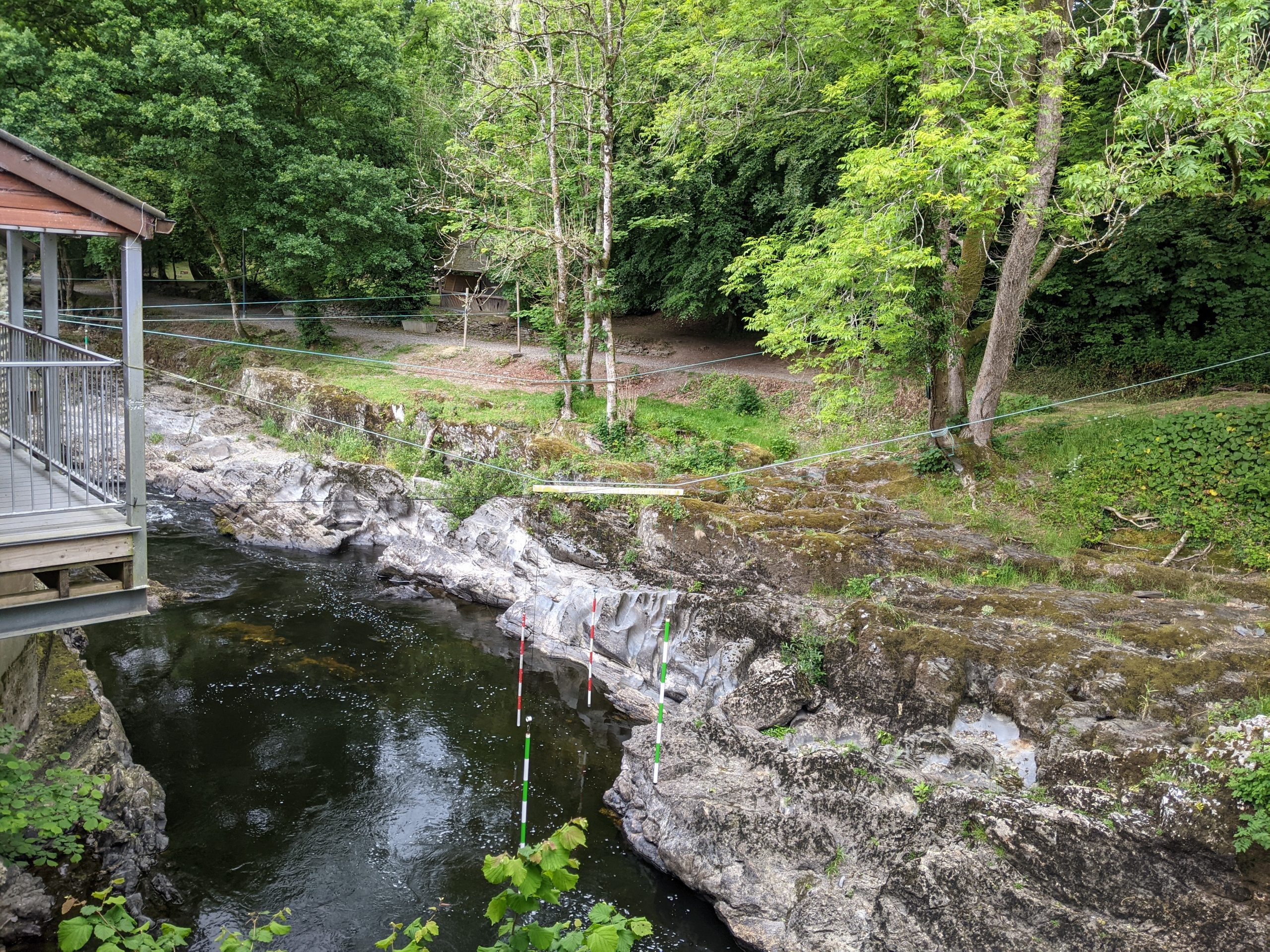
Any footbridge across the Afon Teifi should be sensitively delivered to enhance and protect natural habitats. When designing the walking route, the use of boardwalks (using natural materials) is an alternative which could help to elevate the trail and could be designed to reduce stress on sensitive habitats, while providing a connection between people and the river. Trails should be carefully designed to keep recreational traffic away from the most sensitive areas of the river corridor.
The Quarry on the Teifi in Llandysul
Inspiration from elsewhere....
Abergavenny is another popular town for paddlers. Walking routes along the River Usk are well used, including a river health walk and heritage trail. The river is well connected to the town centre which also increases visitor footfall in the town.
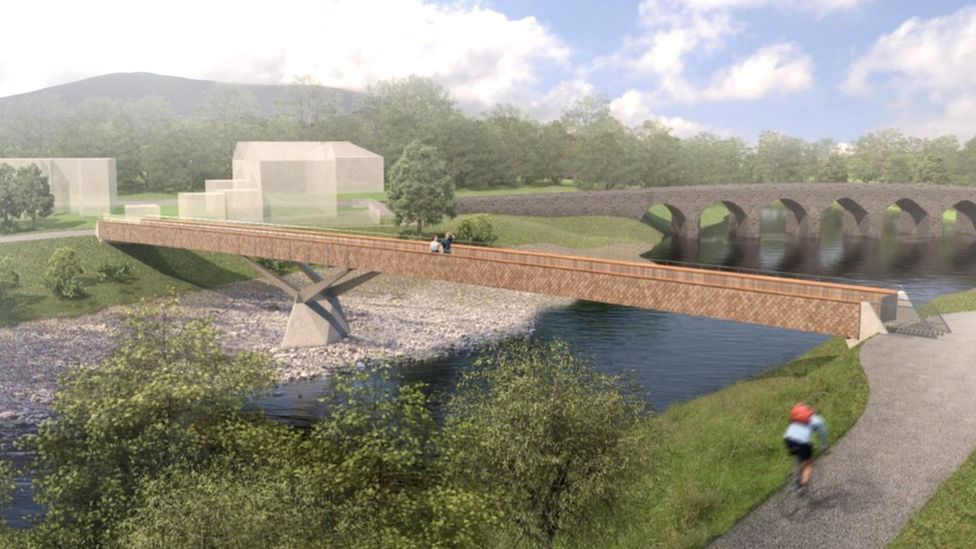
Park spaces along the route host small cafés to cater to riverside and park walkers. Abergavenny recently got approval for a pedestrian footbridge across the River Usk, to provide an alternate safe and accessible route across the river. The route will provide a pedestrian link between Abergavenny and Llanfoist.
The Welsh Government has provided funding for the project in support of its active travel policies.
Case study image: River Usk health walk (Visit Monmouthshire)
Case study image: Visualisation of planned Abergavenny footbridge (Monmouthshire County Council)