Llandysul
Overview of GBI opportunities for Llandysul
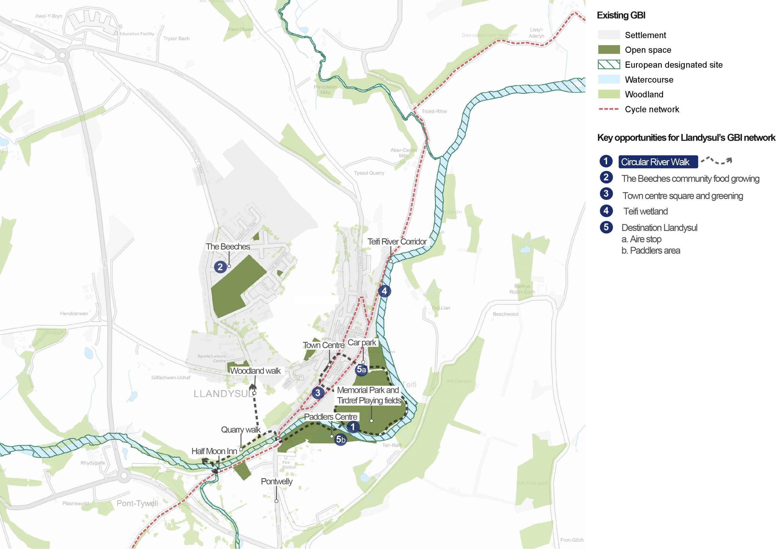
An overview of Llandysul
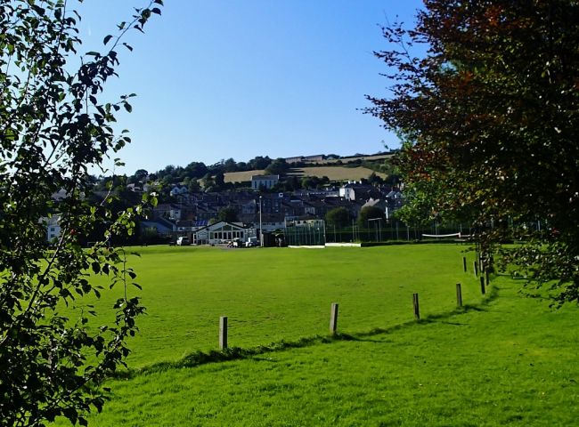
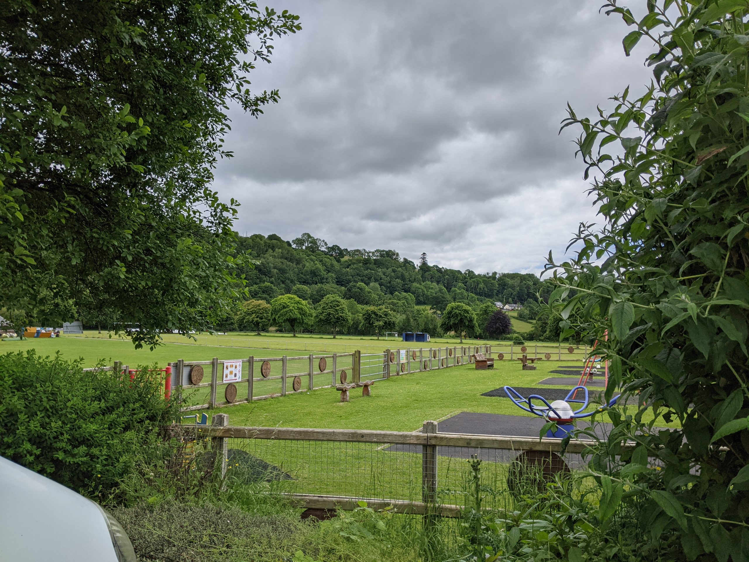
Memorial Park and Tirdref Playing Fields, Stallion Valley
Llandysul is a small market town of around 2,700 people (according to the 2011 census) lying north of the Afon Teifi and adjacent to the neighbouring County of Carmarthenshire. The town lies in the transitional area between the broad U-shaped valley of the Middle Teifi and the more enclosed, wooded slopes and gorges of the lower reaches.
The town is split into the historic centre (on the edge of the floodplain, at the base of steep hillslopes) and modern development, (known as The Beeches, set on the elevated plateau). The narrow floodplain, including land within a large meander, is undeveloped and provides space for a park and playing fields.
The town’s name comes from Saint Tysul, who gave the name to the town’s “Century Church”. Later growth was associated with the wool trade in Wales. Mills were powered by the fast-flowing streams in the local area. Today these “blue” assets make Llandysul popular for canoeing with the town being home to the Llandysul Paddlers canoe club.
National Cycle Route 82 and Ceredigion County Council cycle routes run through the town. These provide links through the Teifi valley towards Cardigan to the west and north through Lampeter and Tregaron.
Llandysul has been identified as part of the Teifi Valley Regional Growth Area – in Future Wales – National Plan 2040.
“There are certainly a number of good green routes and green spaces, but these are not managed by any form of co-ordinating group or agency.”
– Stakeholder, online survey
See Appendix B for a summary of all stakeholder comments.
What are the key challenges facing Llandysul?
Walking and cycling access: The steep topography in the town presents a challenge for active travel, particularly for less mobile members of the community. However, the increasing availability and popularity of e-bikes could help to overcome this challenge. The limited number of river crossings across the Teifi (which play an important role in linking Llandysul to neighbouring Pontwelly south of the river) poses further connectivity challenges.
Town centre economy: The challenge of attracting people to Llandysul’s town centre has been exacerbated by the closure of the livestock market and banks. The Post Office has also relocated out of the high street. This had negative impacts on established small local businesses. Creating a vision of a town centre that is nature-rich, attractive and accessible by walking and cycling for as many members of the community as possible will help to reestablish a thriving town centre.
Water quality: Llandysul is located along the lower reaches of the Teifi, where phosphorous levels are causing severe challenges. The most recent assessment of river water quality against phosphorous targets indicated that the targets were now being exceeded at Llandysul due to cumulative loading. The Cerdin, Tyweli and Teifi water quality remains of “high” quality for other chemical parameters. The water is assessed to be of “good” quality in biological terms.
Flood risk: The community of Llandysul has been subject to a number of devastating flood events. These include Storm Callum in 2018, when numerous residential and commercial properties were affected and roads were closed. In response, the County Councils of Carmarthenshire and Ceredigion partnered with Natural Resources Wales (NRW) to launch a consultation event presenting options for mitigating flooding in the town. At the time of writing, this consultation is live and presents a number of options for mitigation. These range from “hard” engineering solutions to natural flood management (NFM)
Tree cover: Llandysul has the lowest overall tree cover of all urban areas in Ceredigion. According to NRW data, cover stands at less than 10% within the town itself. This makes the area potentially less resilient to climate change. Exploring opportunities for tree planting and woodland creation in Llandysul should be a key priority.
Flagship project: Memorial Park and Circular River Walk
For more information on this project, see the dedicated Llandysul Memorial Park and circular river walk flagship project page.
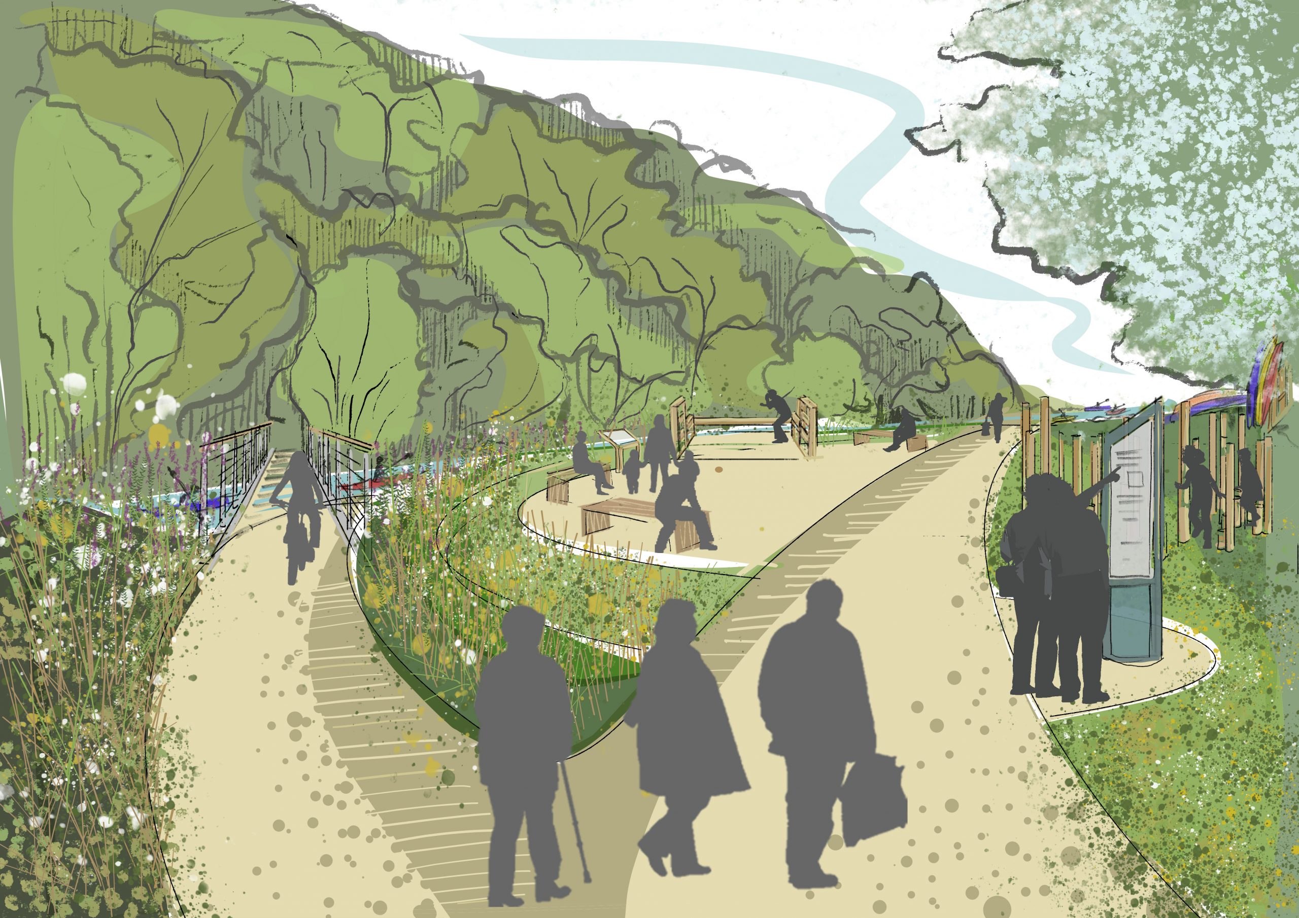
Purpose: To introduce a footbridge and riverside walking route to increase footfall between key destinations in Llandysul. The river walk would help to establish a nature-rich corridor, provide opportunities to interact with the town’s river and provide a nature-based solution to manage flood risk.
Project 2: The Beeches community food growing
Purpose: To encourage community food growing and sharing and to create a cheerful network of edible planting through Llandysul’s more deprived neighbourhoods.
Example of a community growing space

Potential partners: Ceredigion County Council Tackling Hardship Strategy and Action Plan, Ieuenctid Tysul Youth, Yr Ardd, The Orchard Project.
Description: Llandysul already benefits from significant local enthusiasm for community food growing, led by community food growing project Yr Ardd. There is also interest in piloting suburban food growing schemes in lower income neighbourhoods of the town, such as The Beeches neighbourhood.
A neighbourhood scheme should be led by the local community and supported by groups who are able to share knowledge, funding, time or resources.
Community food streets (also known as ‘incredible edible neighbourhoods’) often start with identifying unused and unloved open spaces on a street or in a neighbourhood. These areas are then used for the planting of vegetable beds, raised planters, fruiting trees or small orchards.
The establishment of community hubs are powerful ways to share tools, bring volunteers together and raise awareness, through events focused on food sharing, seed swapping or pop-up neighbourhood meals. Connections with local schools can also be made. Collectively, this would drive local enthusiasm for planting and growing.
Local food growing has multiple benefits. Gardening and growing is an important wellbeing resource, an educational tool to learn how to grow food and understand local food systems, and a great way to socialise and bring different members of the community together. Introducing trees, planted vegetable beds and food planters also brings colour, pollinators and greater biodiversity.
Inspiration from elsewhere…
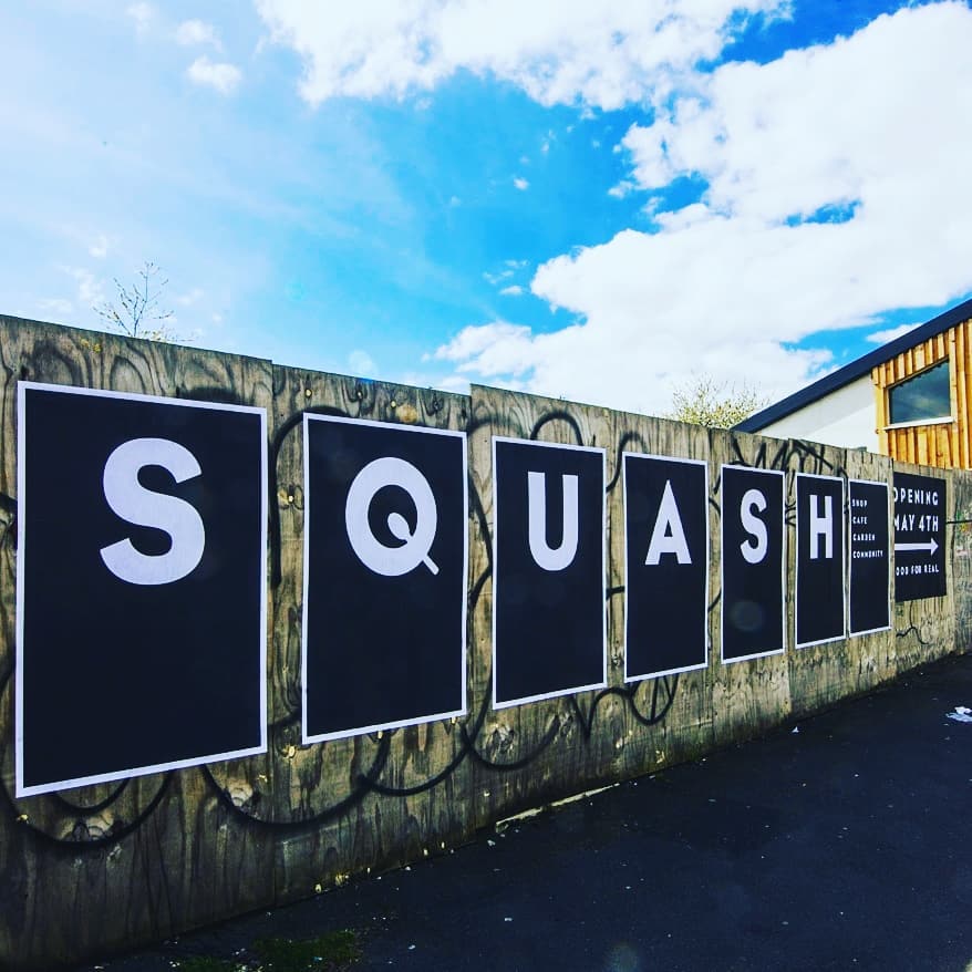
The Squash community food garden in Toxteth (Liverpool) started by transforming streets in the neighbourhood using food growing planters and fruit trees. It later expanded by planting community food gardens in underused green spaces. Finally, the project also built a community food hub that acts as a local cafe, community event space, seed swap, food shop and provides lessons in seasonal, cheap healthy cooking.
Case study image: Squash community garden (Squash)
Project 3: Llandysul town centre square and greening
Purpose: To introduce attractive, nature-rich planting features that will connect habitats through the town while providing a softer, enhanced sense of place within the civic spaces of the town centre.
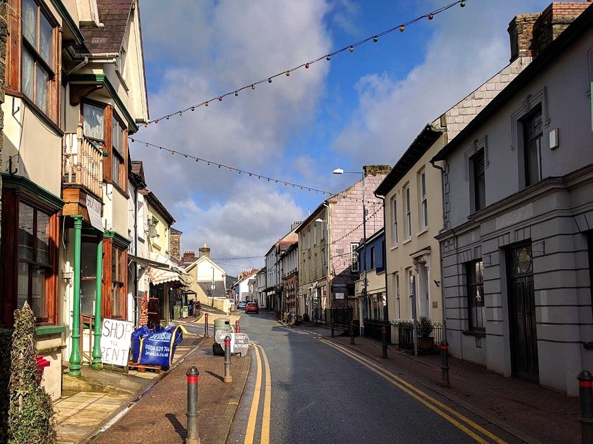
Centre of Llandysul (Rural Futures Wales)
Potential partners: Ceredigion County Council, local businesses, Llandysul Town Council.
Description: The one-way system in Llandysul provides space to enhance the quality and walkability of public space in the town centre in order to create a more successful thoroughfare along Church Street, Wind Street, High Street, Lincoln Street and King Street.
This could be achieved through pedestrian-friendly interventions such as dropped kerbs and unified paving, in line with guidance from Manual for Streets. On Bridge Street, opportunities to improve pedestrian crossings and widen pavements would create a more walkable town centre and address the severance created by major roads between the town centre, the Llandysul Paddlers, and Pontwelly.
Multifunctional urban greening should be an important element of this reallocation of space. “Rain garden” borders could be introduced in place of kerbs and bollards, creating attractive routes through the town. It is important that these features go beyond ornamental value to deliver multiple benefits, primarily by slowing the flow of water runoff in sections of the town centre at risk of flooding. They could also provide the additional benefit of creating a wildlife corridor through the urban area.
Community food growing (see Project 2) could be extended through the town centre with window boxes and planters. Initial priority locations would be main streets such as Church Street, Wind Street, High Street, Lincoln Street and King Street.
At the time of writing, Llandysul Town Council are trying to acquire land in the town centre to create a town square. Options include the acquisition of the former printworks, a car park and bank to create a town square on two levels (between Wind Street and New Road). Creating an attractive green pedestrian route through this site would successfully connect routes from the Paddlers, through the Tirdref playing fields, and directly to the town centre. This would offer the opportunity to increase footfall through the town and to successfully weave green space through the town centre.
A town square would create an important public space for events, outdoor seating and socialising. Integrated seating and planters could be introduced to create space for the public to rest and socialise as well as for businesses to spill out onto the square.
The space could be made explicitly ‘bike friendly’ by introducing features such as a water fountain, solar powered charging points for e-bikes, a bike pump and shared maintenance tools. This would give local cyclists and visiting cyclists passing through the town a place to congregate or stop and explore the local businesses, cafes and shops. A focus on e-bikes would help to overcome the challenge of the surrounding hilly landscape.
Together these features would boost the visitor economy by showcasing Llandysul as a “gateway” location to the wider countryside.
Inspiration from elsewhere…
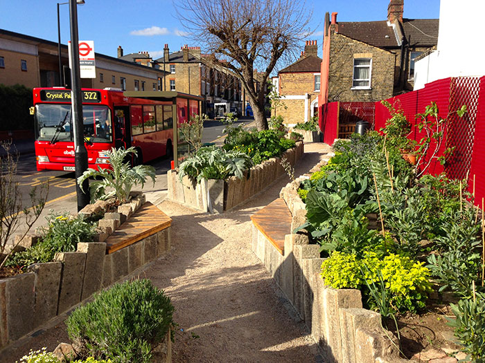
In nearby Lampeter, the Incredible Edibles project has introduced planters outside local supermarkets with herbs, salads, edible flowers, vegetables and fruiting plants. Similarly, ‘Edible bus stops‘ have been introduced as part of London’s transport network. A similar scheme could be pioneered in Llandysul to “green” bus stop roofs and seating areas.
Bee bus stops, which have living roofs covered with wildflowers and sedum plants, have been introduced in Leicester, Brighton, Derby, Oxford and Hereford.
Case study image: Edible bus stop in London (Carbon Gold)
Project 4: Teifi wetland
Purpose: To improve the health of the Teifi river corridor and provide a nature-based solution to flood risk through the creation of a wetland habitat in Llandysul. The wetland could also be used as a recreational, wellbeing and educational resource for the local community.
Potential partners: Natural Resources Wales, Dŵr Cymru / Welsh Water, Environmental Record Centre for West Wales, Walking for Wellbeing, Welsh Wildlife Centre, Llandysul Town Council , Wildfowl and Wetlands Trust, local schools, Ceredigion and Carmarthenshire County Councils.
Description: Stakeholders have expressed interest in identifying a site for a wetland in Llandysul to boost the town’s natural flood defences, increase biodiversity and explore educational and community uses of the river corridor.
Project partners will need to work with local landowners to identify a floodplain site on the Teifi river corridor near Church Street. This would help to mitigate areas currently identified as being at high risk of flooding and would help to mitigate flood risk downstream in Llandysul.
Natural flood management (NFM) has been identified as an option for improving flood resilience during the ongoing (at the time of writing) Llandysul/Pont Tyweli consultation event. Previous work has identified land to the east of the Teifi (near Dol Llan farm) as a potential location. Other options include locations further upstream, more distant from the town itself.
Wetlands are created with soft engineering to allow water to cover soil in a controlled area, creating a series of ponds and flooded spaces that form an appropriate eco system for planting wetland shrubs, grasses and trees. Wetlands have been called ‘biodiverse super systems’ because they can support such a large number and variety of species. Wetlands slow the flow of water, which naturally reduces surface water flood risk downstream of wetland sites.
Creating a wetland in Llandysul would reduce the level of nutrients downstream of the Afon Teifi, including the level of phosphates. This is because water slowly flows through the wetland, naturally occurring processes absorb, transform, sequester, and remove phosphates, nitrates and other chemicals.
Boardwalks connecting to the river path could be introduced to provide access to the wetland site and a wellbeing programme could be explored with local schools. Educational boards could also be used to create an interactive nature trail through the wetland.
Inspiration from elsewhere….
The Integrated Wetlands project in Herefordshire has been implemented to address the problem of nutrient (specifically phosphorous) loading on the River Lugg SAC – similar to those problems encountered along the Teifi.
The project includes the construction of a new system of wetland on land next to the Welsh Water sewage works at Luston. These wetlands will receive water from the sewage works and provide additional treatment of the water before it is allowed to flow into the Lugg.
The ‘SuDS for Schools’ program, run by the Wildfowl & Wetlands Trust, introduced mini wetlands in ten schools in a North London catchment found to be at risk from surface water flooding. They also became places where students can play and learn outdoors. As a result, the schools became hubs for reconnecting the local people with their river. A similar programme could be led by local schools in Llandysul as part of a large-scale wetland project, focussing on reconnecting young people with the Afon Teifi.
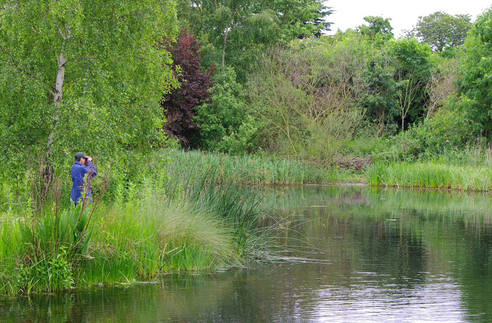
Example of an urban wetland (Wildfowl and Wetlands Trust)
Project 5: Destination Llandysul
Purpose: To increase the interaction of both locals and visitors with the river in Llandysul – providing benefits for health, wellbeing and biodiversity.
Memorial Park from Church Street Car Park
Potential partners: Natural Resources Wales, Dŵr Cymru / Welsh Water, Carmarthenshire County Council, Llandysul Paddlers Club.
Description: Llandysul’s location on the beautiful Afon Teifi provides an opportunity to build a thriving connection with this blue corridor for both locals and tourists. The success of the Llandysul Paddlers indicates the increasing desire for connection with nature and the water environment. This project covers a series of interventions which would boost the visitor offer of Llandysul as a nature destination.
One of the options being explored by Natural Resources Wales (NRW) along with the County Councils is to remodel the floodplain within the area of Paddlers Lake. The aim is to increase flood storage capacity and provide new overflow routes back to the Teifi. This intervention could provide an opportunity to expand and enhance Paddlers Lake, expanding and enhancing its functions.
Improving the lake’s connectivity with the river could also present opportunities for wetland creation around its margins and for new canoeing or rafting channels. Changing shelters and shower facilities for recreational river users should be considered.
Formalising a space for touring vans and campervans in the town would encourage an increasing number of motorhome users in the local area to stay overnight in the town, use its facilities and visit local businesses. The car park off Church Street presents one option – it is set against a backdrop of Parc Coffa and the river corridor, with well-maintained public toilets adjacent. The location would be within easy walking reach of the town centre and (with a new pedestrian footbridge as outlined in Llandysul’s flagship project) would also be within a short, pleasant walk to Paddlers Lake and its facilities.
The setting of the site could be enhanced through tree planting, picnic bench seating and bins, EV charging points and 24-hour access to the public toilets. This could also provide an opportunity to incorporate “rain gardens” and other soft landscaped SUDs features into the car park area.
Inspiration from elsewhere…
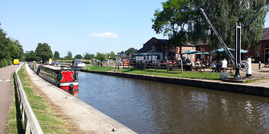
Fradley Junction in Staffordshire is where the Trent & Mersey and Coventry canals meet. A nature reserve, accessible woodland trails and an angling pool were created at the site in order to enhance the area as a destination, whilst also leaving inaccessible marshy edges for wildlife. Recycled materials were used to build the angling platforms, seating and boardwalks. School children were also involved in the project to design timber sculptures and carvings for seating areas.
Craven District Council, Yorkshire, has established several “Aires” (stops for motorhomes) across its rural towns and villages. They have supported the visitor economy and particularly the night time economy of the areas. As a result, it boosted Council income, helped to make the local area more secure and helped to address antisocial behaviour.
Case study image: Fradley Junction (Canal and Rivers Trust)