Aberteifi Otter Walk
Purpose
To improve Aberteifi’s connection with the Afon Teifi, to increase the biodiversity and quality of greenspace along the riverfront and to encourage walking to local green spaces.
Key elements
- Enhancing ribbon of green spaces along the river (Prince Charles Quay, the Strand and Quay Street car park).
- Creating green connections
- Riverside planting for biodiversity
Delivery
Potential partners: Natural Resources Wales Flood Defence Scheme for Cardigan , Dŵr Cymru / Welsh Water, Cardigan Nature Watch, Environmental Record Centre for West Wales, Ceredigion Disability Forum, Walking for Wellbeing, Welsh Wildlife Centre, Cardigan Town Council and Biodiversity Subcommittee.
Indicative cost: £1 – 1.5 million (see Appendix 3 for details on project cost estimates).
Description
Improving Aberteifi’s connection with the Afon Teifi would provide an important wellbeing resource for the local community. It would also act as a focal point for visitors to the town and would enable the movement of people and wildlife along the river corridor. Key proposed interventions in green spaces along the corridor are provided below.
Element 1: Enhancing ribbon of green spaces along the river
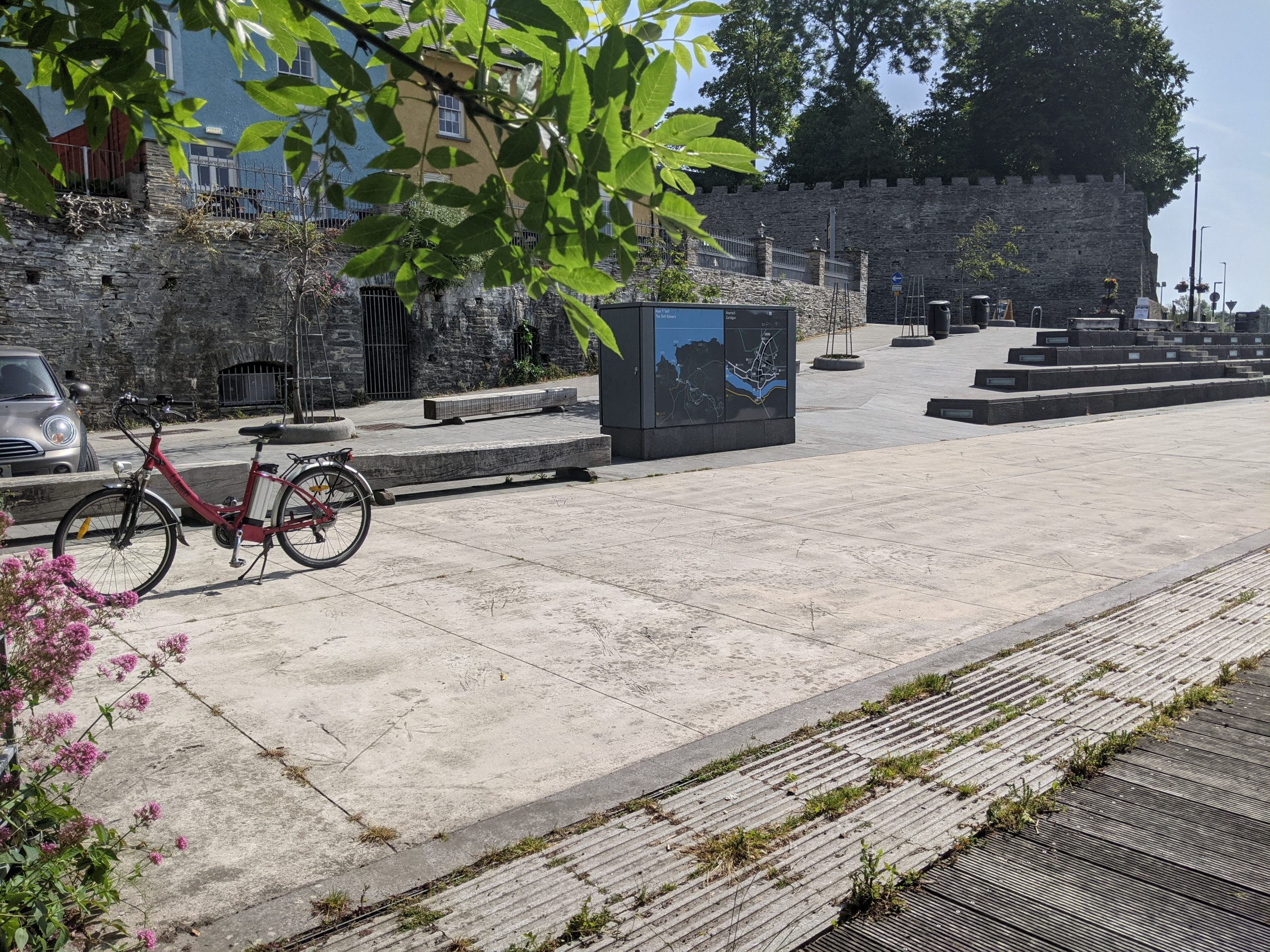
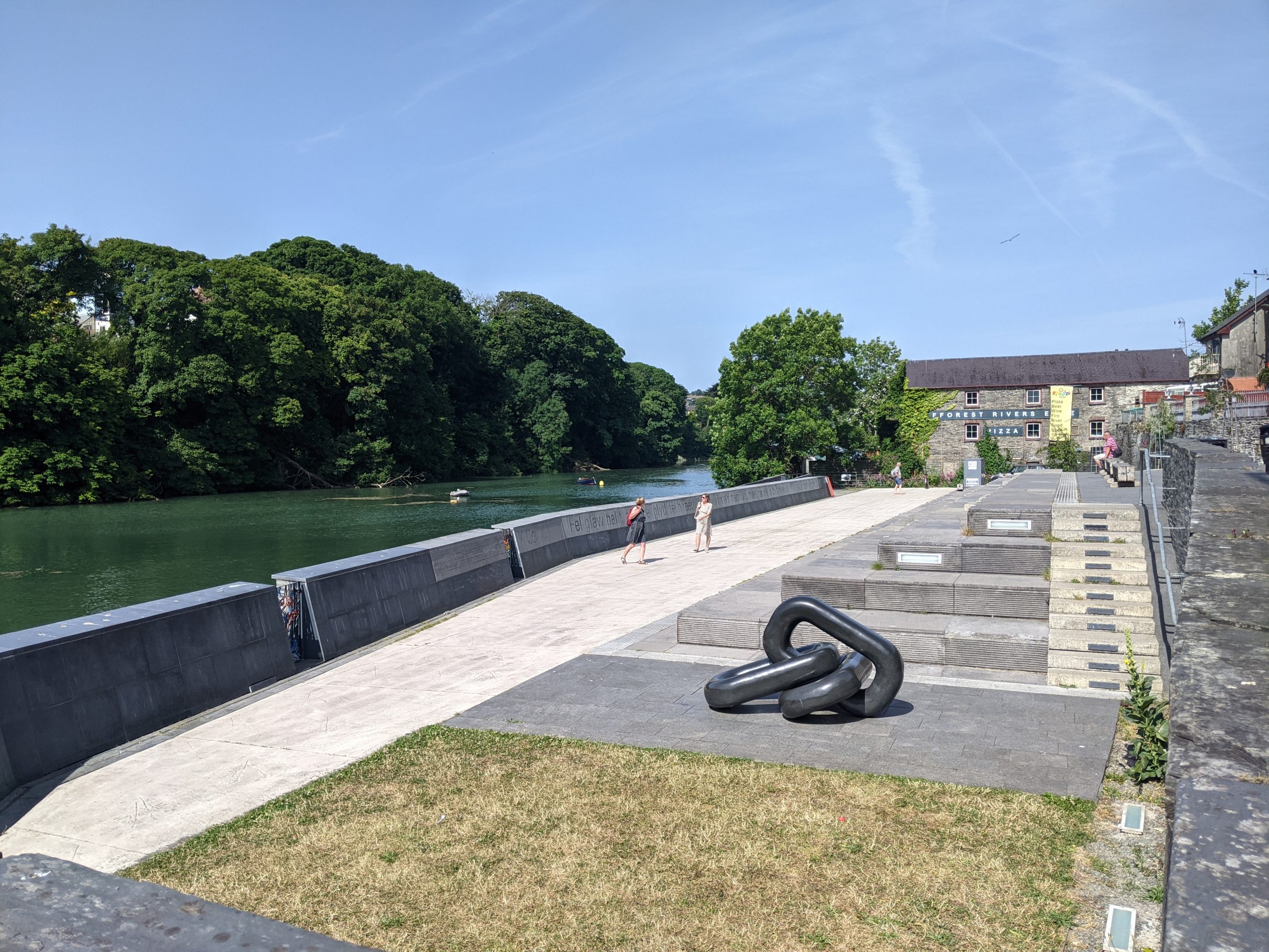
Prince Charles Quay:
- Planting a mature tree line along the northern perimeter of the existing public space, in place of the existing bollards, would screen Prince Charles Quay from traffic on Bridge Street. This would create a more tranquil experience for pedestrians to enjoy the natural environment.
- Planting trees with large canopies at intervals through the space, and on the existing lawn in the north east corner, would provide shade on hot days and rain cover on wet days.
- Adding a scattering of informal timber decked seating near to the trees would help to break up the space and create smaller, more intimate, spaces for socialising, music performances and buskers, or for eating a picnic or lunch. Wildflower planters could also be introduced in front of the tidal defence wall to break up the appearance of the existing concrete wall.
- Informal, nature-based play could be created on the existing lawn space in the north east corner. Features should prioritise natural materials and could include timber climbing logs or a playable wooden otter, as a nod to the town’s unofficial otter mascot. Climbing hand and footholds could be added on part of the concrete tidal defence wall to activate the space for children and families.
- Cycle parking, a bike pump and water fountain could be added to create a welcome space for walkers,wheelers and cyclists alongside the existing tourist information boards in the western corner of the space.
- Options should be explored to remove vehicle traffic from the access road, with the exception of deliveries. This would be important in making the riverside more accessible for wheelchairs and bicycles.
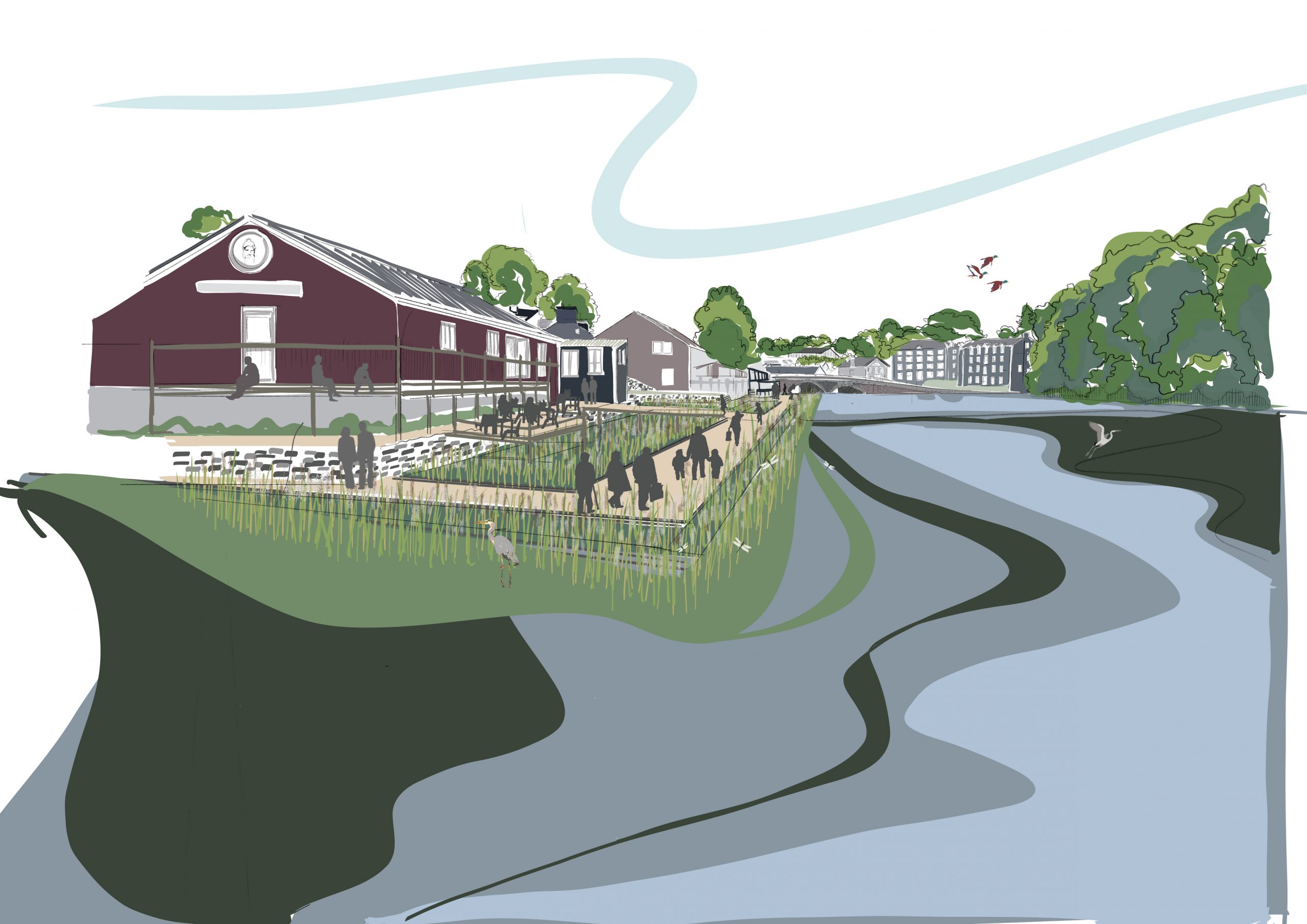
The Strand:
- This riverside space should be brought back into community use as part of planned tidal flood defences to be carried out by Welsh Water and Natural Resource Wales.
- There is potential to introduce community involvement in this unused space, which would benefit from the stewardship of a local group or an educational partnership with one of Cardigan’s schools. An empowered community garden project could access funding to plant it with either appropriate wildflower species to support pollinators, or a herb or kitchen garden.
- Planting a mature tree line along the northern perimeter of the space would screen the space from traffic on The Strand. It would also create a quieter spot for local contemplation and relaxation by the river. ‘Access for all’ should be introduced to the site, including for those with lower mobility.
- Stepped access down to the riverbank should be explored, with floating reed beds encouraging marine life. Riparian tree planting would help to enhance natural flood defences and reduce erosion.
- Educational boards and other features providing information on local marine and wildlife could be incorporated at this site. All features should be provided in both Welsh and English to celebrate the Welsh language and wildlife in this area.
Quay Street Car Park:
- The boundary of Quay Street Car Park should be moved as part of planned tidal flood defences. As part of this change, natural flood defences (including riparian planting) should be introduced to break up the concrete edge of the riverbank.
- Depaving and introducing permeable surfaces and ‘rain garden’ planting throughout the car park would address existing surface water flooding issues.
- Enhancing the planting around the Afon Mwldan and through the car park would improve nature connectivity through the car park and create a more attractive gateway to the town. This would also create an attractive space from which to launch kayaks and boats, and would expand on the success of the River and Food Festival which is hosted annually in Quay Street Car Park.
- Moving the boundary would also create the opportunity to introduce a walking, cycling and wheeling connection along the riverside to Netpool.
The Strand riverside space
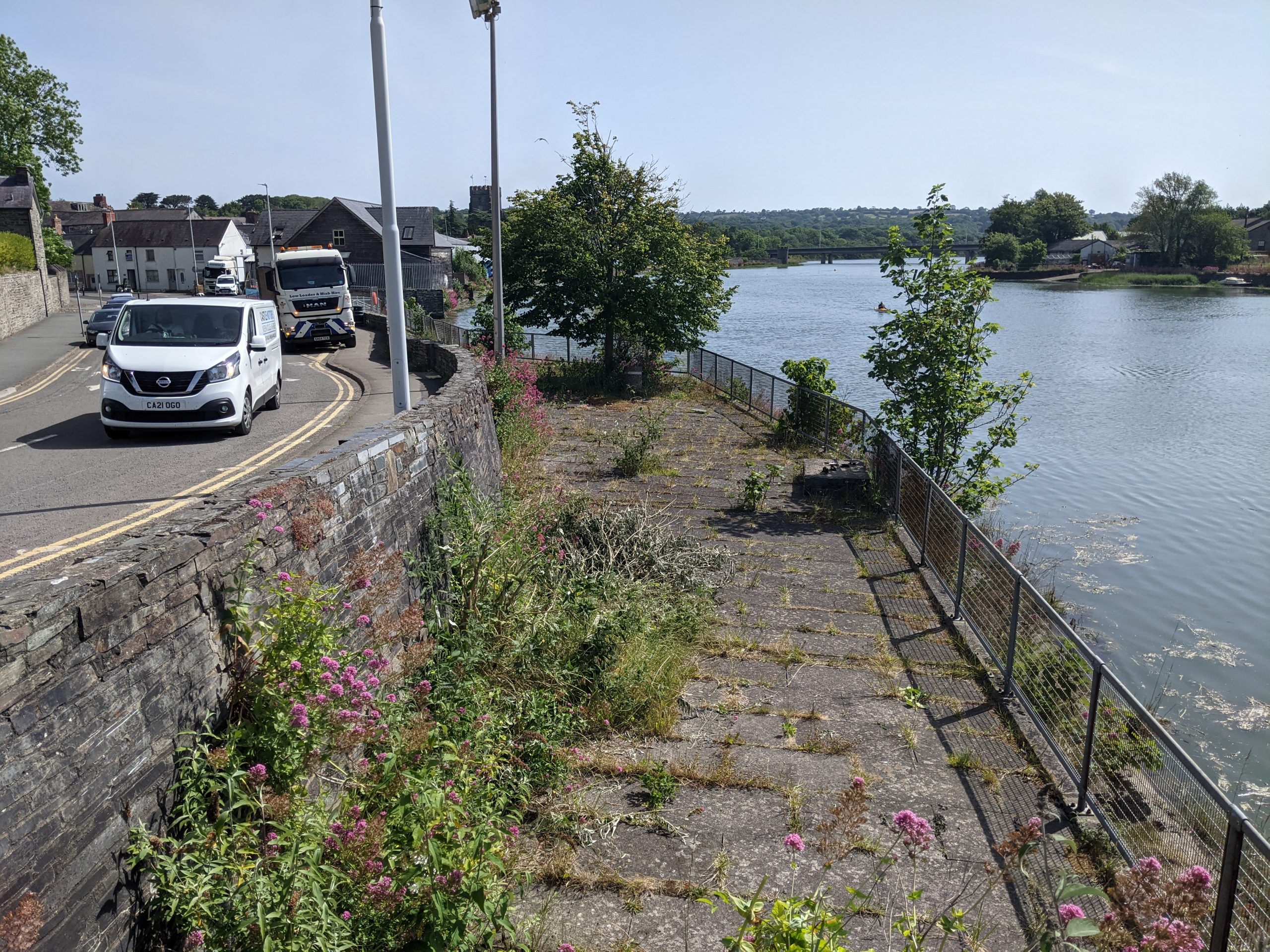
Quay Street car park
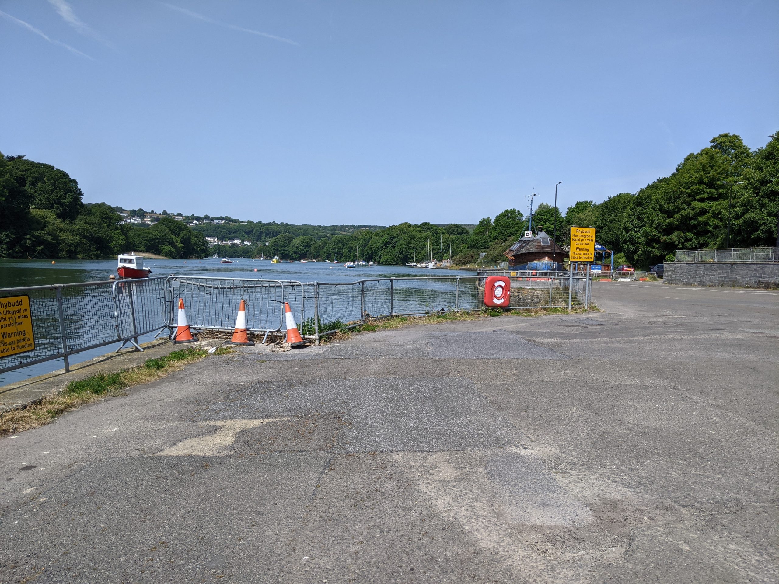
Prince Charles Quay
Element 2: Creating green connections
River walk:
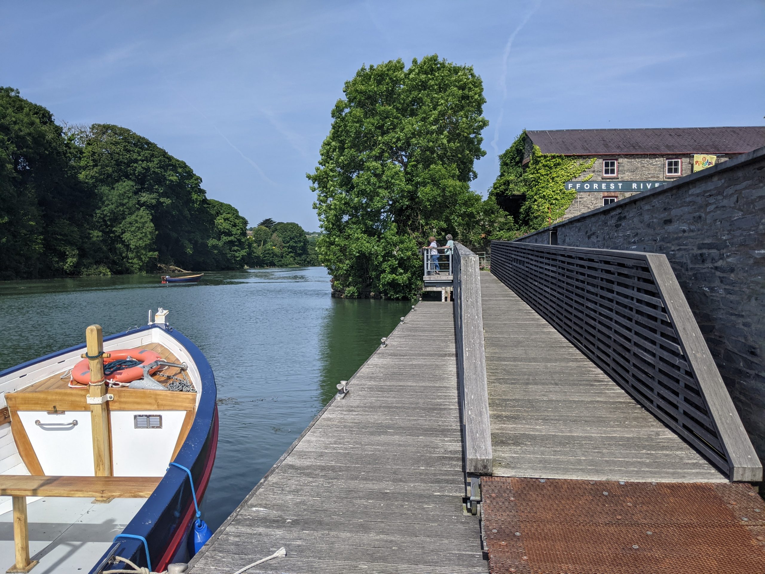
Creating a direct access to join Prince Charles Quay to Quay Street Car Park would create more public space along the riverside and shorten walking distances between Netpool Park, the car park and the Quay. This would encourage more visitors and locals to explore Cardigan’s riverside spaces.
Creating a river walk along this section of the Teifi could be achieved by extending the existing mooring area at Prince Charles Quay with new floating wooden walkways all the way around to Quay Street Car Park (see Case Studies). Extending this space may create areas for local hospitality businesses, including Pizza Tipi and The Fisherman’s Rest, to spill out with al fresco seating or host events on the river.
Circular walking routes:
A consistent and high quality signage and wayfinding strategy should signpost visitors and local residents along accessible 30-minute round walks. These would follow the riverfront to Netpool Park, along the Afon Mwldan to Millennium Wood (Coed Y Mwldan Nature Reserve), to the town centre, and across the river to link up with the Teifi Trail.
Longer routes (between 30 minutes and 2 hours) should be signposted across the river to connect Cardigan to the Teifi Trail and to local destinations such as the Welsh Wildlife Centre and St Dogmaels.
Creating a riverside link between Cardigan and St Dogmaels (with an off-road or segregated footpath) has been a long-term ambition of authorities either side of the Teifi. There is an existing footpath, which is currently not useable due to erosion and lack of maintenance. Restoring and enhancing this link would create an attractive route that will encourage active travel and footfall in both towns. Interventions should consider that previous attempts have faltered around ecological concerns. This means that partnerships should be explored, which should draw on ecological expertise and take these concerns into account along both banks of the Teifi.
This project should also explore opening up the walkway from Castle Street Bridge to the Welsh Wildlife Centre (and wildlife mural) and on to the river. Seating and planting using consistent wooden materials to create an attractive and unified riverfront. High quality wooden signage for the ‘Cardigan Otter Walk’ would be a powerful way of encouraging people to explore walking routes around the town. Cycling and walking times should also be indicated on signage.
Prince Charles Quay
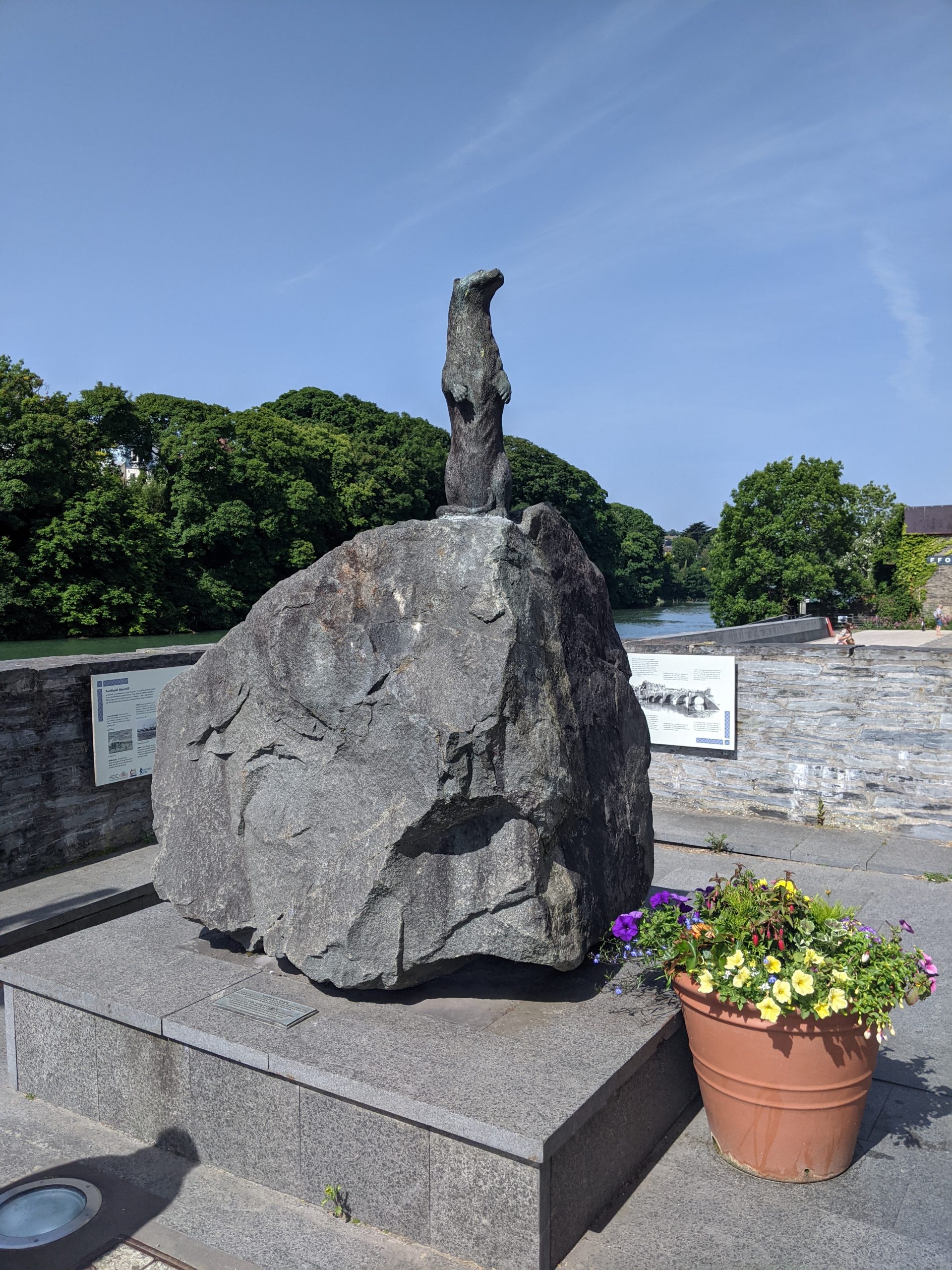
Existing otter statue in Aberteifi
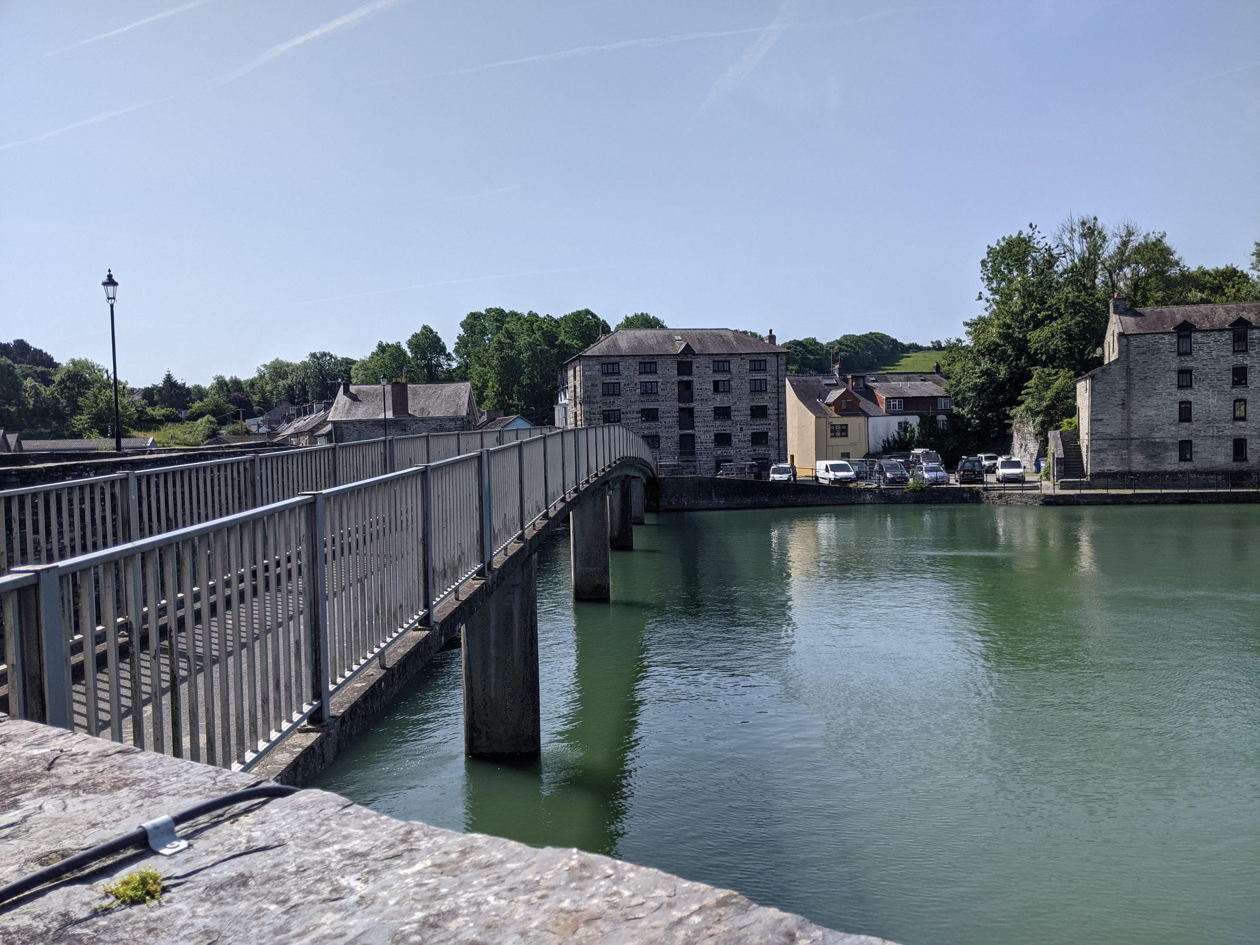
Bridge over the River Teifi in Aberteifi
Element 3: Riverside planting for biodiversity
Various features can be used to enhance the natural environment along the river corridor and restore habitats. These include riparian planting, enhancing the mud flats and introducing floating reed beds and floating planters for local plant species. These features should be incorporated into planned tidal flood defences and along any riverside walkways.
Local ecologists from the Environmental Record Centre for the Cardigan area have been organising weekly wildlife walks in Cardigan. Under the framework of ‘Cardigan Nature Watch’, they generate wildlife records for the area and give people a chance to get to know their local biodiversity. Partnerships like this with local wildlife groups should be supported. The town council recently started a biodiversity sub-committee to formalise partnership working.
Existing public realm at Prince Charles Quay
Inspiration from elsewhere
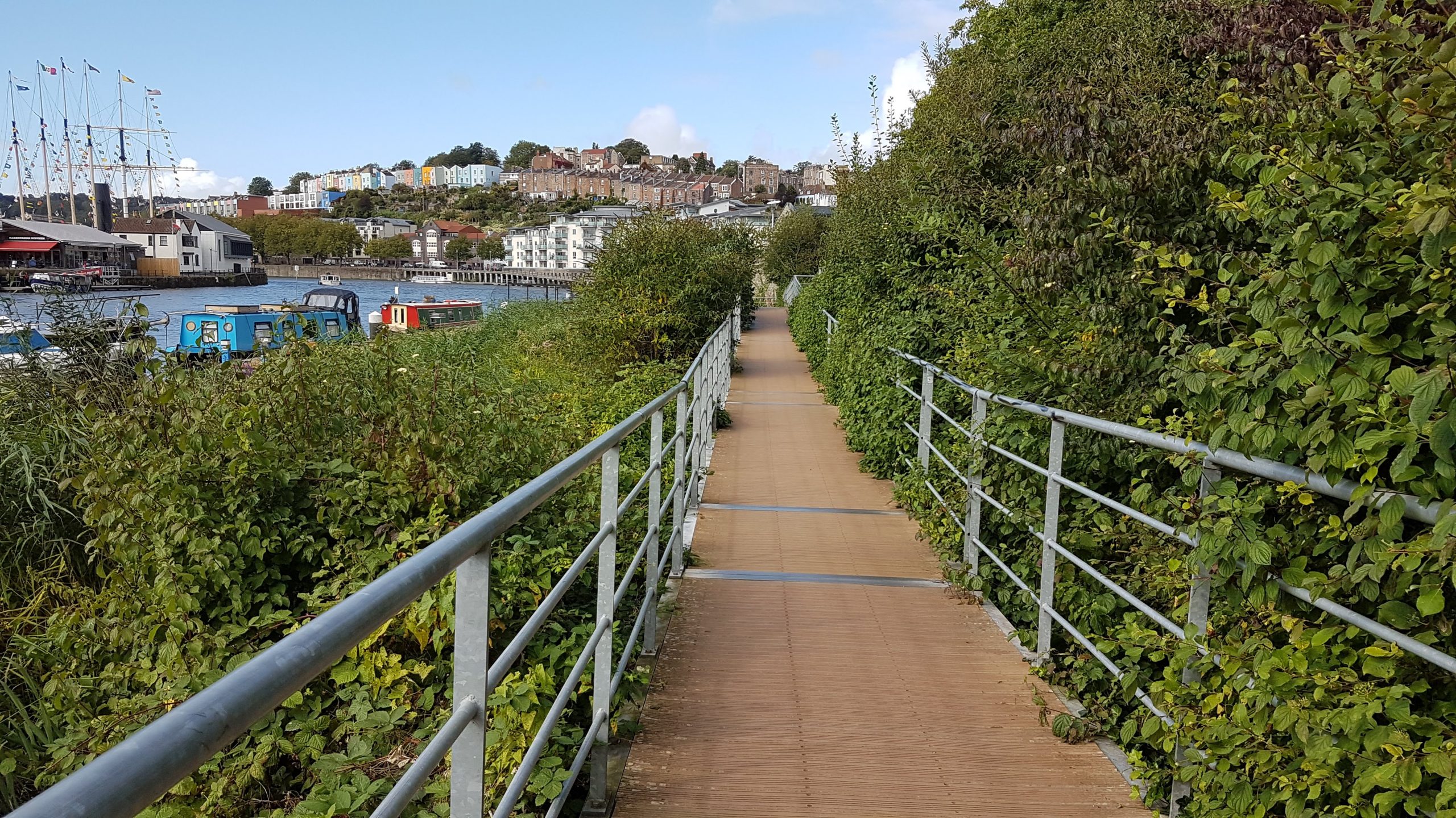
At Bristol Harbourside, floating river walks have been combined with larger floating platforms to create space for riverside public seating, and have been coupled with floating reed bed planters.
As a result of waterfront regeneration, Bristol’s dock sides have been transformed from a declining industrial area into a hub of activity for walking, socialising and recreational activities making use of the waterfront. Key to its success was the integration of environmental features, the provision of waterside walkways and urban greening features. In particular, the regeneration provides a unique floating reed bed in the heart of an urban area.
The reed beds provide nesting sites for birds, helps ensure that runoff from nearby buildings is clear when it enters the harbour and creates an attractive soft edge to the Floating Harbour.
Case study image: Reed beds and walkway at Bristol harbour