Aberaeron
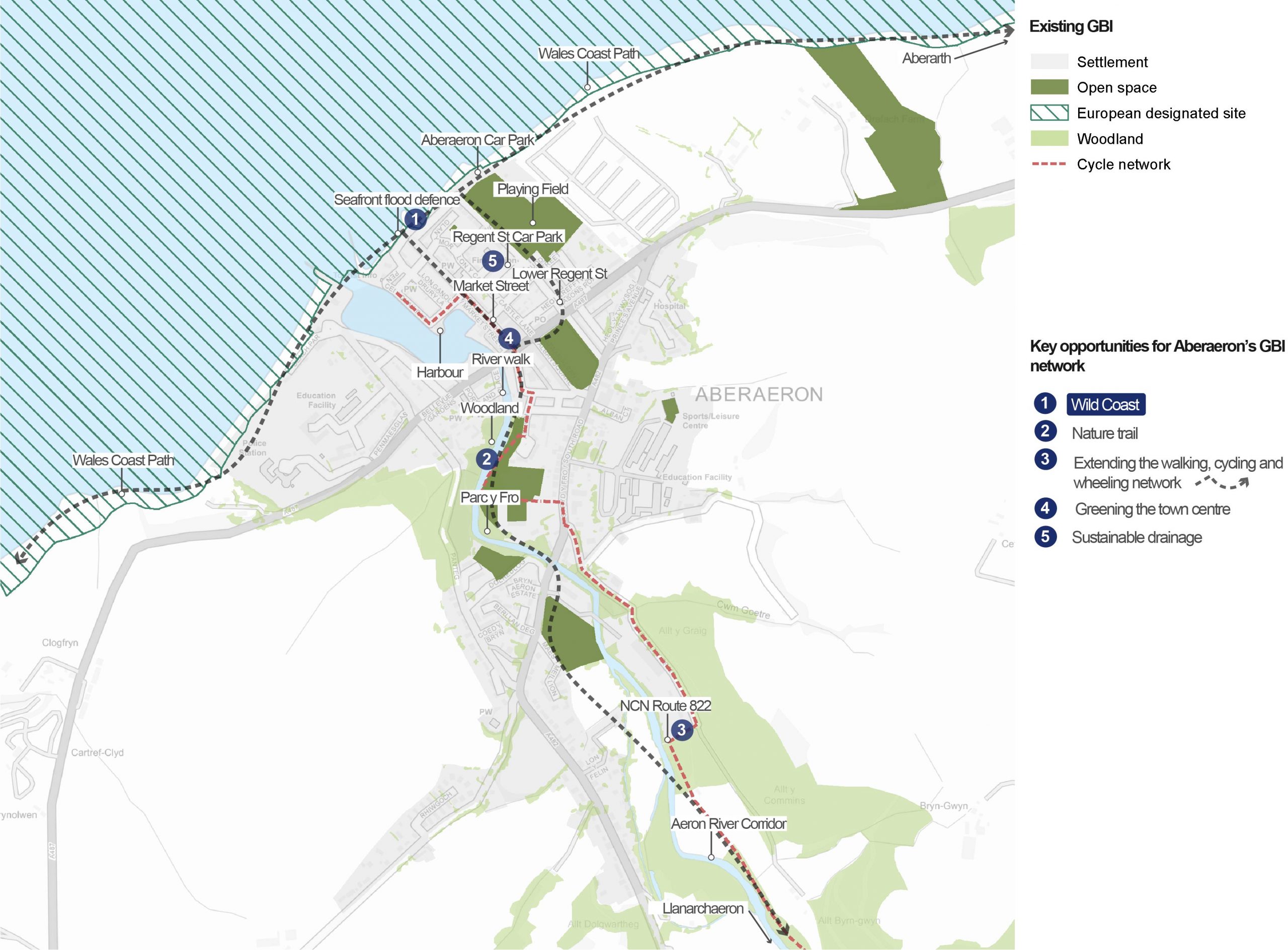
Overview of GBI opportunities in Aberaeron
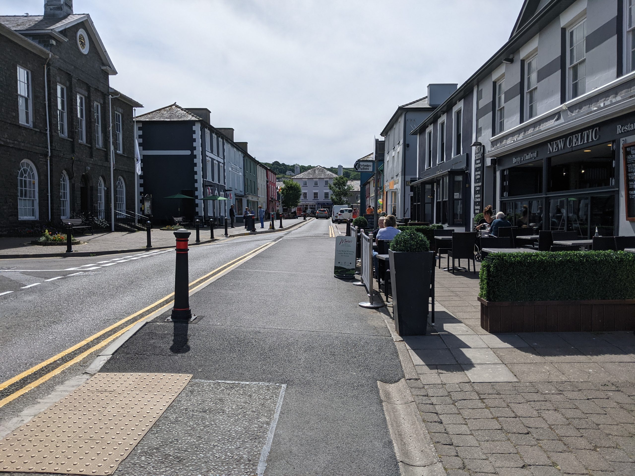
An overview of Aberaeron
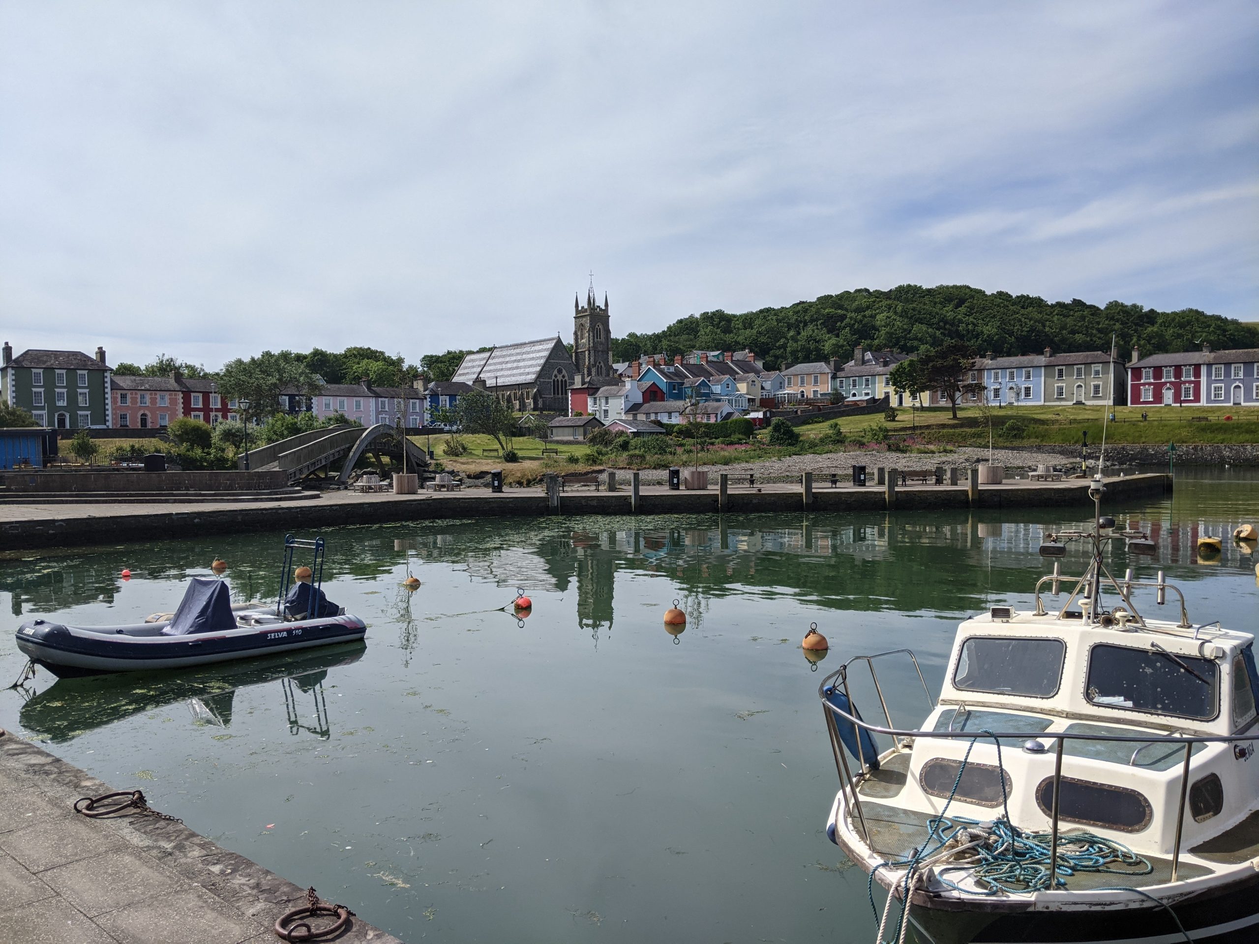
Aberaeron harbour
Aberaeron lies at the mouth of the Afon Aeron along the designated Heritage Coast of Cardigan Bay. It is surrounded by steep hillsides and cliffs. To the north of Aberaeron, the landscape becomes a narrow coastal plain.
Aberaeron owes its initial growth to the passing of the Harbours Act and the building of its piers in 1808, which allowed the establishment of a thriving port. Development in the 19th century left a legacy of Regency era architecture and distinct painted houses. According to the 2011 census, the town now has a population of around 1,400 and is important as an administrative centre as well as a coastal destination.
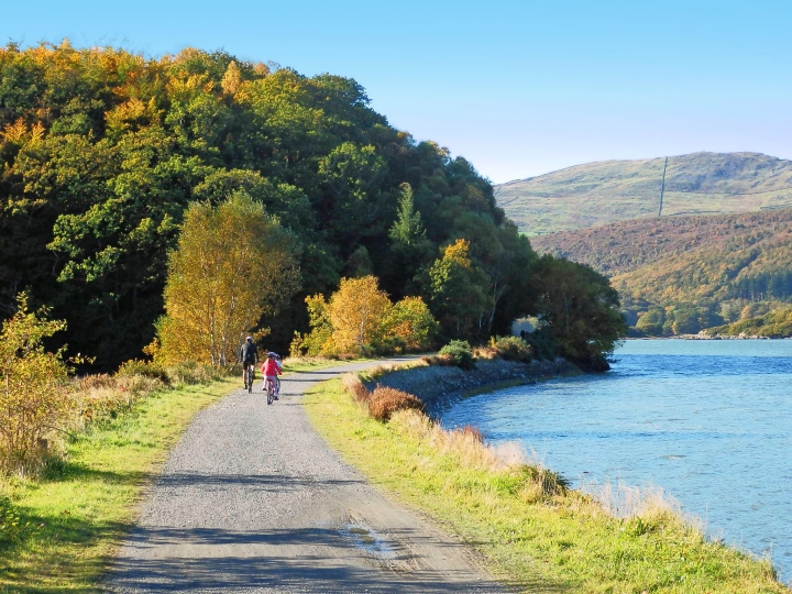
Woodland, including blocks of ancient woodland, run alongside the Afon Aeron further inland from the town centre. The Aberaeron to Lampeter Trail and traffic-free National Cycle Route 822 run through this wooded valley. These walking and cycling routes link the town to the open access land at the Georgian villa of Llanerchaeron.
Further strategic walking and cycling routes include the Ceredigion Coastal Path.
Aberaeron’s coastal location also means the visitor economy plays an important role in the town, also making it home to significant areas of ecological interest (including the Cardigan Bay SAC).
“Cae Sgwar in Aberaeron is a good example of a key area which could draw people in. At the moment it is featureless except for a few trees around its perimeter and does little to support ecology.
– Stakeholder, online survey
See Appendix B for a summary of all stakeholder comments.
What are the key challenges facing Aberaeron?
Walking and cycling: There is very limited provision of cycle networks, particularly those providing long-distance links to nearby towns. The Sustrans route 822 is only 4.3 kilometres in length, connecting only a short distance along the Afon Aeron.
Tree cover: Tree cover in Aberaeron is average for urban areas in Wales with around 11.6% canopy cover, according to NRW. However, there has been a significant decrease in tree cover between 2006 and 2013, with over 1000 trees lost. The majority of these were small amenity trees. Work is required to clarify why so many young trees were lost. On the basis of this, more refined management and maintenance plans – including better species selection – may be required to ensure that healthy tree cover can be reestablished.
Flood risk: The majority of Aberaeron is at high risk of coastal flooding and flooding from the Afon Aeron. The east of the town around Regent Street and Oxford Street is also at high risk of flooding from surface water. The combination of flooding from both the river and the sea caused significant damage to boats within the harbour during Storm Callum in 2018.
Loss of green space: The topography around Aberaeron constrains future development. This puts pressure on open land for development and presents a challenge for providing expansive areas of GBI.
Flagship Project: Aberaeron Wild Coast
For more information on this project, see the dedicated Aberaeron Wild Coast flagship project page.
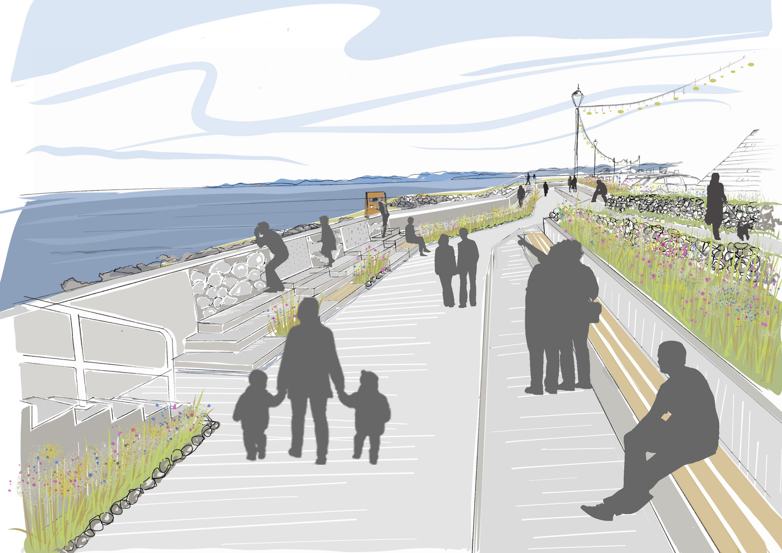
Purpose: To improve Aberaeron’s coastal biodiversity by introducing coastal planting and space for nature as part of the seafront flood defence scheme. This will activate the seafront public realm by introducing space to socialise, play, explore, learn, walk and cycle.
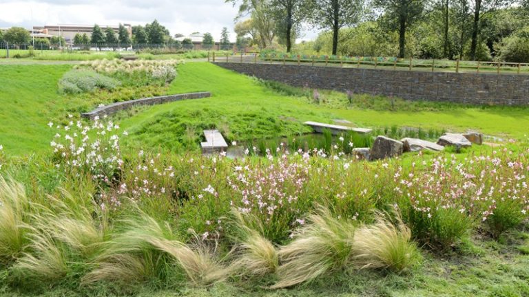
Project 2: Aberaeron riverside and woodland nature trail
Purpose: Celebrating and improving Aberaeron’s riverside walk and woodland paths by establishing a ‘nature trail’. This would help to restore the health of the riverside, reduce flood risk along the river, and create better habitat for wildlife and pollinators.
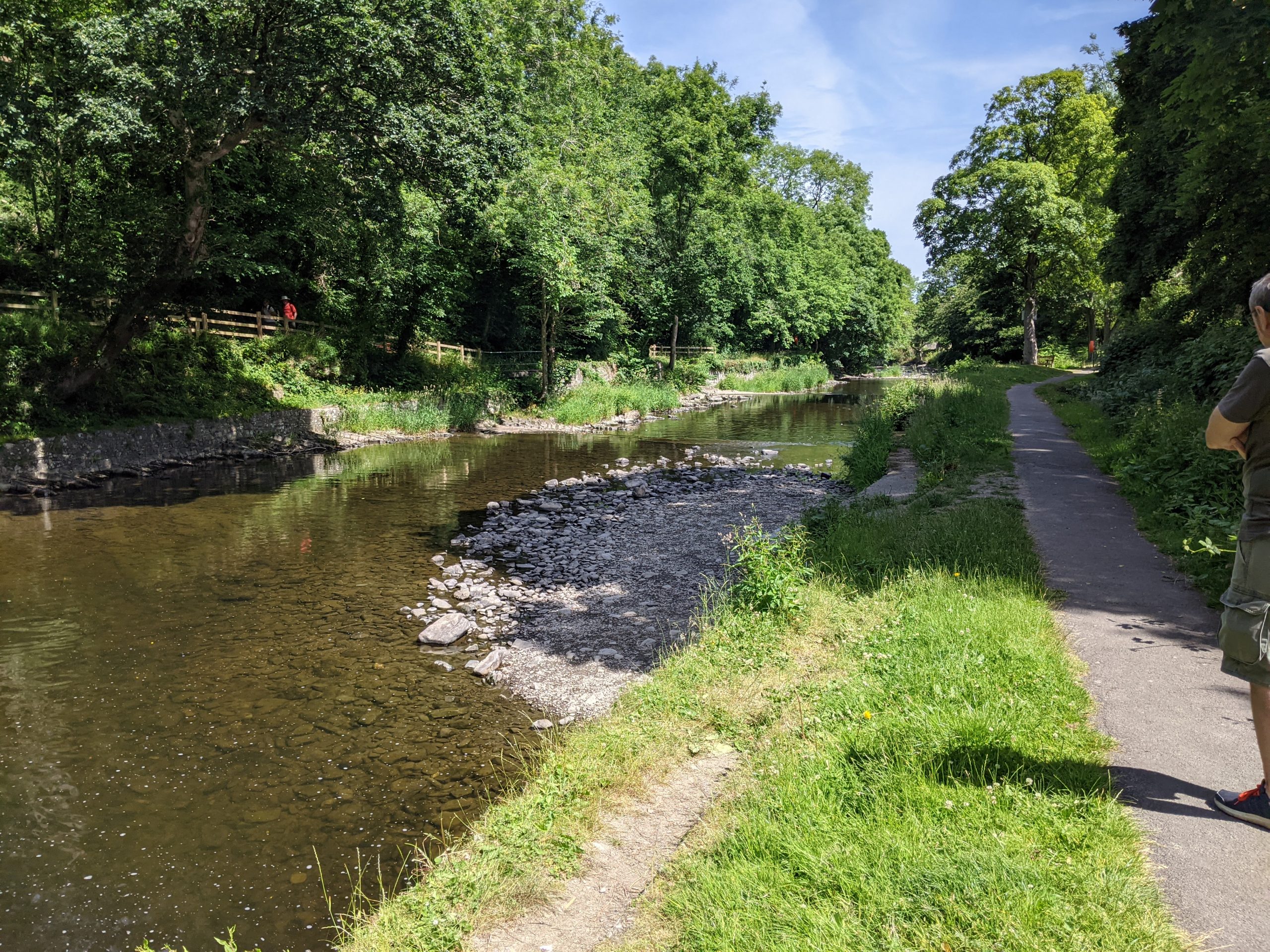
Riverside walk along River Aeron
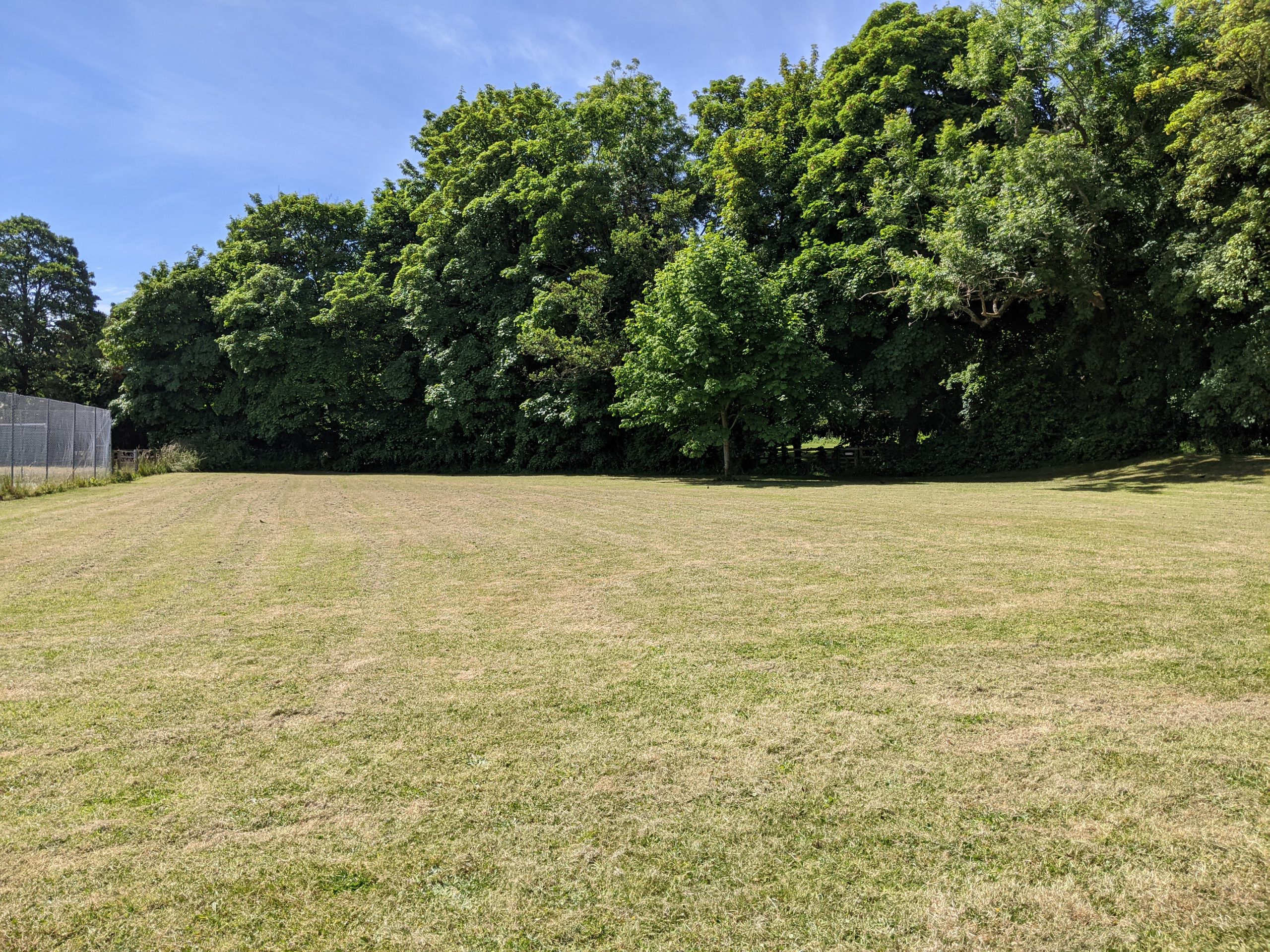
Parc y Fro
Potential partners: Natural Resources Wales, Dŵr Cymru / Welsh Water, Environmental Record Centre for West Wales, Ceredigion Disability Centre, Walking for Wellbeing, The Creative Nature Partnership, local schools, youth centre, Aberaeron Town Council, local community groups, Angling club, RAY Ceredigion.
Description: A joined up riverside nature trail through Aberaeron’s riverside and woodlands would be an important wellbeing resource for the town, connecting local people with the Afon Aeron and creating a green and blue corridor for local wildlife. Key features should include improved signage, access and expanded space for social activities, education and play.
The existing riverside walk along the Afon Aeron could be better connected and extended to connect to the harbour, town centre, and waterfront. This could be achieved by improving pedestrian crossings over the A487 and A482, introducing high quality signage and providing ‘wilder’ planting at entrance points to the walk.
The trail could be made nature-rich by planting a strip of local wildflower species along the trail and increasing riparian planting along the riverbanks. This would reduce flood risk, support biodiversity and join up habitats for local wildlife through Aberaeron’s green space network.
An educational nature and heritage trail could provide information on important species and habitats along the river and in woodland areas. ”Bee posts” within wildflower areas would serve as an educational feature to raise awareness of the importance of pollinator species.
A range of social activities could be introduced along the river, in the woods, and at the riverside green space at Parc y Fro. Introducing informal playful spaces (stepping stones, climbing logs, or wooden wildlife sculptures) would help to create natural spaces that are more interactive for children to explore. Space for a community orchard has been identified at Parc y Fro, either lining the pedestrian path, screening the local residential properties or on the piece of land between the river and the sports club. A community orchard could serve as an important wellbeing resource for the local community.
Inspiration from elsewhere…
The Orchard Project, aims for every household in the UK’s towns and cities to be within walking distance of a productive, well cared for, community-run orchard.
Their model involves providing expert advice and training community groups in orchard management skills for long-term sustainability. In doing so, they hope to strengthen communities, improve wellbeing and build resilience. The harvesting period provides an opportunity for community events and for volunteers and local children to come together and raise awareness about local food systems.
Case study image: Alexandra Park Food Forest (The Orchard Project)
Project 3: Extending Aberaeron’s walking, cycling and wheeling network
Purpose: To create and maintain a connected network of traffic-free, “access for all” routes between Aberaeron’s town centre and waterfront. This would provide a stronger connection to the Wales Coast Path, nearby villages and the larger National Cycle Network. Creating and restoring habitat along cycle routes would create a strategic green corridor for wildlife and pollinators.
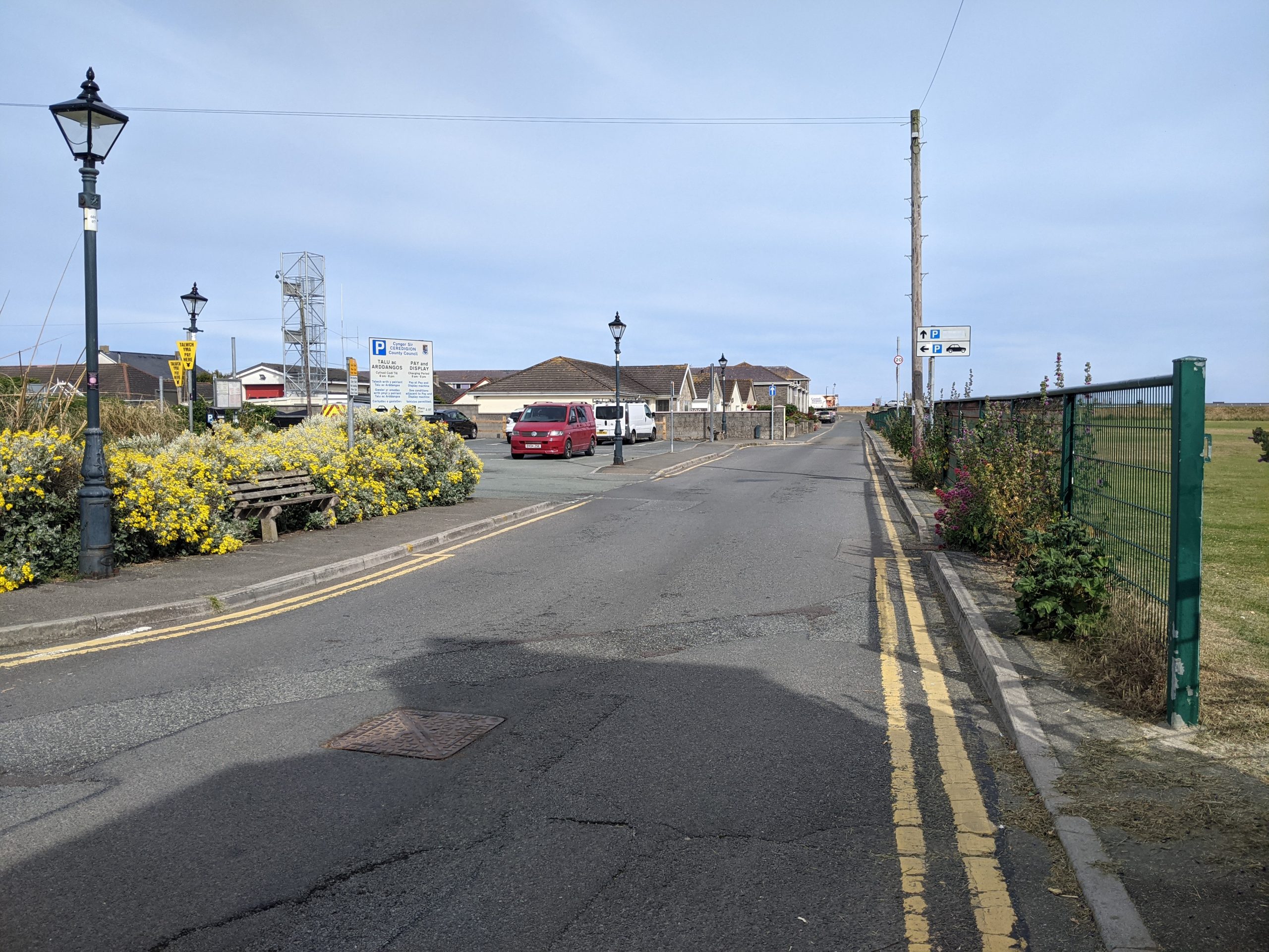
Regent Street Car Park
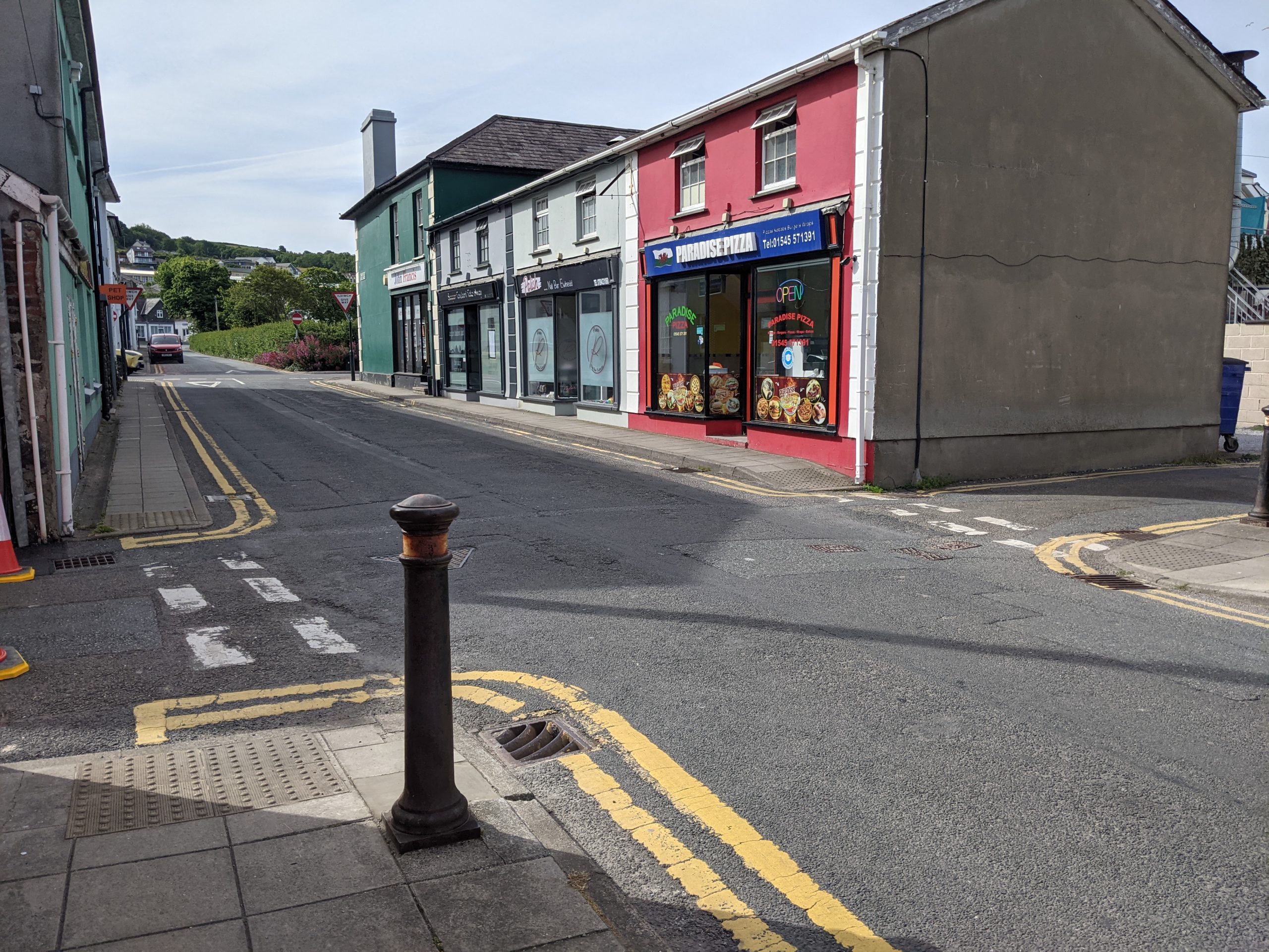
Market Street
Potential partners: Natural Resources Wales, Sustrans, Ceredigion Disability Centre, Walking for Wellbeing, Aberaeron Town Council, , RAY Ceredigion.
Description: This project seeks to strengthen Aberaeron’s network of traffic-free routes from the town centre to the waterfront and Wales Coast Path. The network should also connect to the riverside and the National Cycle Route 822.
This project should also explore the potential to extend National Cycle Route 822 to Lampeter along disused railway lines. This would link Aberaeron to Llanerchaeron, the new Aeron Valley School in Felinfach, and Lampeter. This route is being explored as part of Ceredigion County Council’s Active Travel Strategy for the Welsh Government.
Biodiversity could be supported along the route by maintaining hedgerows and introducing wildflower planting along the edges of trails. This would also create a strong sense of place along the route for people travelling through it.
Walking and cycling through the town itself could be improved by reallocating space to walkers, cyclists and wheelers. This could include segregated cycle paths and wider pavements on busy roads and better maintenance of ‘back routes’ through the town (in line with guidance from Manual for Streets).
Walking and cycling should be prioritised on “school streets” and integrated with urban greening initiatives. New cycling routes should also be considered as an alternative to particularly steep and narrow sections of the National Cycle Route 822. For example, the dangerous route along Bro Allt-Y-Graig could be improved or relocated to follow the walking route around the playing field and the Afon Aeron.
All routes have options for safe walking, cycling and wheeling if the “access for all” principles are followed. Working with existing local groups is a good way to audit the accessibility of infrastructure (such as gates and benches) for a range of walkers.
Particular strategic links which should form the focus of the network include:
- Improving connectivity to local green spaces, playing fields and parks in the town.
- Improving walking, cycling and wheeling access along Aberaeron’s existing riverside paths.
- Improving the link from the current trail car park (beyond Jewsons) into the town and harbour.
- Exploring a pedestrian bridge across Aberaeron’s harbour as part of accessibility improvements to local sections of the Wales Coast Path and links to Aberarth.
- Creating links outside of the town to the Llanerchaeron National Trust site.
Extending popular trails to Aberaeron would encourage more walkers and cyclists in the area to visit businesses in the town. This would provide an opportunity to market the town as a base from which to stay and explore Ceredigion.
Inspiration from elsewhere…
The Mawddach Trail is a scenic, nine-mile cycle path with excellent traffic-free hard surfacing that stretches from the historic town of Dolgellau to the popular seaside town of Barmouth. The path is well used and runs along the old railway line.
Case study image: Mawddach trail (Discover North Wales)
Project 4: Greening Aberaeron town centre
Purpose: To introduce urban greening features that will connect biodiversity and tree cover through Aberaeron and improve the vitality and quality of place of the town centre.
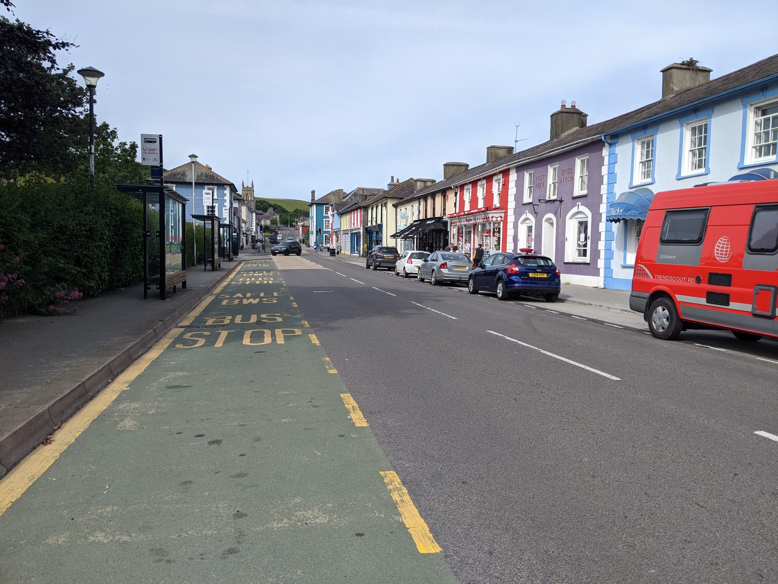
Regent Street
North Road
Potential partners: Ceredigion County Council, local businesses, Aberaeron Town Council, RAY Ceredigion.
Description: The one-way system currently being trialled in Aberaeron has created opportunities to enhance the quality and walkability of public space in the town centre. Reallocating space more permanently would improve access and movement through the town, creating a more successful thoroughfare along Lower Regent Street, Tabernacle Street and Market Street.
Interventions to improve crossings could include dropped kerbs and unified paving (in line with guidance from the Manual for Streets).
On the A487 North Road, there are opportunities to reduce on-street car parking, improve pedestrian crossings and widen pavements. This would help to create a more pedestrian-friendly shopping street and combat the severance created by major road infrastructure.
Multifunctional urban greening should be an important element of this reallocation of space. “Rain garden” borders could be introduced in place of kerbs and bollards, creating attractive and nature-rich routes through the town. It is important that these features go beyond ornamental value to deliver multiple benefits, primarily by slowing the flow of water runoff in sections of the town centre at risk of flooding and creating a wildlife corridor through the urban area.
High quality seating integrated with planters and street trees should be introduced along the most active streets in the town centre. Priority locations include the area around the businesses on Market Street, North Road and Sgwar Alban.
The project should explore the feasibility of reallocating some car parking space as ‘parklets‘, freeing them up for the use of businesses as seating, particularly during the summer months. Planters or structural planting could be used to enclose roadside seating spaces away from vehicular traffic.
Creating a greener pedestrian route along Lower Regent Street would create an attractive walking route between Aberaeron waterfront, the playing fields and the town centre.
The restaurants and cafes of Aberaeron’s Market Street have already started to embrace outdoor seating, which has given this area of town an emerging ‘food quarter’ identity. Urban greening and a redesign to make this area more walkable would enable more businesses to spill out onto the street, with European style awnings and street side dining.
Kitchen planting could help to support this identity by using orchard and fruit tree species, herb window boxes, and planters with fruits and salads.
Inspiration from elsewhere…
Glasgow Avenues is a key initiative led by Glasgow City Council and Sustrans to rethink the city’s main streets, putting people at their heart. By redressing the balance between vehicles, pedestrians and cyclists, the city found a way to make streets of every size more “people friendly”. It was important to separate and manage vehicle and pedestrian traffic and to make the wayfinding through the streets clear. The project also used greenery and paving to make streets and the wider neighbourhood more attractive, more sustainable and more economically competitive.
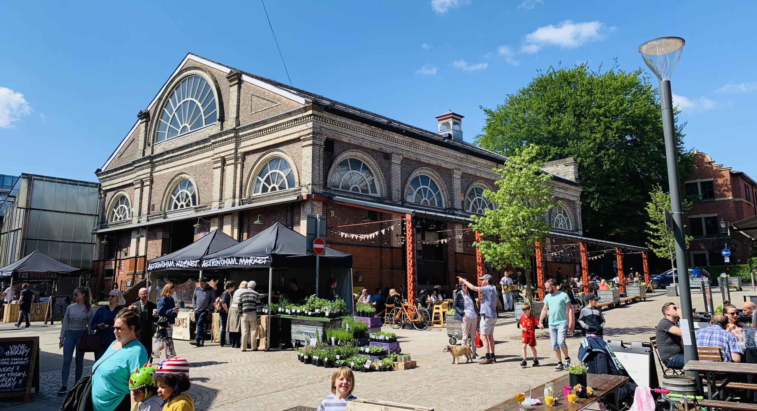
Greening the streets around Altrincham market in a suburb of Manchester was key to the regeneration of the towns’ market hall and wider area. Altrincham is now developing plans to extend planting and public realm improvements through the town centre streets.
‘Edible bus stops‘ have been introduced as part of London’s transport network. Lessons from this scheme could be used to “green” bus stop roofs and seating areas at stops on the A487 North Road. This would activate underused spaces, giving them a purpose and supporting biodiversity.
Case study image: Altrincham market
Project 5: Aberaeron SuDS network
Purpose: To improve Aberaeron’s resilience to surface water flooding and support biodiversity in priority areas of the town.
Lower Regent Street
Potential partners: Natural Resources Wales, Dŵr Cymru / Welsh Water, Local businesses.
Description: Flood risk is one of the foremost concerns among residents of Aberaeron, one of the areas at highest risk of flooding in the County. There are certain areas of the town that have a much higher degree of impermeable cover, where rainfall is diverted into storm sewers which contributes to flood risk. These areas form the focus of this project.
Flood risk in urban areas can be addressed by integrating sustainable drainage solutions (SuDS), which slows the flow of water and reduces surface water runoff. Importantly, these SuDS features can be multifunctional. They can simultaneously address food risk and provide valuable habitats, pollinator resources and enhance the streetscape.
The final targeted location for a network of SuDS should be identified using mapped evidence of sewer overflows and surface water flood risk. Provisionally, key priority locations for SuDS features could include:
- Penmorfa (an office site owned by Ceredigion County Council): The creation of wetland habitats (or SuDS planters) would help to absorb rainfall from the roof and car park, diverting it from the storm sewer. This could be coupled with biodiversity benefits if combined with a relaxed mowing regime for the surrounding semi-natural grassland.
- Around other large buildings with car parks. These might include the old people’s home, school or primary care centre in Aberaeron.
- Area around Regent Street and Oxford Street: This is at high risk of surface water flooding. There may be an opportunity here to introduce street trees, “rain gardens” and associated tree pits for rainwater drainage. Where roads are too narrow to enable this, it may be possible to reconfigure street drainage towards areas with more space (such Lower Regent Street car park or the adjacent playing fields) and introduce swales or other wetland features. This could provide a more biodiverse edge to the playing fields as well as attenuating rainfall.
Inspiration from elsewhere…
The Greener Grangetown project in Cardiff is an example of a residential neighbourhood that has successfully depaved and installed attractive rain gardens, kerbside greenery and tree planting. The project was led by a partnership between Cardiff Council, Dŵr Cymru/Welsh Water and Natural Resources Wales (NRW).
Dŵr Cymru/Welsh Water’s Rainscape project in Llanelli is part of Dŵr Cymru/Welsh Water’s approach to managing surface water and reducing sewer flooding. It separates rainwater from the existing system, slowing down the rate it enters the network and redirects it to local rivers and watercourses. The partnership has completed 36 projects in the Llanelli area since the project was launched in 2012.
Case study image: Greener Grangetown (Susdrain)
Case study image: Llanelli Rainscape