Aberystwyth Circular Nature Trail
Purpose
To connect Aberystwyth’s waterfront, green spaces and woodlands on a circular walking route and nature trail. The route aims to improve connectivity for both people and nature.
Key elements
- Joining up existing routes into a circular walk.
- Wayfinding, signage and interpreting the route
- Habitat restoration along the route
- Integrating playful and social spaces
Delivery
Potential partners: Natural Resources Wales, Dŵr Cymru / Welsh Water, Environmental Record Centre for West Wales, Ceredigion Disability Forum, Walking for Wellbeing, Pendinas LNR, Parc Natur Penglais LNR, Woodland Trust Coed Geufron, Coed Lleol Small Woods, Aberystwyth University, National Library of Wales, Marina development, the Penparcau community, Golf Club.
Indicative costs: £9 – 10 million (see Appendix 3 for details on project cost estimates)
Description
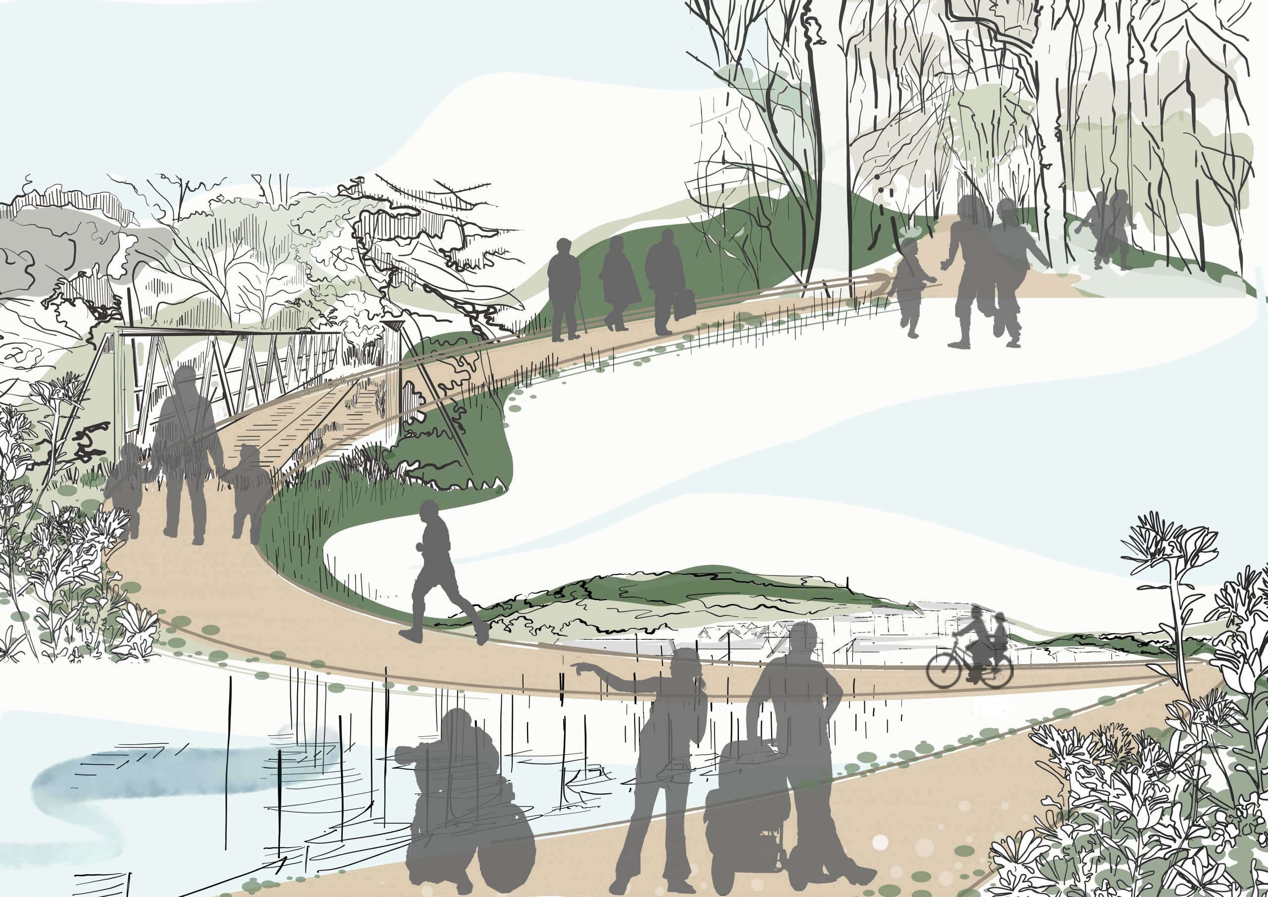
Joining up Aberystwyth’s web of beautiful and biodiverse local nature reserves, hills, woodlands, rivers and coastline with a traffic-free round walk. This will enable and encourage all generations to get out walking and explore the natural environment around the town.
Element 1: Joining up existing routes into a round walk
Existing traffic-free routes should be protected and extended where possible. The following are the existing walking and cycling routes which can be incorporated into the round walk. The list also highlights gaps which need filling between key natural spaces:
- South Beach – Castle Grounds – Aberystwyth Beach – Constitution Hill (Gap: Access across Cliff Terrace, Lovers Dingle and Brynmor Road).
- The Lookout at the Quarry – Parc Natur Penglais (Gap: Access beyond Parc Natur Penglais and across Penglais Road)
- National Library and University Campus – Cefn Llan Cemetery (Gap: Heol-Y-Bont Road)
- Llanbadarn Fawr Play Area – Blaendolau Playing Fields – Afon Rheidol Riverside – Parc Kronberg – Penparcau Allotments (Gap: Access through Penparcau neighbourhood)
- Pendinas Hill – Tan-y-Bwlch (Gap: Access around the marina / bridge over the marina)
Strategies to determine the most appropriate route through natural assets (such as the Marina and Lover’s Dingle) should be sensitively developed in order to enhance and protect the natural habitat and the “wilder” feeling of natural spaces. Features such as stepping stones or accessible boardwalks may be more appropriate than paved surfacing near Lovers Dingle.
The potential to construct a bridge linking the two sides of Aberystwyth’s harbour is being discussed at the time of writing as part of the harbour redevelopment. This would allow the development of retail and leisure facilities on the north side. The bridge would form a key connection between the south side of the town and Pen Dinas Hill. Connecting the bridge to a clear walking trail between these assets will ensure that the bridge provides a strategic connection for the community, beyond the harbour redevelopment alone.
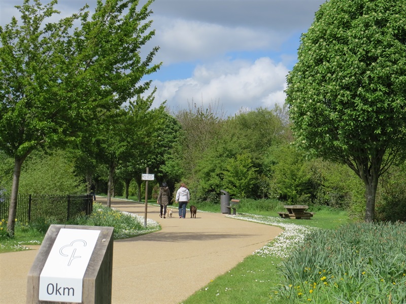
The surfacing on existing and new paved routes should be well maintained, accessible to all and safe. Walking and cycling infrastructure should be introduced to separate pedestrians from traffic on sections of the trail that are on the road. High quality paving should be used where possible along more urban sections of the trail to ensure a consistent quality and clear demarcation of the route.
Element 2: Wayfinding, signage and interpreting the route
High quality wooden signage and maps should be introduced along the trail and from the town centre – to support access, awareness and understanding of the town’s natural and cultural heritage. This could help build the brand identity for the ‘Aber Round Walk’, ‘Aber Nature Trail’, or similar. This can later be expanded to include existing and new green routes – including those within projects 2, 3, 4 and 5 for Aberystwyth. A consistent wayfinding strategy across all routes would ensure that the network of walking routes fulfils its potential.
Signage should be marked up with walking distances (‘nature within 10 minutes’ and ‘nature within 30 minutes’) to encourage users of all abilities.
An educational nature and heritage trail could provide information on important species, habitats and the history of destinations along the trail. In combination with a tourism marketing strategy, this would support Aberystwyth’s status as a destination for nature, walking and green tourism. An events strategy (exploring events such as an Aberystwyth “green” half marathon) would help to celebrate Aberystwyth’s natural environment.
Element 3: Habitat restoration along the route
Native tree cover should be expanded along the trail and local wildflower species planted. This will provide multiple functions including carbon storage, biodiversity enhancement and valuable connectivity for mammals, birds and bees to move along green corridors.
Landscaped wildflower areas in key areas of activity along the trail would create attractive spaces where people can walk, cycle, sit and socialise. Different blends of local wildflower species could be created for roadside verges, riverside banks, coastal areas, and to edge woodlands and greenways inland. Incorporating bee posts would serve as a powerful educational feature to draw attention to the importance of the corridor for pollinators.
Structural planting along walkways should be incorporated as part of the town’s marina redevelopment. A strip of wildflower grassland could be planted around the edges of the marina and within surrounding planters (see Lancashire case study).
Element 4: Integrating playful and social spaces
Introducing informal playful spaces would make natural spaces along the route more interactive for children to explore. Features should be inspired by nature and where possible from natural materials – including stepping stones, climbing logs or timber style play features. Potential priority locations include:
- Beech Glade (at Parc Natur Penglais).
- Pendinas Hill riverside.
Alongside play spaces, there is an opportunity to shape multifunctional social spaces for sitting and picnics. Larger social spaces, where viable, could be used for pop-up events.
Spaces such as these should be incorporated at key nodes, heritage assets and viewpoints (including the Lookout viewpoint and former pitch and putt golf space in the castle grounds).
Inspiration from elsewhere
Case study image: Connswater Community Greenway (Walk NI)
The Connswater Community Greenway in Northern Ireland is a successful example of a strategic, regeneration-focussed approach to creating car-free green corridors with multiple functions.
Completed in 2017, the project has created a 9km linear park, with 16km of cycles paths, green spaces, bridges, crossings and heritage trails. It follows the course of the Connswater, Knock and Loop rivers, connecting open and green spaces, and also linking residents to leisure facilities, businesses, shopping centres, schools and colleges. It has become a key asset for the visitor economy, as a ‘living landmark’ for Belfast.
Local residents were involved in shaping the design and function of spaces along the greenway, capturing the meaning of their local green spaces and led the naming of new green spaces and bridges.