Otmoor, Bernwood and Ray
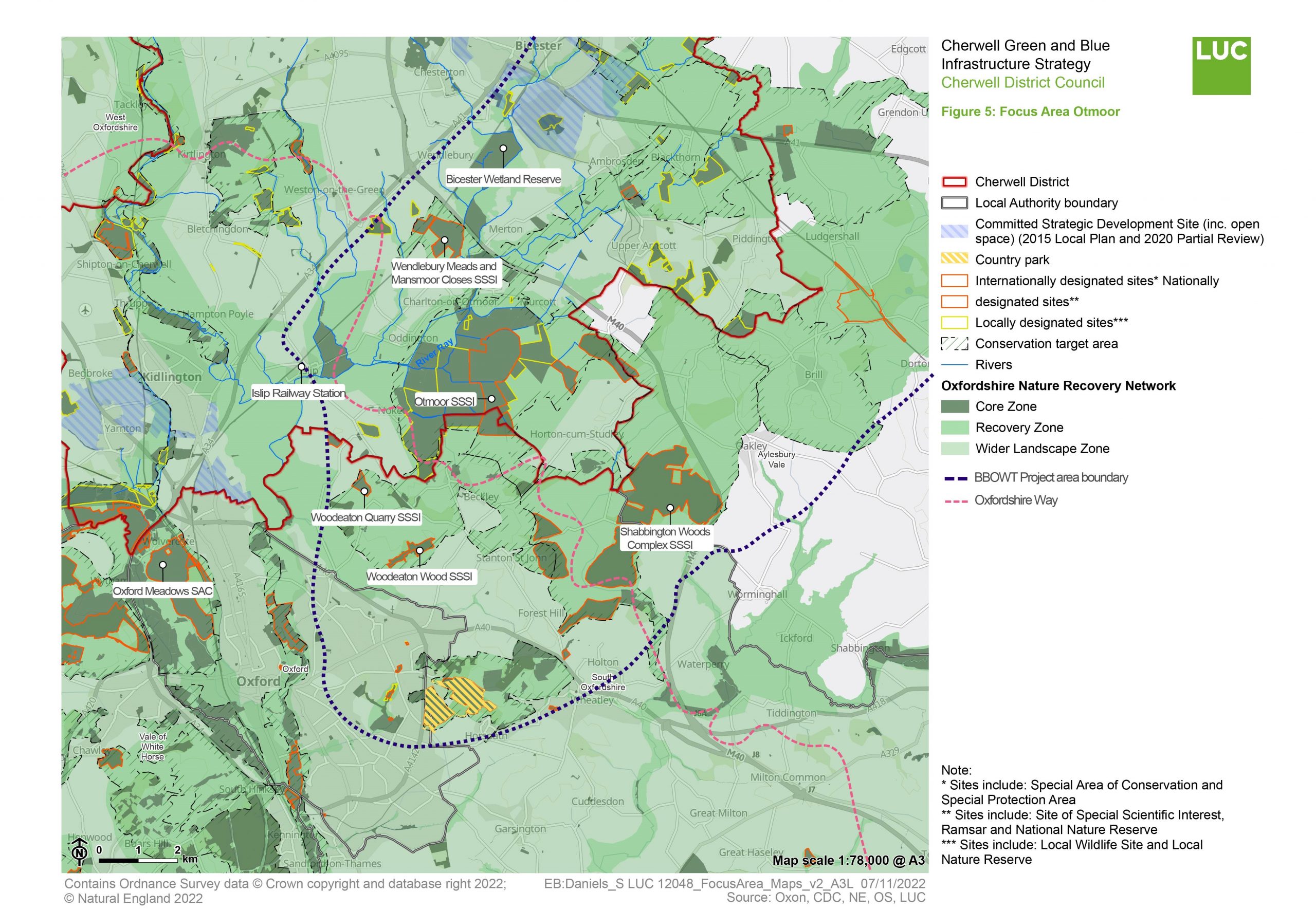
The GBI Network in the Otmoor, Bernwood and Ray area today
This large expanse of open land lies to the south of Bicester and extends across the border into South Oxfordshire. It is an area where high natural capital value has been identified – and has been highlighted as one of the best remaining ecologically coherent, large-scale landscapes in Southern England. The area would be roughly bounded by the M40, A40 and the Oxford-Bicester railway.
The entirety of the Focus Area lies within the Oxford Green Belt and hosts a number of sites designated for their nature value – including the Otmoor SSSI (the site of an RSPB reserve), the Wendlebury Meads SSSI and Woodeaton Wood SSSI. No other region within Oxfordshire has such a large area of designated sites (SSSIs and LWSs).
The area also sits within one of the “Living Landscapes” identified by the Berks, Bucks & Oxon Wildlife Trust (BBOWT) – the Bernwood Forest and Ray Valley Living Landscape. This covers around 300 square kilometres and is likely to form a key part of emerging Local Nature Recovery Strategies.
The River Ray and its tributaries run as a blue corridor through the area, coming to a head just north of the Otmoor Reserve. As a result, some of the key habitats within this area include marsh, reed beds, open water, large woodlands, wet meadows and floodplains.
The nearest railway station is in the village of Islip (5 minutes journey from Bicester and 12 minutes from Oxford). From the station, you can access this Focus Area along the Oxfordshire Way. The area is also connected to surrounding villages by bridleways.
“Extreme care needs to be taken in this area not to plant trees everywhere. By doing so you could damage species rich meadows, or important nesting areas for curlew and other waders. Trees are important but so too are other habitats. Why is there just a focus on trees, and not wetlands and grasslands?”
– Stakeholder, online survey
See Appendix 2 for a summary of all stakeholder comments.
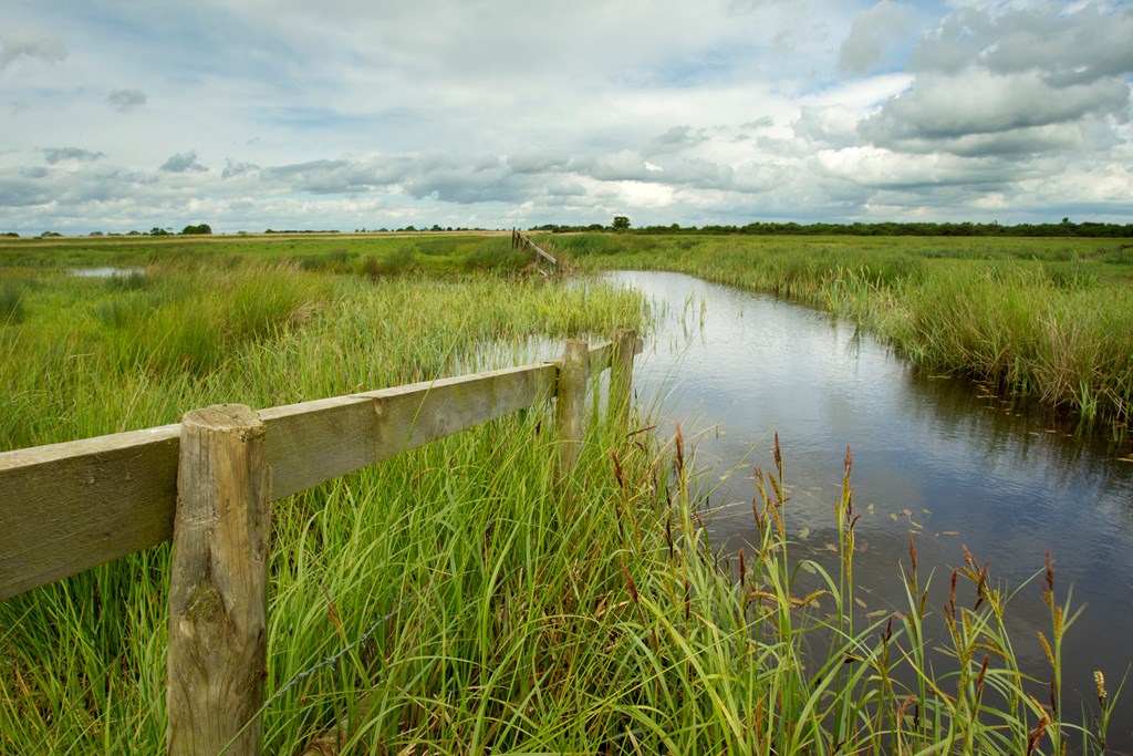
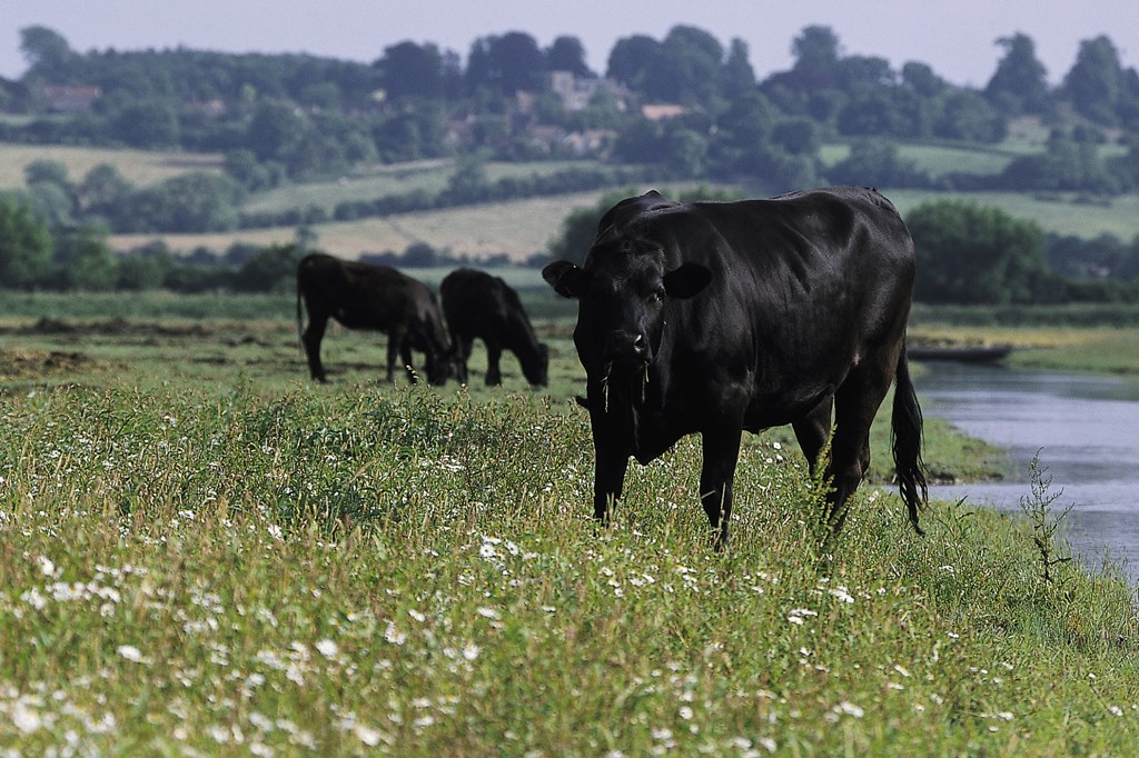
Photos of Otmoor Nature Reserve (Image source: RSPB)
Conservation Target Areas around the Otmoor, Bernwood and Ray area
There are four designated Conservation Target Areas (CTA) within and around the Otmoor, Bernwood and Ray area:
- The Otmoor CTA includes the wet low lying Otmoor basin and adjacent areas. Key habitats include floodplain grazing marsh, lowland meadow, reedbed, hedgerows, lowland fen and river.
- The Oxford Heights East CTA lies to the south of Otmoor covering the escarpment from Elsfield to Stanton St. John and the land between. Key habitats include lowland mixed deciduous woodland, fens, lowland meadows, arable field margins, limestone and lowland dry acid grassland.
- The Ray CTA is the alluvial floodplain area extending into Buckinghamshire and onto the clay including the main areas of ridge and furrow. Main habitat areas include the lowland meadow, wet grassland, hedgerows and ponds.
- The Bernwood CTA area includes the woodlands of Bernwood and Shotover Forest to the east of Horton-cum-Studley. This encompasses the valley of the Holton Brook, Moonbridge Brook and Danes Brook. This also extends into Buckinghamshire. The main habitats include woodland and lowland meadows.
Key challenges for the GBI network in the Otmoor, Bernwood and Ray area
Water quality: The Oxon Ray watercourse, which includes the Otmoor Water Body, is currently assessed as having ‘bad’ ecological status (as determined by the Environment Agency). Key drivers for this include intensive agricultural land use, poor nutrient management, sewage and water treatment inputs, drought and barriers.
Connectivity: A number of cycle routes and PROW run through this area, including the Oxfordshire Way (see interactive map). However the network is fragmented. Creating a robust network of walking and cycling routes to and through this potential area would be an effective way to encourage physical activity and expand access to high quality green space for surrounding communities.
Lack of accessible greenspace and development pressures: While this Focus Area itself lies in the Green Belt and is not heavily settled, settlements in the surrounding area (notably Bicester to the north and Kidlington to the west) are set for significant expansion. As these settlements continue to grow, accessible green space and natural landscapes in this area would provide much-needed accessible greenspace, while allowing the space for nature to thrive.
Recreational pressure: The Otmoor RSPB site and other nature reserves within the area are currently under increasing recreational pressure, especially at sensitive habitat areas. The landscape scale recovery initiative must be mindful of these concerns through thoughtful design of access and wayfinding arrangements.
Land ownership: Land ownership within this Focus Area is fragmented. As such, securing buy-in by landowners for habitat creation and restoration will be essential.
Flooding: A large expanse of this Focus Area is at high risk of flooding, with high risk areas concentrated along the River Ray and its tributaries (see interactive map). This presents a significant opportunity for landscape-scale nature-based solutions (NBS) which can store water within the landscape.
Key local delivery partners in the Otmoor, Bernwood and Ray area
- Oxfordshire County Council
- BBOWT
- RSPB (as manager of Otmoor Reserve)
- Banbury Ornithological Society/Thames Water (managers of Bicester Wetland Reserve)
- Wild Oxfordshire
- Cherwell District Council
- South Oxfordshire District Council
- Buckinghamshire Council
- Environment Agency
- Cherwell and Ray Catchment Partnership
- Thames Water
- National Farmers Union
- CLA
- CPRE
- Local landowners and farmers
Strategic project for improving the GBI network in the Otmoor, Bernwood and Ray area
In the case of this Focus Area, this Strategy only proposes one overarching Strategic Project – the protection, connection and enhancement of a landscape-scale Otmoor, Bernwood and Ray Nature Recovery Area. This could be delivered in stages and any future development in this area would be required to strengthen it and support its restoration.
The map at the top of this page summarises the various components of the one identified Strategic Project prioritised for this Focus Area. It also illustrates how these fit in with areas highlighted as part of the Oxfordshire Nature Recovery Network. The strategic project would provide significant support for the many high-value undesignated sites within the area, such as the Otmoor RSPB reserve and other meadow areas.
You can find a summary of the method for identifying the Strategic Projects in Appendix 3 of this report.
Purpose
To protect, connect and enhance a landscape-scale Nature Recovery Area as a multifunctional GBI asset and anchor for the wider Oxfordshire Nature Recovery Network. The Nature Recovery area will be a meaningful way of responding to development pressures within surrounding settlements and safeguarding land for nature recovery. It will form a crucial part of Cherwell’s strategic GBI network that responds to the challenges identified by this Strategy.
The area is uniquely suited to becoming a regional nature area as it is a high quality recreational and ecological asset and able to deliver land management changes that increase carbon sequestration. It is also unsuitable for other strategic land uses (such as major housing, transport or employment land).
Finally, the project responds to the requirement within the National Planning Policy Framework (paragraph 145) for local planning authorities to plan positively to enhance the “beneficial use” of Green Belts – including recreational access, enhancing landscapes and improving biodiversity.
Key components of opportunity
An existing partnership is already working on progressing a nature recovery plan for this area, led by the Berks, Bucks & Oxon Wildlife Trust (BBOWT) and Chris Bowden Consulting (with the support of Logika Consultants). The goal of this parallel work is to identify a number of “project concepts” within the region and then provide a “roadmap” for each of these projects as a practical guide to delivering them.
With this in mind, this GBI Strategy will not be identifying strategic projects within this Focus Area. Instead, it summarises the Priority Areas currently being explored.
These Priority Areas were identified so that a delivery body can work with a manageable and coherent set of environmental, partnership and funding opportunities in order to progress the initiative. They will be further progressed by the BBOWT partnership:
- Linking Otmoor, the River Ray and Bicester Wetland Reserve
- Linking Graven Hill Wood, Arncott woodlands, Bernwood Forest and Shotover Hill
- Linking Blackthorn, Arncott grasslands, Piddington and Ludgershall (via the River Ray catchment)
- Linking Rushbed Woods, Doddershall Wood, Finmere Wood, Home Wood and Calvert Jubilee
Delivery of projects in this the Nature Recovery Area will require a multi-partner approach. This will mean drawing on a range of different funding sources brought together under one strategic goal. Some of the funding opportunities and delivery mechanisms being explored by the partnership include:
- Working with coordinated “farmer clusters” to deliver nature recovery projects as part of Environmental Land Management Schemes (ELMS).
- Biodiversity Net Gain (BNG) opportunities that would be of interest to developers in Bicester.
- Corporate funding from Thames Water who are currently funding the Bicester Wetland Reserve.
- Grant applications for specific project funding.
- National woodland creation grants (including the HS2 Woodland Fund).
- Corporate funding associated with carbon credits.
- Supporting landowners with innovative finance opportunities – including payment for ecosystem services and investment opportunities from the private sector.