Mid-Cherwell river corridor
The GBI Network in the Mid-Cherwell River Corridor today
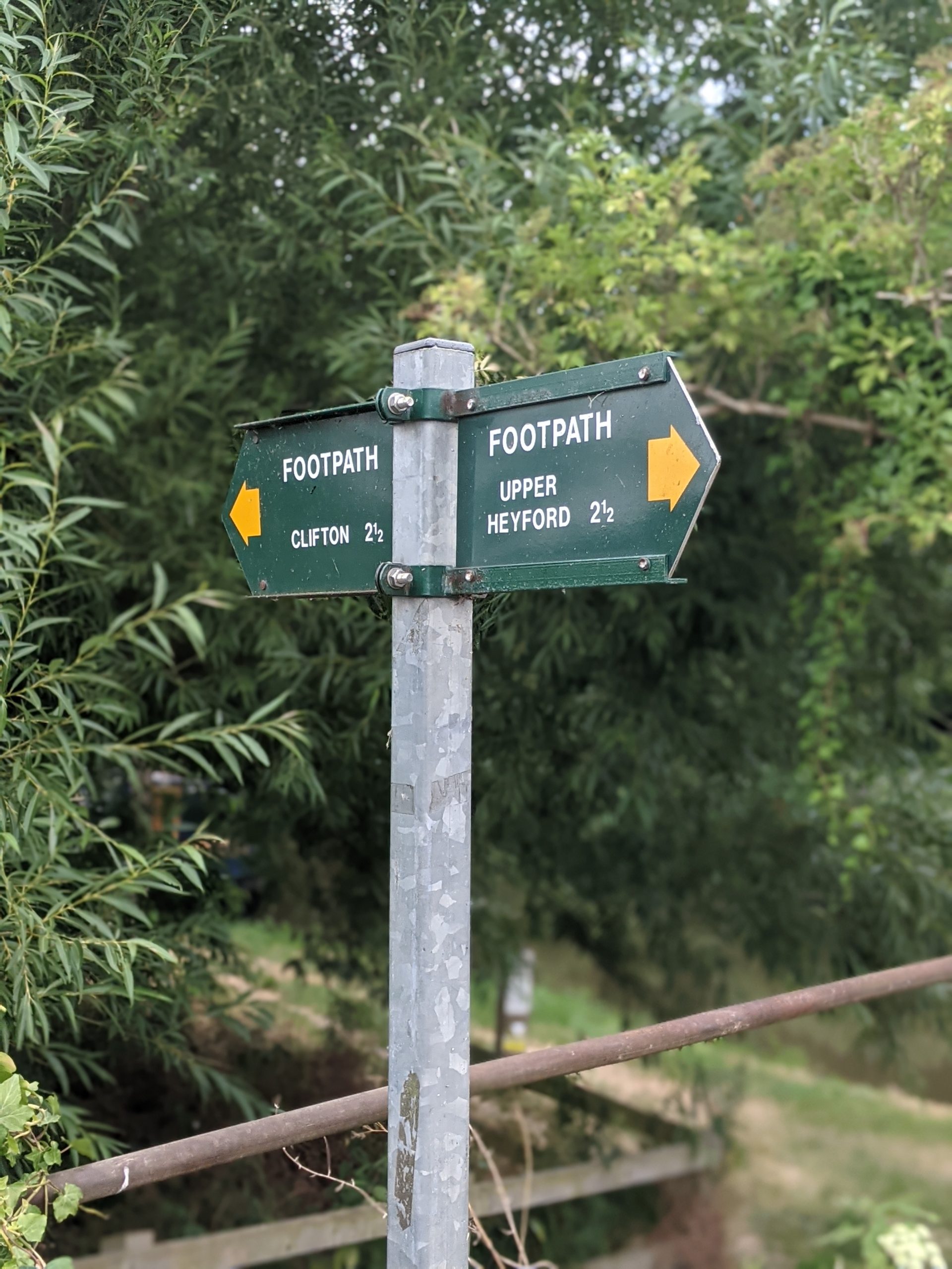
The Mid-Cherwell River corridor Focus Area is anchored by a swath of land along the Cherwell Valley – it closely follows the Upper Cherwell Valley Conservation Target Area (CTA) and runs from Clifton past Lower Heyford in the south.
Habitats here are primarily low-lying arable fields and meadows sitting within the floodplain either side of the river corridor. Settlements are sparse in this area, with only smaller villages in the vicinity and the former RAF Airfield at Upper Heyford. The Upper Heyford site has been identified within planning policy as a strategic development site, which in the longer term is likely to bring significant change to the wider area.
There are a series of sites protected for the habitats they provide lying along this corridor. They include the Bestmoor SSSI – which has a long history as a hay meadow and provides species-rich grassland – and the Wharf Farm Meadows LWS.
A larger cluster of protected habitat lies further to the east at Upper Heyford – including the Ardley Trackways SSSI, the linear Ardley Cutting and Quarry SSSI, as well as multiple local wildlife sites at the former RAF Airfield and at Stoke Wood.
Beyond these protected sites, there are smaller areas along the river with important lowland meadow habitat – however they are disparate and often not connected by wildlife or green corridors.
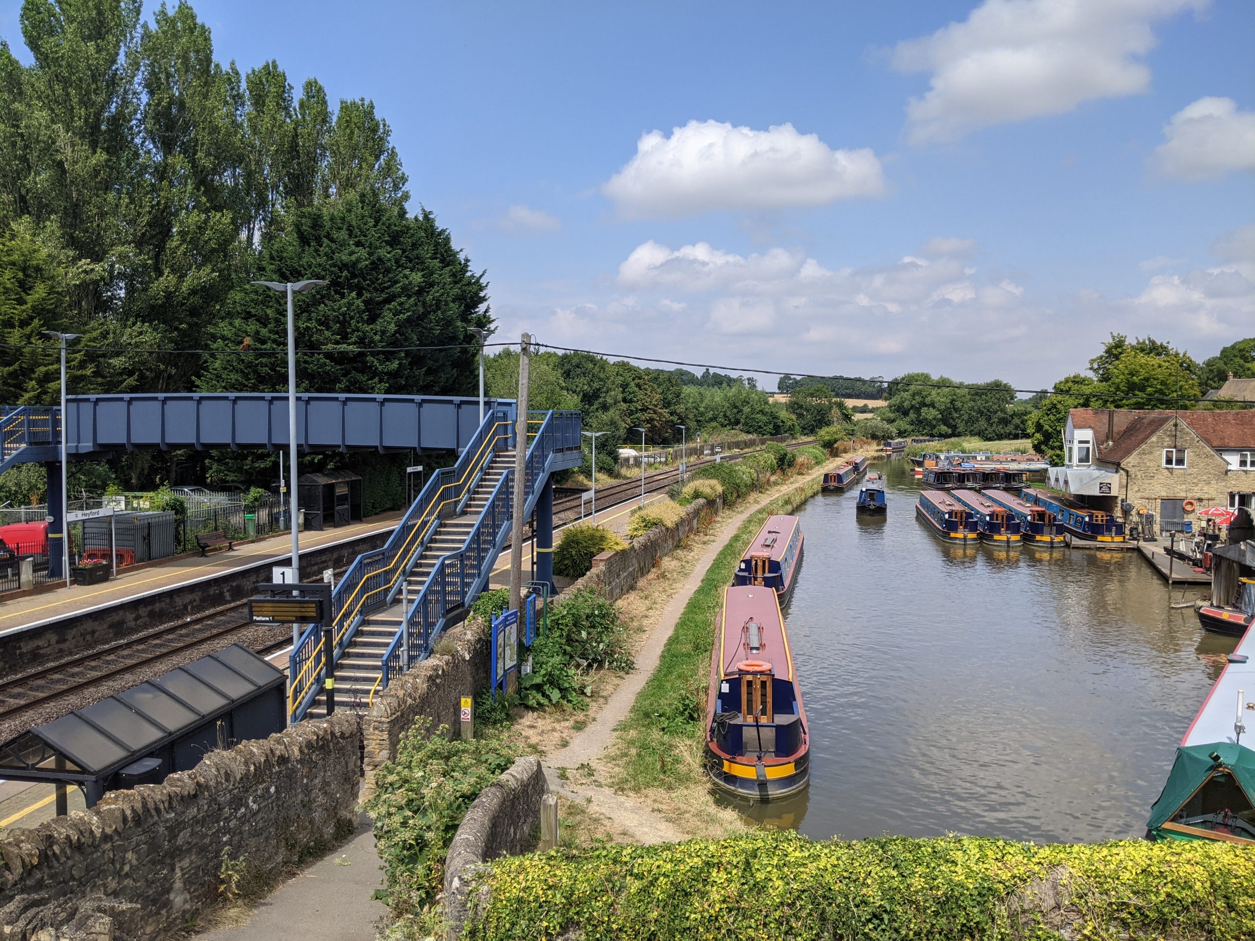
Recreational access along the corridor is somewhat limited, with few areas of public open space. However, the long-distance Oxford Canal Walk provides routes as far south as Oxford. Heyford Station provides railway access to the area, with a car park occasionally used for access to the long-distance walks in the Cherwell Valley.
The existing 2015 Local Plan includes a long-term objective to establish a series of open spaces along the Oxford Canal and River Cherwell corridors. This would be linked by public footpaths/cycleways, with opportunities for parks, play and recreation along the way.
See Appendix 2 for a summary of all stakeholder comments.
Lower Heyford train station and Oxford Canal Path
Conservation Target Areas around the Mid-Cherwell River Corridor
There are two designated Conservation Target Areas (CTA) in proximity to this corridor:
- The Upper Cherwell Valley CTA follows the River Cherwell Valley, and encompasses both the River Cherwell and Oxford Canal from Clifton to Lower Heyford. Key habitats include extensive areas of lowland meadows, areas of lowland fens and swamp, limestone grasslands, and reedbeds.
- The Ardley and Upper Heyford CTA relates to the plateau of land between Ardley and Upper Heyford. The area supports approximately 50% of calcareous grassland within Cherwell District and supports abundant wildlife and species diversity. Key habitats include important grassland habitat at Upper Heyford, lowland calcareous grassland at Upper Heyford Airfield. Targets include the restoration of grassland and hedgerows, grassland management to support nesting birds, and protecting Great crested newts.
Key challenges for Mid-Cherwell’s GBI network
Flooding: The Cherwell Valley is a floodplain and has a history of both fluvial and groundwater flooding (see interactive map). Although there is limited settlement along this stretch of the river, there are significant opportunities here for preventative upstream flood mitigation. This would minimise impacts downstream in areas of denser population. Nature-based solutions (including flood retention areas upstream, riparian plantings, and thoughtful use of floodplains) offer an opportunity to address this challenge. Academic research from 2003 suggests that meandering and naturalised sections of the River Cherwell floodplain can slow water flows and reduce flood impacts.
Access to open space: There are few areas of publicly accessible large natural space in this area. Any new development within this area will need to provide significantly enhanced access to open space.
Connectivity: The Mid-Cherwell area has limited connectivity for walking and cycling, particularly moving east-west. The Oxford Canal Walk provides some connectivity moving north-south, but there are limited connections from this central spine out into the wider landscape.
Water quality: This section of the River Cherwell is currently assessed as having ‘moderate’ ecological status (as determined by the Environment Agency). Major drivers leading to poor water quality include poor livestock management, agricultural land uses and sewage and water treatment inputs.
Key local delivery partners in Mid-Cherwell
- Oxfordshire County Council
- Upper Heyford Parish Council
- Canal and River Trust
- Lower Heyford Parish Council
- Somerton Parish Council
- Cherwell District Council
- Thames Water
- Cherwell and Ray Catchment Partnership (hosted by BBOWT)
- Local businesses and developers
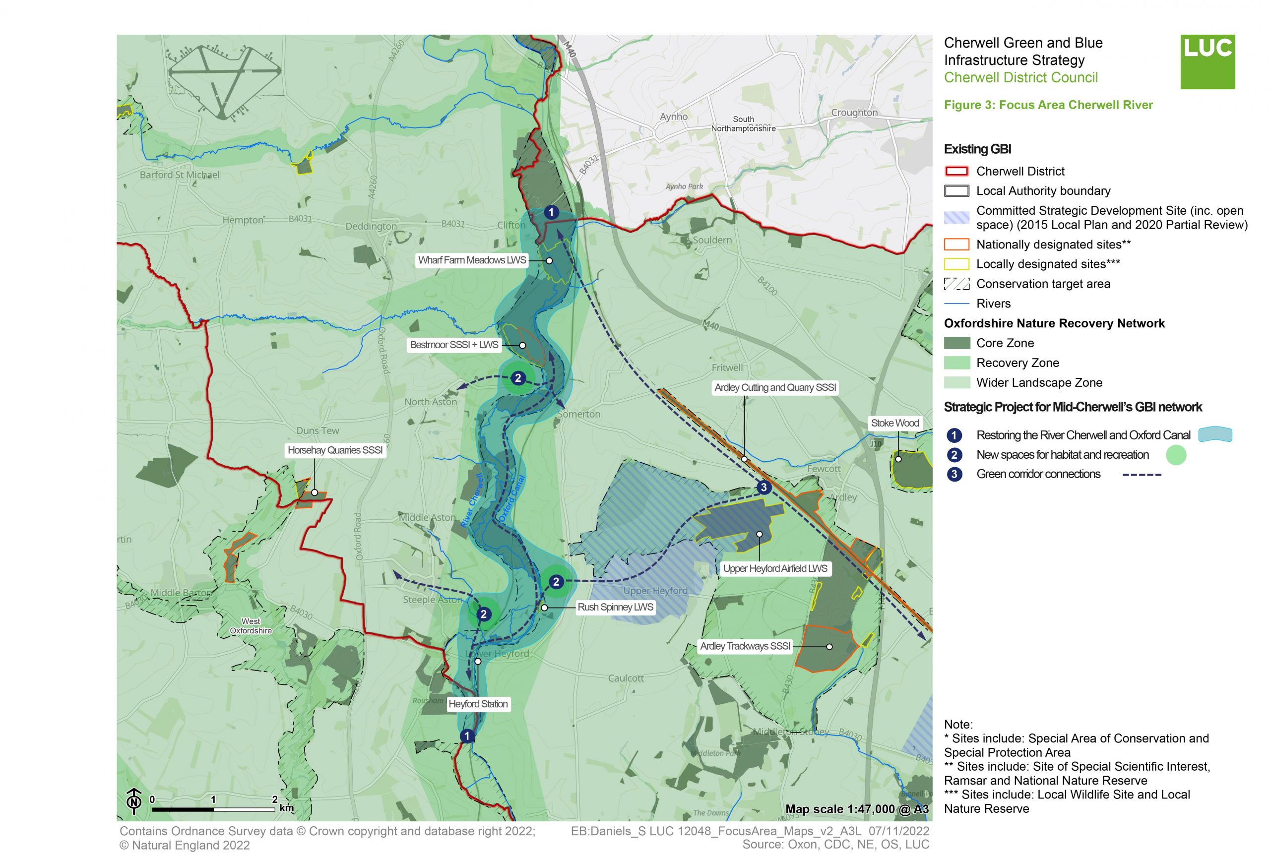
Strategic project for improving Mid-Cherwell's GBI network: A River Cherwell Waterway Park
This corridor, and enhancements along it, are likely to continue to form a key node within the wider GBI network and Nature Recovery Network.
In the case of this Focus Area, this Strategy only proposes one overarching Strategic Project – the creation of a landscape-scale River Cherwell Waterway Park. This could be delivered in stages. Any future development in this area would be required to strengthen it and support its restoration.
This map summarises the various components of this Strategic Project. It also illustrates how these components align with areas highlighted as part of the Oxfordshire Nature Recovery Network.
The paragraphs below provide further commentary on the components highlighted on the map – including indicative costs and time frame.
You can find a summary of the method for identifying these strategic projects in Appendix 3 of this report.
Purpose
To create a nature-rich “green lung” through the central part of Cherwell, enhancing access to the landscape along the green-blue spine of the River Cherwell and allowing for landscape-scale nature recovery. The corridor should also play a significant role as a long-term nature-based solution (NBS) to flood risk in the wider area by storing water in the landscape and reducing flooding downstream.
Key components of opportunity
Component 1: Restoring the health of the River Cherwell and Oxford Canal
As a primarily arable landscape, water quality within the River Cherwell is impacted by run-off and silting, with knock-on effects on riparian and aquatic habitats. The following improvements would help to restore the health of the river corridor:
- Enhancing water quality through vegetation: Where appropriate, riparian planting can help to reduce silting and runoff, reducing nutrients within the watercourse. Riverside and floodplain planting would help to restore habitats, supporting priority species such as otter and water voles – particularly in areas where it has been removed for arable or grazing use. Vegetation also builds natural water retention capacity and slows water flows, reducing flood risk. Trees and shrubs cool the temperature of rivers, increasing the resilience of fish and invertebrate species to climate change impacts.
- Floodplain restoration: In parts of these corridors where interventions will not impact existing settled areas, land should be identified for floodplain expansion and restoration. In line with the Upper Cherwell Valley CTA targets, areas may be identified for floodplain grazing marsh restoration, the creation of lowland meadows and reedbeds. Research has found that re-naturalised sections of the River Cherwell slow water flow and reduce flood impacts.
- Removing barriers: There are a number of weirs along the River Cherwell in this area and a number of sluices along the Oxford Canal. Research shows that weirs in particular can have an impact on the natural state and hydrological function of the river and the river’s ability to support diverse species. Removing barriers can both reduce flood risk and enhance the natural environment.
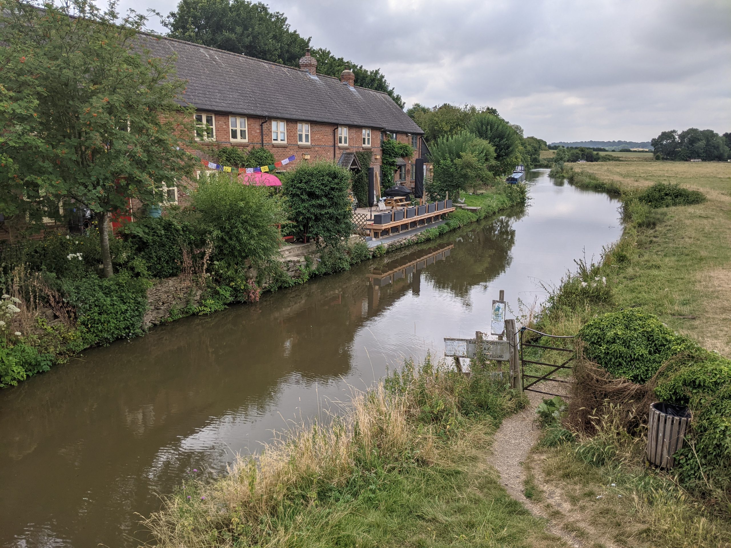
River Cherwell through Somerton
Component 2: New spaces for habitat and recreation
This component seeks to identify appropriate areas for publicly accessible nature spaces along the Oxford Canal and River Cherwell. These spaces would provide important recreational nodes near existing settlements, connecting residents to an important wellbeing resource and opening up a more cohesive network of green-blue spaces.
Opportunities for interpretation boards and educational spaces should be explored to shape a ‘learning space’ and promoted as part of the creation of a nature-rich waterway park.
Key opportunities include:
- Connecting Steeple Aston and Lower Heyford: Existing elements within Lower Heyford (such as the railway station with access to the canal, boat hire services, waterfront pubs, and overall recreational popularity) suggest the need for a new green space close to the village. An existing PROW connects Steeple Aston and Lower Heyford and is well used – the creation of a new park along the river here would serve both local communities and visitors to the area.
- Gateway to Upper Heyford: This space would serve as a gateway and landing point between the Upper Heyford settlement (and Strategic Development Site) and the River Cherwell/Oxford Canal corridor. Land north of Allens Lane or north of St Marys Church should be explored as a potential area to connect with the canal towpath and provide public riverside access. Developing a new green space here would also serve as a connecting piece between the Ardley and Upper Heyford CTA and the River Cherwell Corridor. Introducing boardwalks and formalised paths from the settlement through to the river corridor would enhance local access to the high quality blue-green spaces in proximity.
- Nature-exploration park at Somerton near Bestmoor SSSI: There is a deficit of publicly accessible green spaces between North Aston and Somerton. However, the PROW network passes through the area with clear views over the nearby Bestmoor SSSI – which hosts important river meadowlands. A new nature space can be created between the two villages and along the canal and river. The careful introduction of boardwalks and interpretation boards would allow public access to the space with minimal disturbance to the existing habitat.
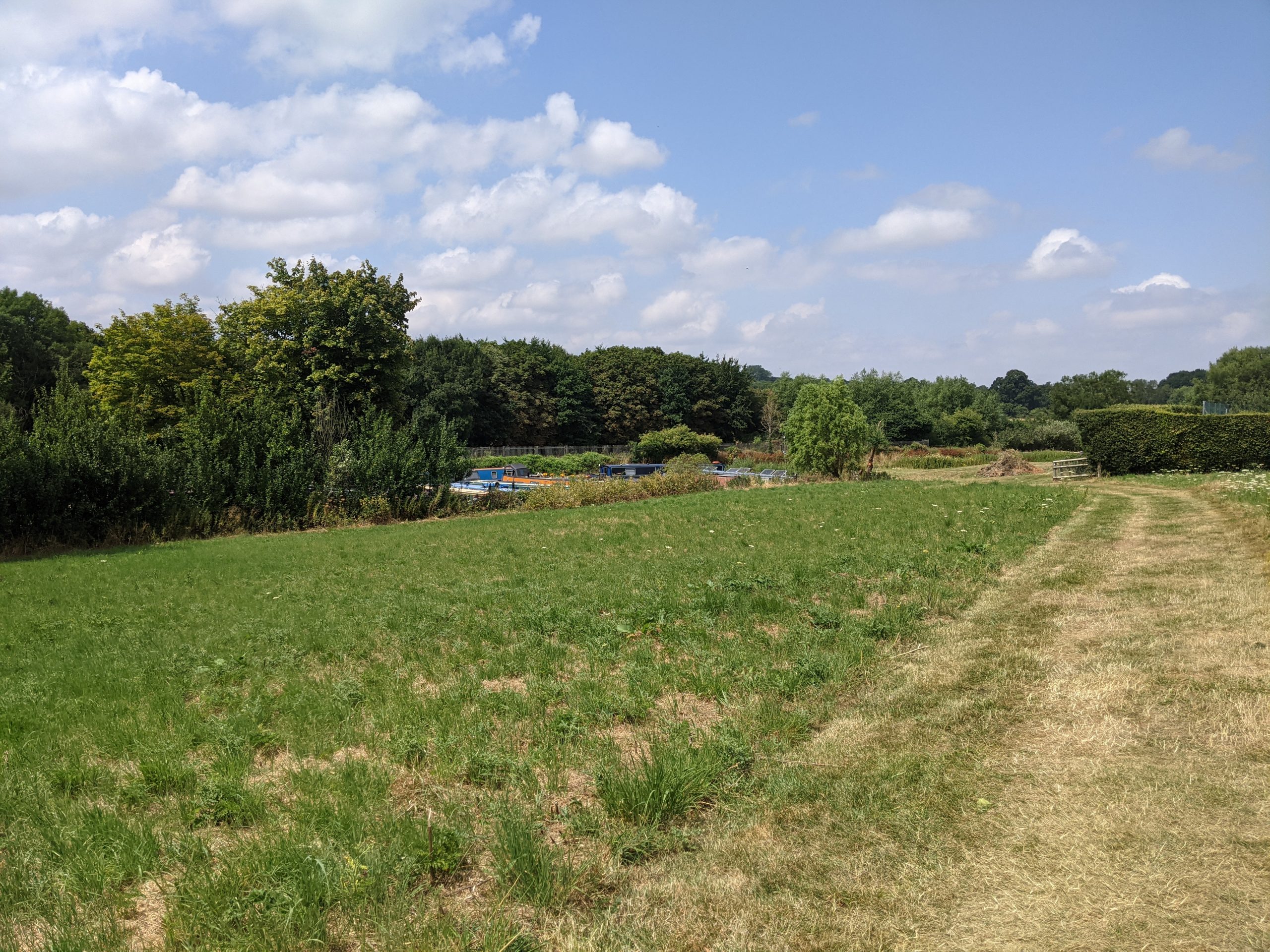
Lower Hayford green space along Oxford Canal
Component 3: Green corridor connections
Enhancing a series of key connections between open spaces within and around the Mid-Cherwell corridor, in order to address fragmentation of wildlife and recreational movement. These would connect local residents to nearby settlements and to the important blue-green corridor. It would also help to reduce the demand for car travel in the local area, enabling sustainable development sites.
The existing footpath and cycling network in the area is fragmented. Efforts should be made to join up important east-west links across, and to the river and canal corridor. The following connections will improve the experience for walkers and cyclists and create greater opportunities for engagement with the natural environment:
- Connections to Ardley Trackways SSSI: Creating a connected pathway along the existing linear Ardley Trackways SSSI. This would link the Strategic Development Site at Upper Heyford and the Oxford Canal. Future residents would have easy access to an important nature and wellbeing space by foot or by bike. It would also open up access to the wider landscape, including to the Bicester Focus Area.
- Oxford Canal to Upper Heyford: Clarifying connections between the eastern edge of Upper Heyford and the Oxford Canal with enhanced signage. This should consider opportunities to connect the existing settlement to the Strategic Development at Heyford Park (through the existing park and playing field in the north).
- Heyford Station: Opportunities for cycle paths extending from Heyford Railway Station, along with improved cycling storage at the station. This will make access easy by foot or by bike to the recreational spaces and tracks along the canal.
- Enhanced canal access: The canalside route could be improved by exploring widening the towpath to 2 metres minimum in order to accommodate multiple uses (see the Canal and River Trust towpath guidance for further information). As a central spine connecting smaller settlements in the area and enabling access to nature, the path should be easy to use and accessible. Signage should be consistent, with east-west connecting footpaths clearly marked and vegetation maintained.
Indicative cost
Low (< £100k) for smaller individual components and maintenance.
High (> £500k) for floodplain restoration and creation of new parks.
Indicative time scale
Quick win (less than 1 year) in the case of smaller scale initiatives.
Long term (5+ years) in the case of more ambitious, larger-scale interventions.