Guidance for new development
The role of GBI in good design
Integrating Green and Blue Infrastructure into new development is a central part of the broader push for high design quality – as advocated by the Cherwell Design Guide SPD. The SPD highlights that:
“Investment in high quality design today will create a legacy of delightful and successful places for future generations to enjoy.”
Stakeholders engaged for this Strategy also highlighted the importance of GBI as an important design tool to address the impacts of development – noting that it must be considered at the earliest stages of development rather than as an afterthought.
The existing Design Guide SPD already incorporates a number of considerations which cumulatively will significantly strengthen the wider GBI network.
A national Housing Design Audit for England carried out by the Place Alliance looked into 142 large-scale, housing-led development projects across England and delivered a number of key messages and recommendations from the nationwide picture.
The audit noted that green infrastructure is “fundamental to creating a pleasant and healthy external environment in which residents will wish to spend time”, but that:
“the green landscape is often viewed as the forgotten dimension of urban design, applied after-the-face in an attempt to obscure ugly architecture or parking, or alternatively removed from masterplans prior to their development in an attempt to save on maintenance costs.”
One of the headlines of the audit is that “too often green landscape and biodiversity was sacrificed for a hard and over-engineered environment”. Development across the UK was overwhelmingly scored as ‘mediocre’ on this dimension – with poorer scores outside the south east.
The key difference was between schemes that exploited the existing landscape as a biodiverse resource (including retaining existing mature trees, water features, hedgerows and so forth) and those which did not. Less successful sites delivered “leftover bits of green with no obvious function, either social or environmental”.
This highlights the need for the design of new development to be considered in terms of functions delivered (for People, Nature and Place) rather than assets provided – as set out within this Strategy.
The Building With Nature (BwN) Standard
Building with Nature is the UK’s first green infrastructure benchmark. It is a voluntary accreditation scheme that enables developers, who want to go beyond the statutory requirements, to create places that really deliver for people and wildlife. It has become something of a ‘gold standard’ in nature-rich design, which CDC may choose to encourage among applicants.
The scheme brings together guidance and good practice to recognise high quality green infrastructure at all stages of the development process. It has been developed by practitioners and policy makers, academic experts and end-users, and has been tried and tested in multiple schemes from Cornwall to Scotland.
Establishing a set of principles for incorporating GBI into new development
The following list of questions and discussion points should form the basis for early-stage discussions between Development Management teams and developer teams – when planning new development in the District.
Developers or site promoters should be aware that there is a wealth of GBI-related spatial data available within Cherwell. This should be reviewed in detail at the very outset of developing conceptual site designs.
The Cherwell Design Guide SPD encourages these early conversations, saying that:
“the Council encourages pre-application engagement before a site is purchased as this provides an opportunity to establish and agree the brief for the site that will inform development value assumptions”.
The principles set out here are grouped around nine important features of a development. The text below in italics highlights key relevant points from the Cherwell Design Guide SPD.
When responding to the site and its context it highlights that analysis should “identify opportunities for reinforcing existing features as part of a green infrastructure strategy”. The green infrastructure network should also form a key part of masterplan refinement – alongside streets and urban blocks.
It is important that developers review these principles alongside the Focus Area Profile relevant to the area in question – which will help to draw out more location-specific considerations, challenges and GBI assets.
Principle 1: Starting with the landscape and natural capital value
- Does the design seek to retain, protect and incorporate existing landscape and ecological features of suitable condition and quality as part of its layout?
- Does the development deliver multifunctional GBI design which effectively integrates benefits for People, Nature and Place?
- Does the site layout safeguard those areas identified for their natural capital value by Oxfordshire-wide mapping?
- Does the site layout take opportunities to enhance the natural capital of those areas where natural capital mapping identifies strategic networks of GBI? And does the site layout seek to boost natural capital value in areas identified as ‘low value’ in the mapping?
- Have surface water management and SuDS opportunities been considered at the earliest stages of concept planning? Including natural flow paths and potential discharge points?
- Does the design of the scheme connect effectively beyond the ‘red line boundary’ of the site and take account of its wider environment?
The Cherwell Design Guide SPD (4.7) places strong emphasis on “landscape structure”. It notes that “existing landscape features should be incorporated positively and reflected in a green infrastructure strategy for development”. This includes open spaces, hedgerows and Sustainable Drainage Systems (SuDS).
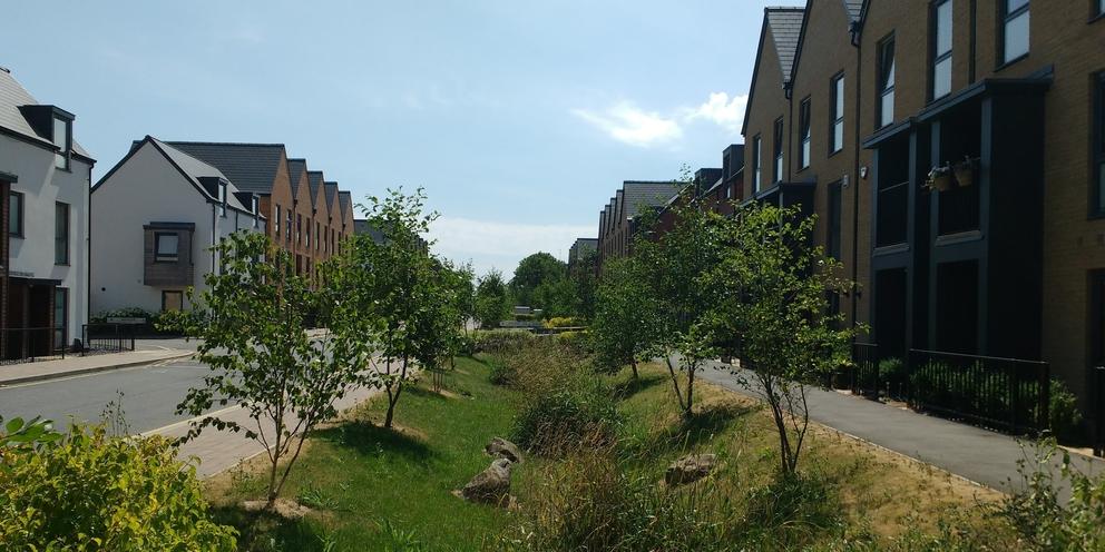
Principle 2: ‘Garden streets’/living streets (for residential developments)
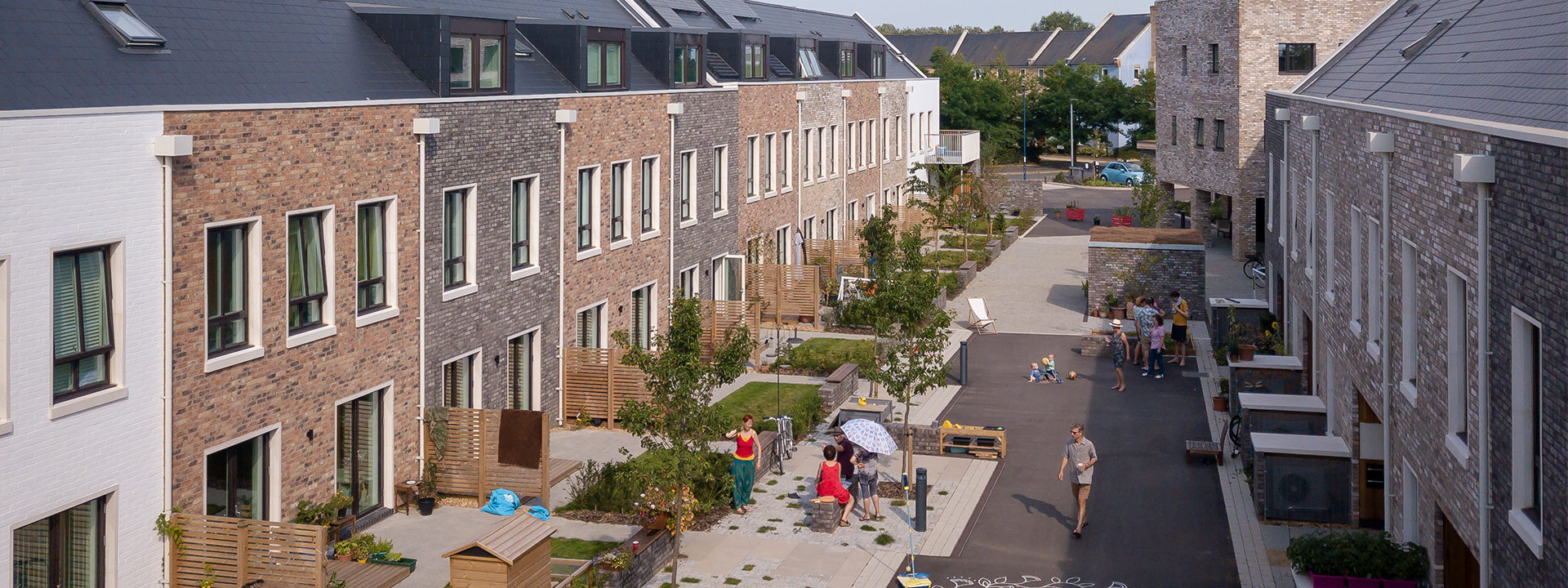
Designing GBI into new development does not meaning maximising the GBI value of the ‘left over space’ between buildings. Specifically, this means re-thinking how a masterplan treats streets, how it arranges the housing layout and whether the masterplan reasserts the place of streets at the heart of the community and the urban GBI network. This approach should take inspiration from the Belgian city of Antwerp’s ‘tuinstraten’ (or ‘garden streets’) or from the community street which sits at the heart of the Marmalade Lane development in Cambridge (pictured above, and highlighted in the UK’s 2021 National Design Guide as good practice, under Principle P1).
As set out in the National Design Guide, these types of living streets provide high levels of value in prioritising pedestrians with a focus on social interaction, such as play, communal gatherings and places to sit with neighbours. Simultaneously, the space freed up for urban greening can help to combat the ‘urban heat island’ effect, manage flood risk and provide resources for wildlife, including pollinators.
- Does the design utilise examples which reject ‘business as usual’ for street design in residential settings – with the incorporation of car-free of ‘car-light’ community streets and low levels of parking instead provided around the edges of the development plot?
- Do streetscapes within the development meaningfully provide spaces where community members of all ages can safely and enjoyable spend time and interact with each other?
- Have the following been considered as part of the ‘toolbox’ for living streets throughout the development?
- modal filters and other traffic calming features e.g. speed tables, raised intersections and low curbs or no curbs.
- planted ‘facade gardens’ (preferred over large front gardens) which help the building frame and enclose the street.
- ample seating.
- bike parking.
- planter boxes (including for small scale growing).
- human-scale lighting.
- limited signage.
- small-scale playful elements within a car-free streetscape.
- Does the street provide ‘access for all’, including for those with constrained mobility and elderly residents?
- Is surfacing permeable where possible and materials selected thoughtfully to provide a ‘cue’ for drivers to slow down – using alternatives to asphalt on small-scale streets unless justified otherwise?
- Do urban greening features actively improve climate resilience, including combatting the ‘urban heat island’ and combatting flood risk (e.g. through small-scale SuDS features)?
Chapter 5 of the Cherwell Design Guide SPD on ‘Streets and Spaces’ reasserts the importance of streets, which “make up the greater part of the public realm” and are “the public face of a settlement, providing the stage for movement and daily life”. The Guide highlights the need for buildings to create a ‘comfortable sense of enclosure’ by buildings, and for traffic calming as part of the urban form. It requires development to avoid ‘over-engineered street design’ and poorly considered parking arrangements (5.1).
Principle 3: Building the Nature Recovery Network
- Does the site layout safeguard those areas identified as ‘core’ parts of the mapped Oxfordshire Nature Recovery Network? Does it avoid major development and create areas of nature-rich accessible green space in areas identified as the ‘recovery zone’?
- Does the site layout and design boost the nature value of the ‘wider landscape zone’ through accessible natural green space, natural flood management, new woodland or other appropriate habitats?
Principle 4: Tree planting
Image source: Manchester City of Trees
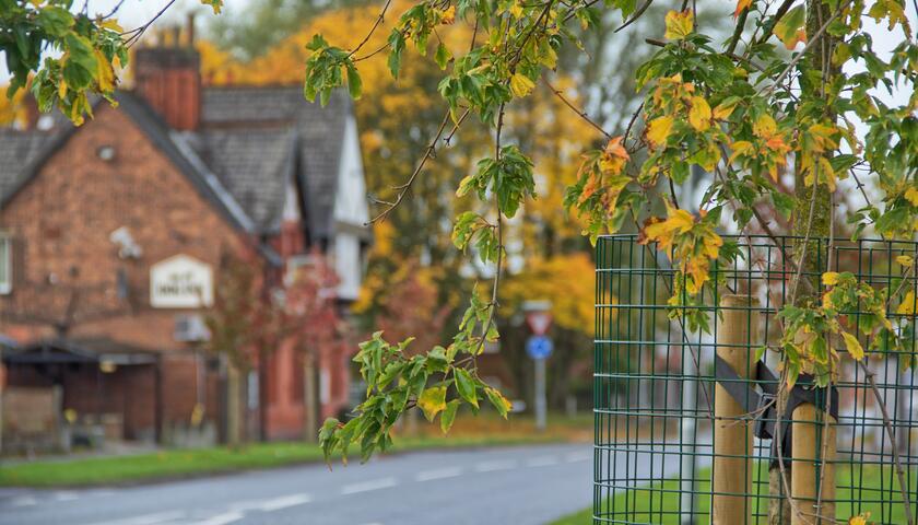
- Does the design seek to retain, protect and incorporate existing trees and hedges of suitable condition and quality as part of the development layout?
- Does the development deliver tree planting as part of a quality landscape design which provides effective benefits for People, Nature and Place?
- Does the selection of the trees take into account factors such as mature crown spread, highway visibility sight-lines, local services, and minimum off sets from intrusive elements?
- Does the placement of trees take into account factors such as below-ground infrastructure irrigation and drainage?
- Where tree lined streets or avenues are planned, careful consideration must be afforded to species, species mix and space for growth.
The Cherwell Good Design SPD (5.9) highlights that “trees and soft landscape are important to the character of Cherwell’s streets and should be incorporated in all street character types”. It adds that street tree planting should be integral to the public realm design”.
In addition, The Tree Policy for Oxfordshire (adopted in 2022) picks this up with a set of policies that include a “presumption in favour of trees” throughout the built environment and the countryside alike.
Principle 5: Walking and Cycling
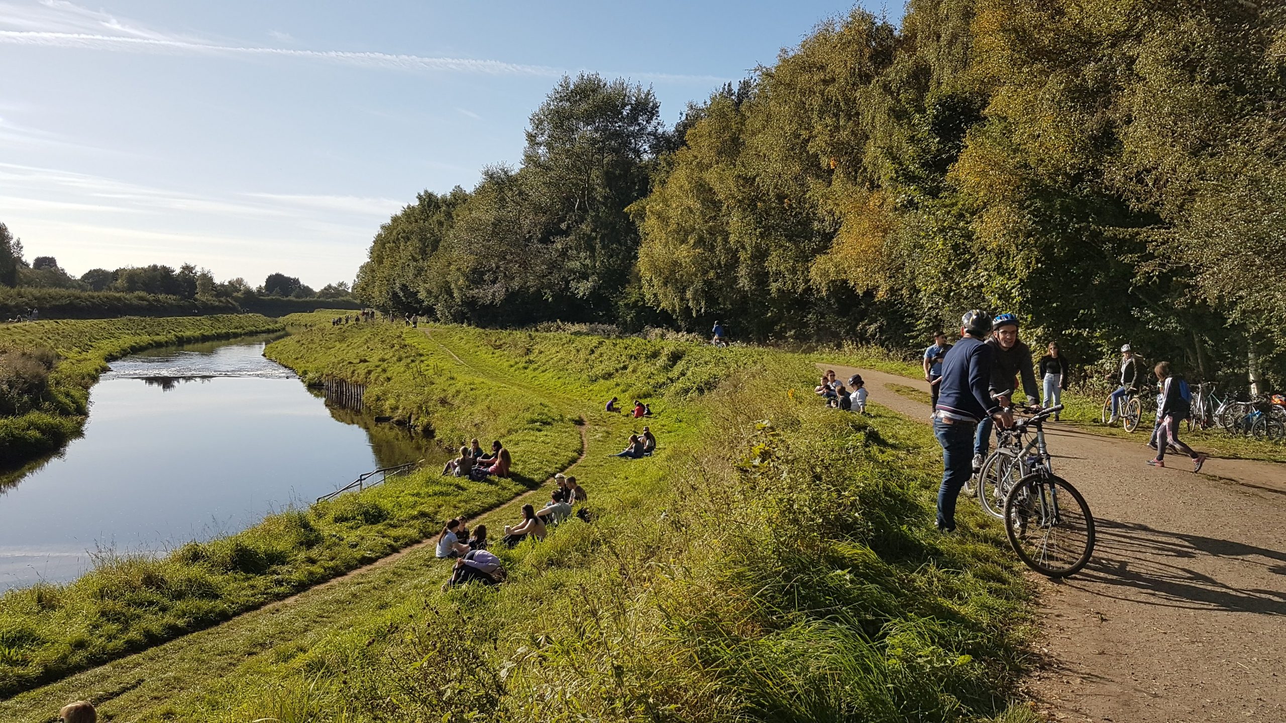
- Does the development start from a presumption that walking and cycling will be the primary mode of travel for short journeys?
- Are walking and cycling routes attractive and integrated with GBI assets of all scales? (see Principle 2 for residential street design)
- Does the scheme connect effectively into the wider walking and cycling networks and greenways, so that people of all ages and abilities can access important daily destinations (including schools, shops and leisure centres) without a private car?
- Can the development minimise car parking provision, supported by controlled parking zones, car free development schemes and car clubs? In cases where this space is ‘freed up’, can it be used for GBI delivery and deliver multiple GBI benefits? (See also Principle 2)
- Greenways that are wide, overlooked and run across sites should seek to benefit the local community in addition to residents of a scheme by ensuring potential connections are utilised. The Council will not permit routes, which whilst direct, are isolated, offer poor accessibility (e.g. narrow) and lack adequate surveillance.
The Cherwell Design Guide SPD (4.9) includes an emphasis on sustainability considerations through masterplan layout. This means that sites should set out a “connected, permeable layout, with a mix of uses within walking distance”. This should incorporate SuDS features and other GI, planned for at an early stage.
Principle 6: Community food growing
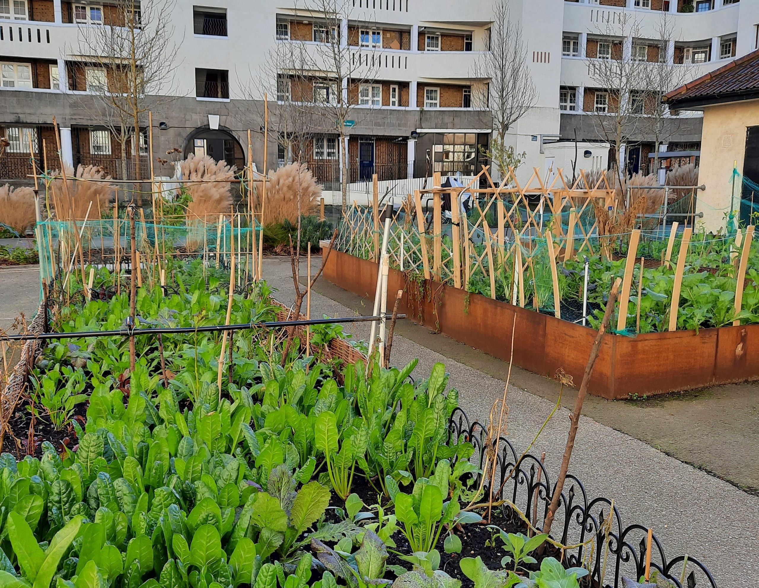
- Does the scheme ensure the provision of designated space to enable effective community growing with appropriate environmental conditions in terms of aspect, shelter, drainage and soil provision?
- Does the scheme consider start-up funding and advertising and support which new residents can use to facilitate a community growing group?
The Cherwell Design Guide SPD (4.7) requires that an overall Green and Blue Infrastructure plan for sites should identify a proposed network of open spaces which offer a range of benefits, including food growing.
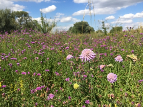
Principle 7: Pollinator Planting
- Are areas of wildflower and ‘wilder’ areas of grassland integrated into the public realm, as opposed to closely mown grass areas? Have any opportunities been missed and why?
- What is the percentage of native species within the proposed planting mix?
The Cherwell Design Guide SPD (4.7) requires that an overall Green and Blue Infrastructure plan for sites should identify a proposed network of open spaces which offer a range of benefits, including the creation of habitats. These features should be fully integrated, connecting new, proposed and existing habitats and public open space on and beyond the site.
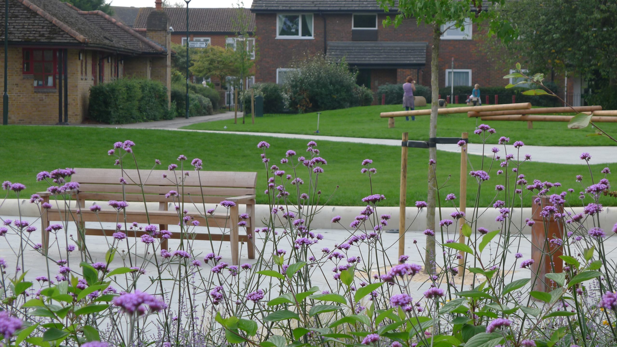
Principle 8: Play
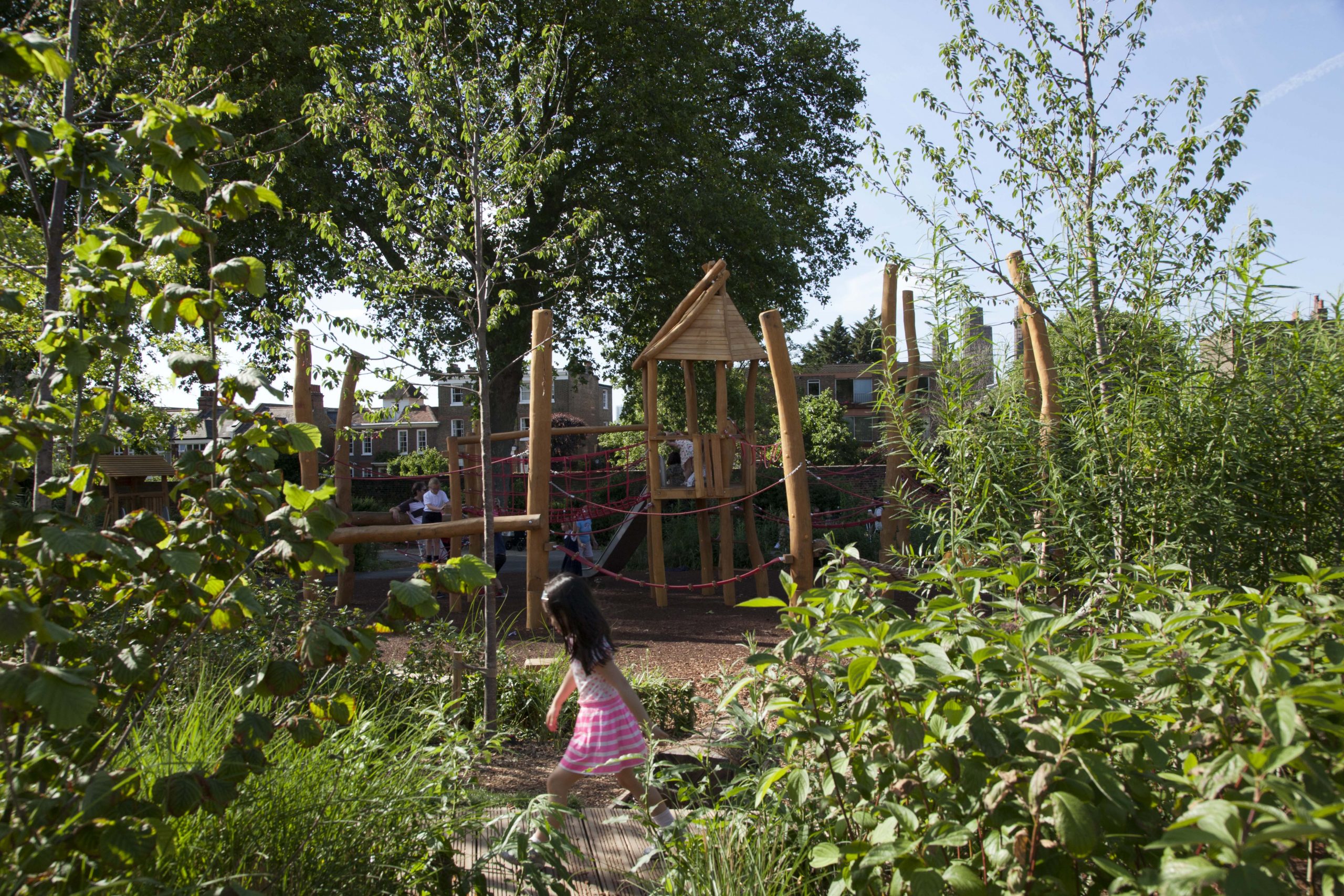
- Do the proposals address the shortfall of play facilities in the area, either by improving quantity and/or quality?
- Is the play area set within an attractive environment with a distinctive sense of place?
- Are the play areas multifunctional and nature-based – effectively delivering benefits for People, Nature and Place?
- Have incidental ‘playable’ spaces been incorporated into the scheme, including along walking and cycling routes? (see also Principle 2)
- Are play spaces provided inclusive – where children of all abilities can play with a rich range of physical, sensory and social experiences? Do the play spaces need to be behind railings? Or can they be more closely integrated into the wider public realm?
Aside from the need for the open space network to accommodate “information recreation”, the Cherwell Design Guide SPD also highlights the importance of designing streets for more than just movement – noting the use of shared surfaces to “create attractive, active streets” which can successfully accommodate children’s play.
In Section 5.10 it also highlights the importance of incorporating play into public spaces – designing these spaces in order to encourage their use for play or other activities.
Principle 9: SuDS and natural flood management
Image source: Susdrain
- Does the proposal ‘make space for water’ through the delivery of new GBI to sustainably manage flood risk for the duration of the anticipated lifespan of the development? Has an allowance for climate change been made in line with Environment Agency guidance?
- Are rivers considered as the centrepiece of the development proposal? Does the proposal take every opportunity to be orientated to encourage access and enjoyment of the water environment – as an important asset within the development layout?
- Does the proposal identify opportunities to better use areas of natural floodplain to store flood waters – to reduce flood risk within this management catchment and further downstream?
- Do the proposed measures provide an important contribution to Flood Risk Management and Water Framework Directive objectives for each watercourse?
- Do the design and long-term maintenance of SuDS support the findings and recommendations of the Cherwell SFRA?
- Have the best SuDS techniques been selected for the available site characteristics – including topography, ground conditions, the surface water runoff destination and the character of the setting?
- Does the proposal maintain at least an 8-metre easement between any built development and the top of the bank of a watercourse and/or the toe of a flood defence? This is to allow for maintenance and inspection requirements – developers should note that the Environment Agency strongly encourages greater buffers (20 metres) as standard to allow for access for larger maintenance works.
- Are SuDS linked to water efficiency measures where possible, including rainwater harvesting?
- Has the local community been engaged in how SuDS should be delivered?
The Cherwell Design Guide SPD includes guidance on the use of SuDS as a key piece of infrastructure which should be considered a structural element of the overall masterplan. They should be “viewed as an opportunity to bring character to the development through their careful integration within both green spaces and streets”.
A SuDS Strategy should be prepared alongside the masterplan and the Council promotes open systems where possible, with swales and ponds preferred over crates.
Principle 10: Long term maintenance
- Has long-term stewardship of GBI assets been discussed at an early stage of the design?
- Have delivery partners been clearly identified?
- Have alternative models been explored, such as partnerships with the Land Trust, the Wildlife Trust, community land trusts (CLTs) or other community-led initiatives?
The Cherwell Design Guide SPD (4.7) highlights the need for secure arrangements for the management and maintenance of open space provided as part of new development.
There is further emphasis on clear arrangements for the ongoing maintenance of SuDS features over the lifetime of development: “In general, it is assumed that the developer will construct the SuDS and provide a maintenance plan and maintain for a minimum period prior to adoption by CDC. This is to be agreed with CDC in pre-planning.”
Maintenance should also be considered at the earliest stages of design. Section 5.9 of the SPD notes that site design should avoid small (narrow) planted areas, which are harder to maintain.