Bicester
Bicester's GBI Network today
Bicester is a historic market town in mid Cherwell with a population of around 30,000. Bicester will rapidly expand over the next 10 years with planned new housing and employment growth. By 2034, the population is estimated to be around 55,000.
The town is surrounded by scenic green rolling fields, meadowland and smaller stone-built villages such as Chesterton, Bucknell, Wendlebury, Ambrosden, Launton and Stratton Audley. The River Cherwell and Oxford Canal river corridor lie just over seven miles west of the town, and the town drains south into the River Ray.
Garth Park, Langford Meadows and Bure Park currently provide access to high quality green spaces for nearby residents. They also provide important corridors to connect wildlife through the town.
In terms of blue corridors, the River Bure runs through Bure Park, Town Brook runs from the town centre to Bicester Village and Langford Brook runs through Langford Meadows. However, Bicester has very few waterfront spaces.
A number of nationally important geological and nature sites (Ardley Trackways, Ardley Fields and Ardley Cutting and Quarry SSSIs) lie to the east of the town. Locally important sites for nature are concentrated south east of the town and surrounding Bicester Airfield.
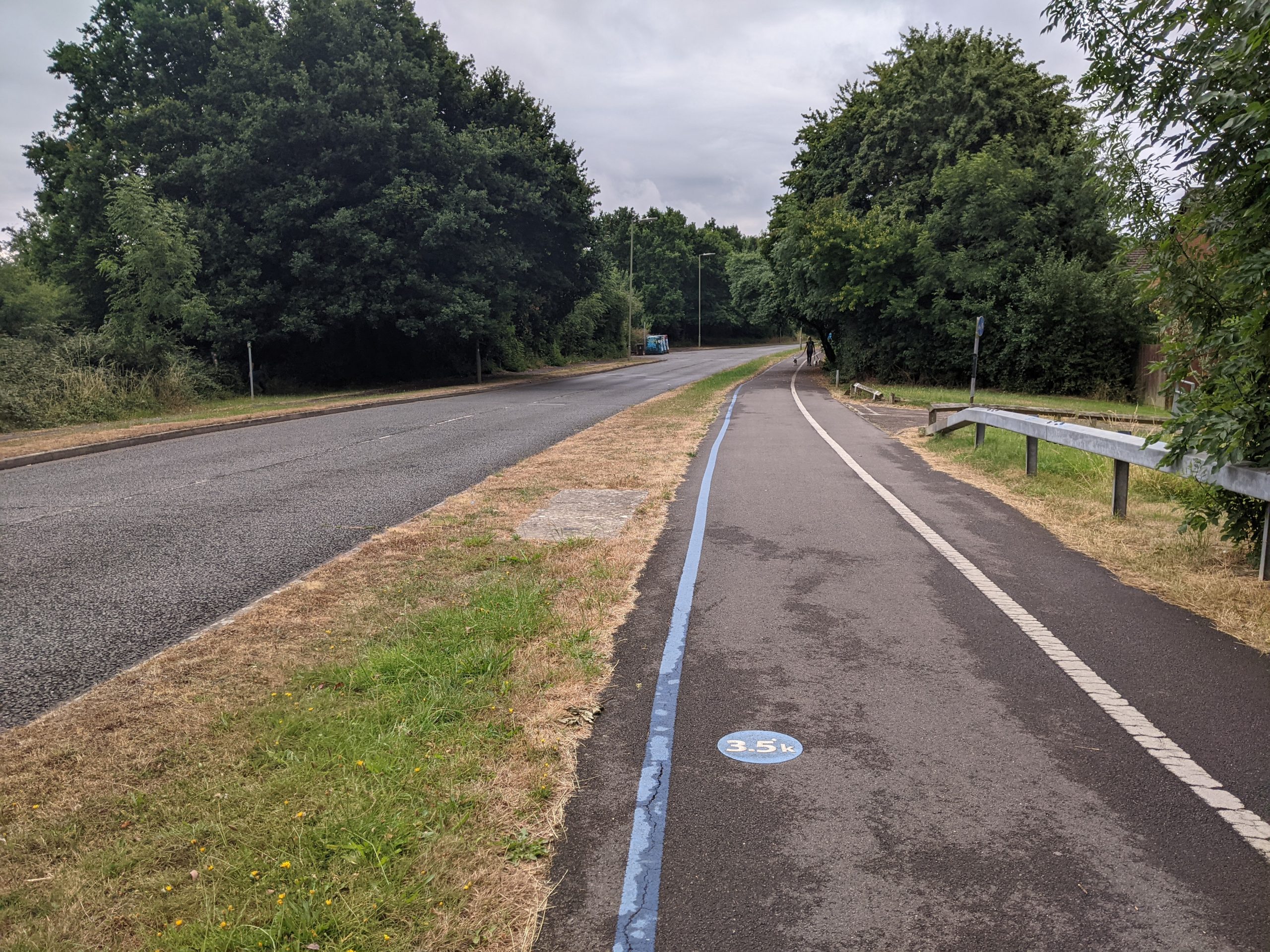
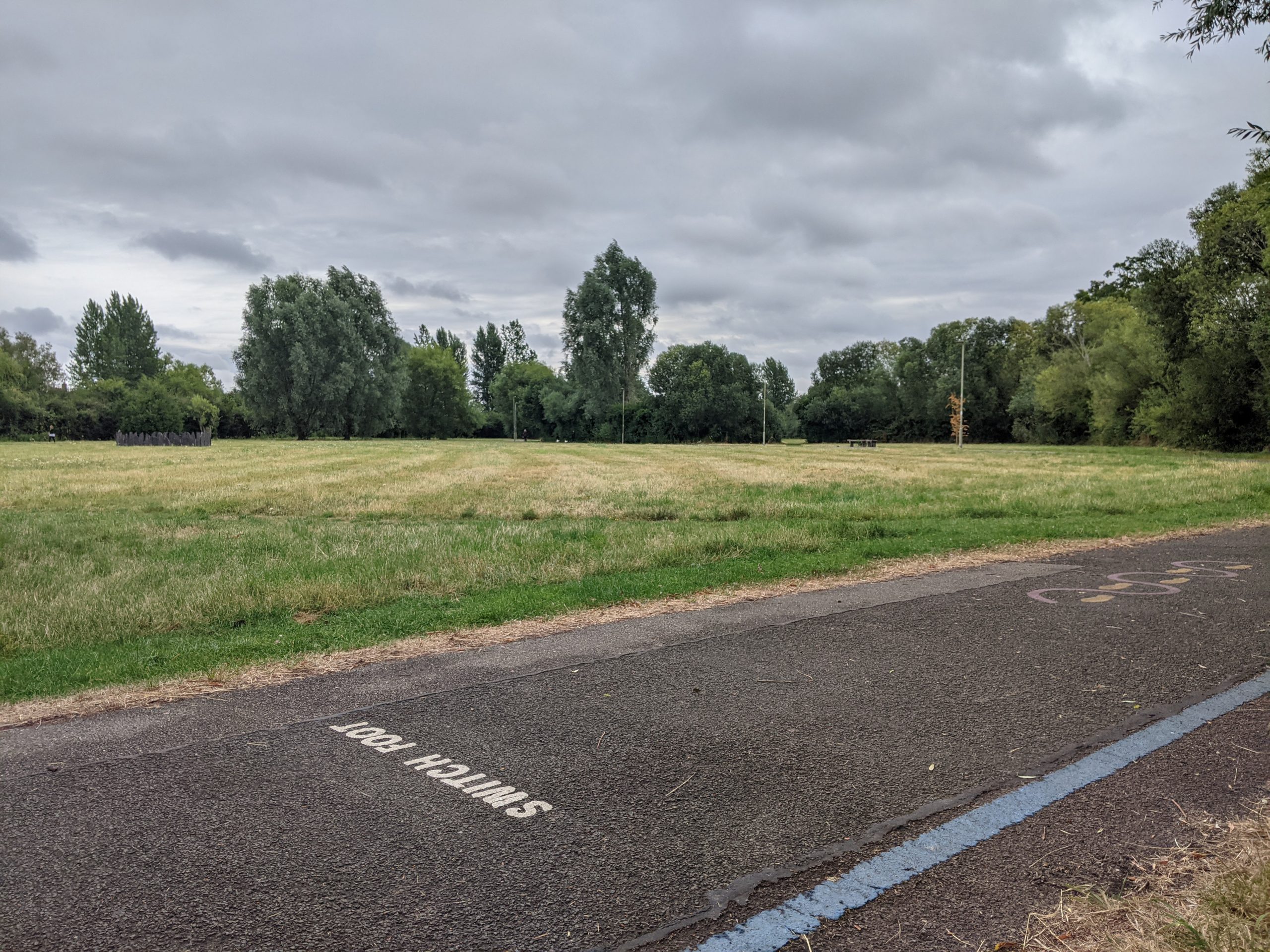
Walking and cycling through Bicester is possible via a network of ‘greenways’ (off-road walking and cycle routes). The greenways mainly connect residential areas to green spaces in the town, but connections are generally poor to the town centre. The Bicester health routes have improved wayfinding in the town.
Walking and cycle routes between Bicester and its surrounding villages (those around 3 to 5 miles away) are largely poor. Bicester is also poorly connected to nearby long-distance walking and cycling routes, such as the Oxford Canal Path.
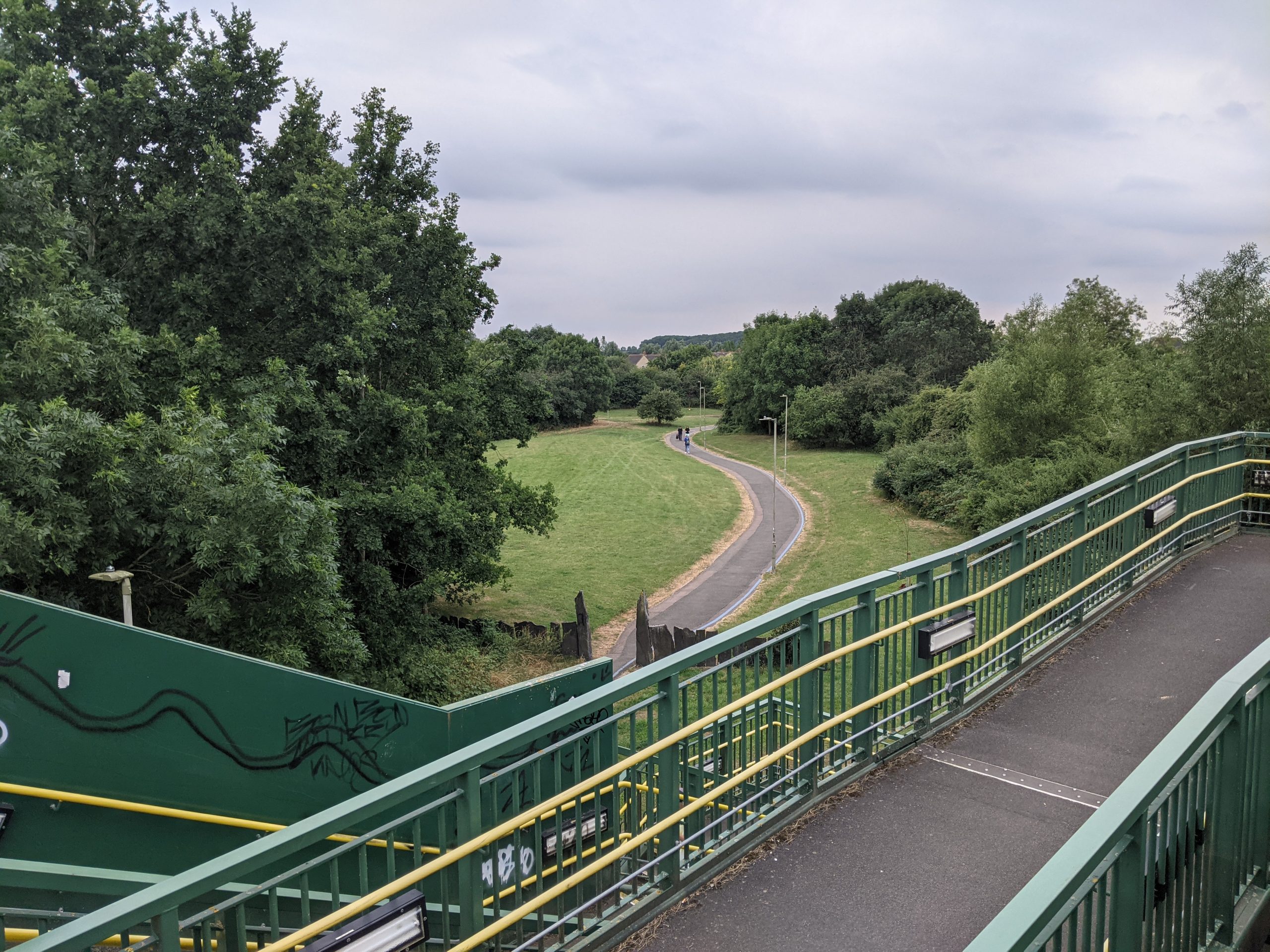
Bandstand and greenway through Garth Park
Stone circle at Langford Meadows
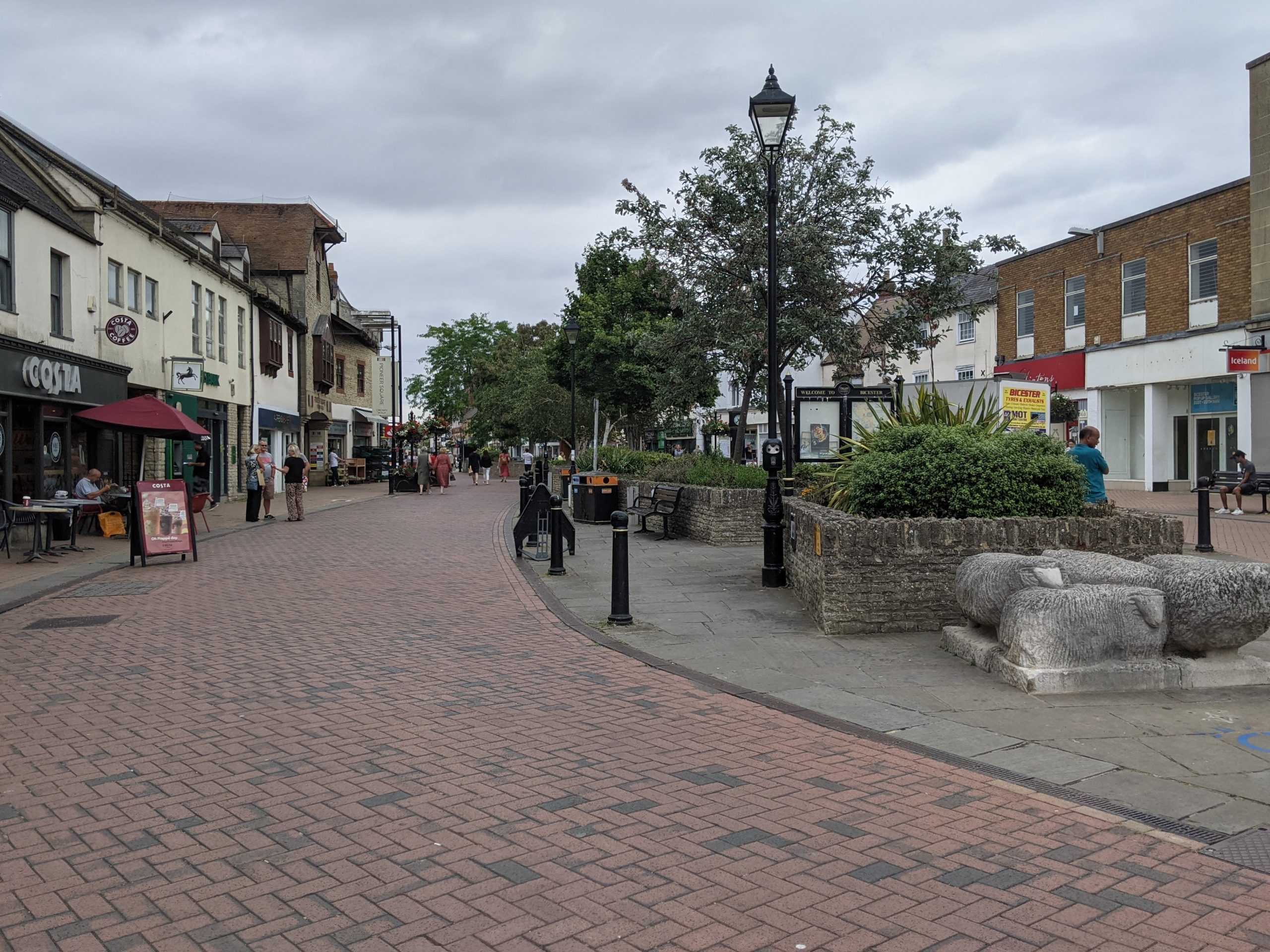
Pedestrianised section of Sheep Street
“Some areas of Bicester are very poorly supplied with green spaces whereas other areas are luckier… There are parts of Bicester which could be promoted as part of our cultural heritage as an ancient Market Town and centre of sheep farming.”
“Bicester is now a garden city but no additional green/open spaces have been created.”
– Stakeholder, online survey
See Appendix 2 for a summary of all stakeholder comments.
Conservation Target Areas around Bicester
There are three designated Conservation Target Area (CTA) within and around Bicester:
- The Ardley and Upper Heyford CTA runs along a limestone plateau between Ardley and Upper Heyford and includes Upper Heyford Airfield, several quarries near Ardley and the railway line. Key habitats and species include calcareous grassland (supporting 50% of this habitat for the Cherwell District). Restoration of tree cover is one of the targets for enhancements, alongside the restoration of the hedgerows and ponds.
- The Tusmore and Shellswell Park CTA includes parks and woodlands at Tusmore and Shelswell and a number of ancient woodlands near Stoke Lyne. Key habitats include wooded estate land and parkland. Targets relate to the creation of mixed deciduous woodland, green corridors between sites and the management and restoration of parkland.
- The Ray CTA extends along the floodplain of the River Ray and into Buckinghamshire. It includes a number of small tributaries and flat riverside land in between them. Key habitats include wet grassland, lowland meadow, hedgerows, rivers and ponds. Targets for enhancement include the management and restoration of wet grassland, lowland meadow, hedgerows, rivers and ponds. They also include protecting the River Ray’s water quality.
Key challenges for Bicester's GBI network
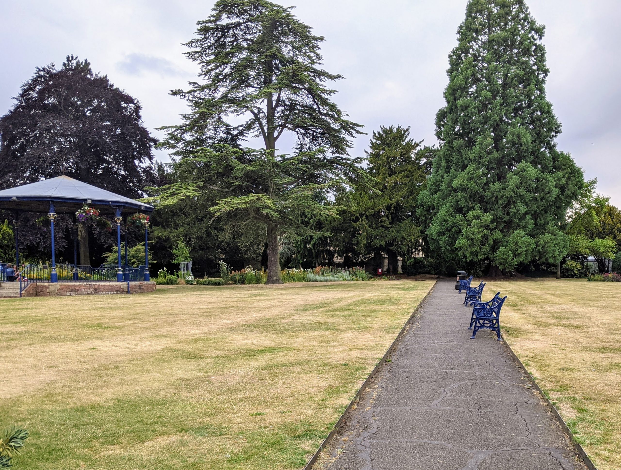
Creating an attractive, green town centre – Bicester has a compact town centre and attractive, heritage-rich historic core. However, the retail, leisure and social offer of the town suffers due to factors including: out-of-town competition, a poor walking and cycling environment with poor connections to the wider town, and few green features or trees. Sheep Street is the main shopping street and has always been at the centre of trade within the town. It is now pedestrianised and hosts a small weekly market. However, the overall street scene is dominated by concrete. Kingsmere retail park and the Bicester Village Designer Outlet luxury shopping destination draw footfall away from the centre.
Integrating new housing development into a robust GBI network – Bicester’s population has already expanded rapidly in the last two decades, driven by the town’s desirable close proximity to Oxford, London and Birmingham. Bicester is recognised as a strategic area for growth in the County and was given Garden Town status in 2014, alongside plans for 13,000 new homes in the town. As a Garden Town, the UK government is providing additional funding for a range of new homes that should be planned around healthy communities, with plenty of access to green spaces. The opportunity map highlights areas where development has been allocated. The North West Bicester Masterplan SPD (2016) is based on a landscape framework for new edge-of town development, using existing field boundaries and hedgerows as features of the site.
Connectivity for walkers and cyclists – There are significant gaps in Bicester’s footpaths and cycling routes, which limits opportunities for active travel in Bicester. This is particularly the case when accessing the town centre, the two train stations, and travelling between peripheral residential areas. Access by walking and cycling to green and blue assets in the town’s wider landscape is also poor. Bicester’s 2020 LCWIP found that 47% of all car trips are made for journeys under 5km and that 22% of trips under 1km are made by car.
Flooding – Areas of the town at high risk of river flooding are concentrated along Langford Brook and Town Brook (see interactive map). Development along the river corridor will be high risk as climate change increases the intensity and frequency of flood events.
Tree and woodland cover – Greenery is limited within the core of the town and on the edges of the town where it meets the wider landscape. Tree cover is more extensive along the east-west rail corridor and to the south and south west edges of the town. Expanding tree cover would improve air quality, mitigate urban heat island effects, absorb carbon, and provide sheltered public spaces within the urban core. It could also help to improve connectivity joining up green spaces, encouraging walking and cycling.
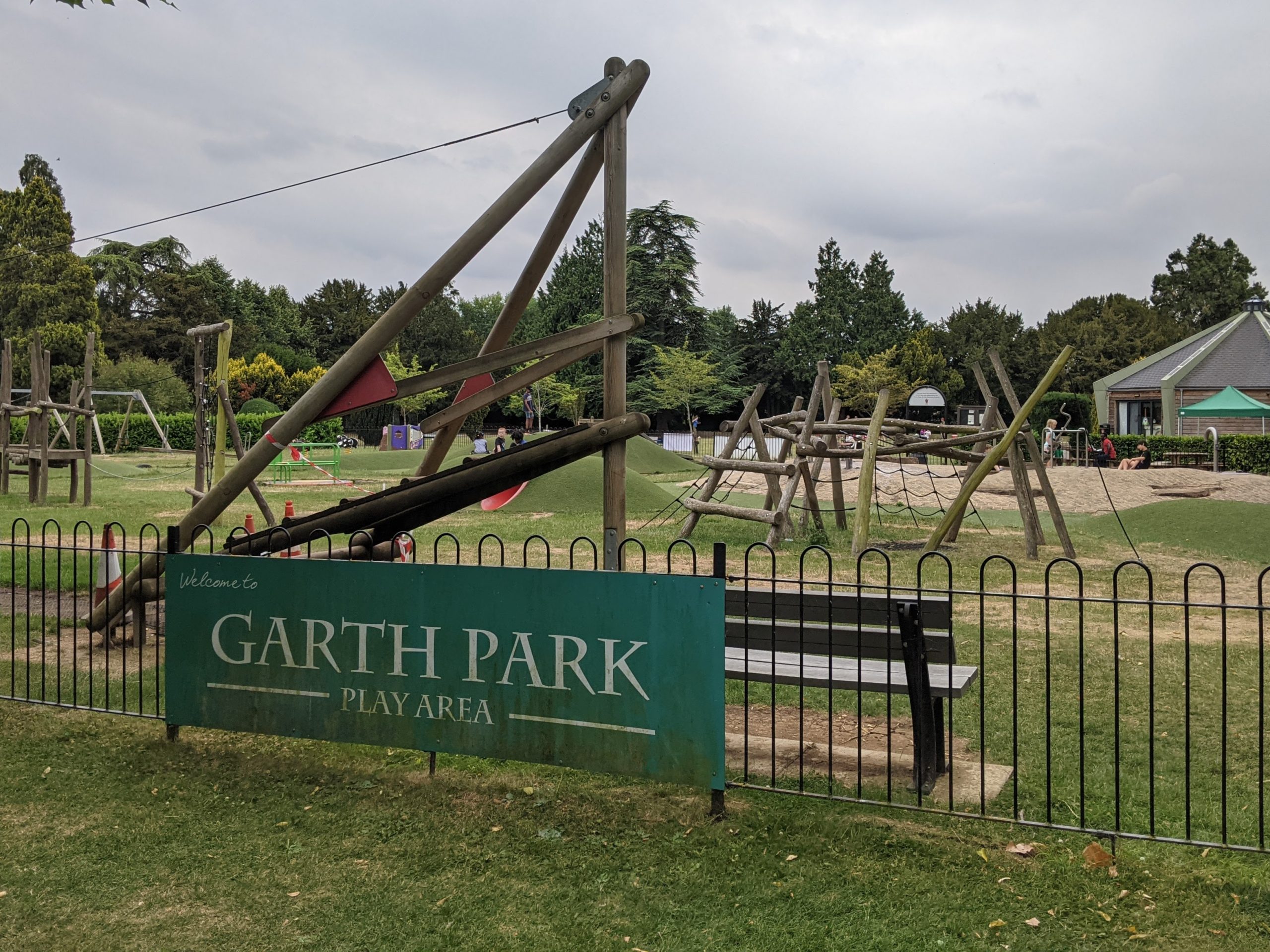
Access to open space – Access to green space in Bicester varies significantly. Access is poorer in the north east and south west residential areas of Bicester. A number of new play spaces are being created along greenways and around the town or refurbished with high quality timber style play – this is part of a five-year commitment by the town council to improve Bicester play areas. However, as the settlement expands, it will be important to proactively preserve existing areas of open space and protect new green corridors of open space, embedding them into areas of new development and ensuring equitable access to green space. This should ensure that all residents live within walkable distance of a network of high-quality green space.
Recreational pressure at sensitive habitats – While access to open spaces must be enhanced, any access improvements must be mindful of concerns over recreational pressure at sensitive habitat areas, including at Stoke Wood to the north west of Bicester (owned by the Woodland Trust and designated as a Local Wildlife Site).
Water quality – The River Bure, Town Brook and Langford Brook currently retain ‘moderate’ ecological status where they cross the town (as determined by the Environment Agency). However, beyond the A41 Langford Brook has ‘poor’ ecological status. The major drivers of this include intensive agricultural land uses in the catchment areas, sewage and water treatment, drought, and urban runoff. The River Bure and Langford Brook also both regularly dry up during hotter and drier summer months.
Play area at Garth Park
Key local delivery partners in Bicester
- Oxfordshire County Council
- Cherwell District Council
- Bicester Town Council
- Bicester Local Cycling and Walking Infrastructure Plan (LCWIP)
- Wild Bicester
- Wild Oxfordshire
- Canal and River Trust
- Garden Town Project
- Bicester Wetland Reserve
- Langford Community Orchard
- Friends of Island Pond Wood
- Bicester Good Neighbour Scheme
- Bicester Community Support Service
- Bicester Green Gym
- Grassroots Bicester (Community Action Group)
- Cherwell and Ray Catchment Partnership
- Local businesses and developers, for example:
Strategic projects for improving Bicester's GBI network
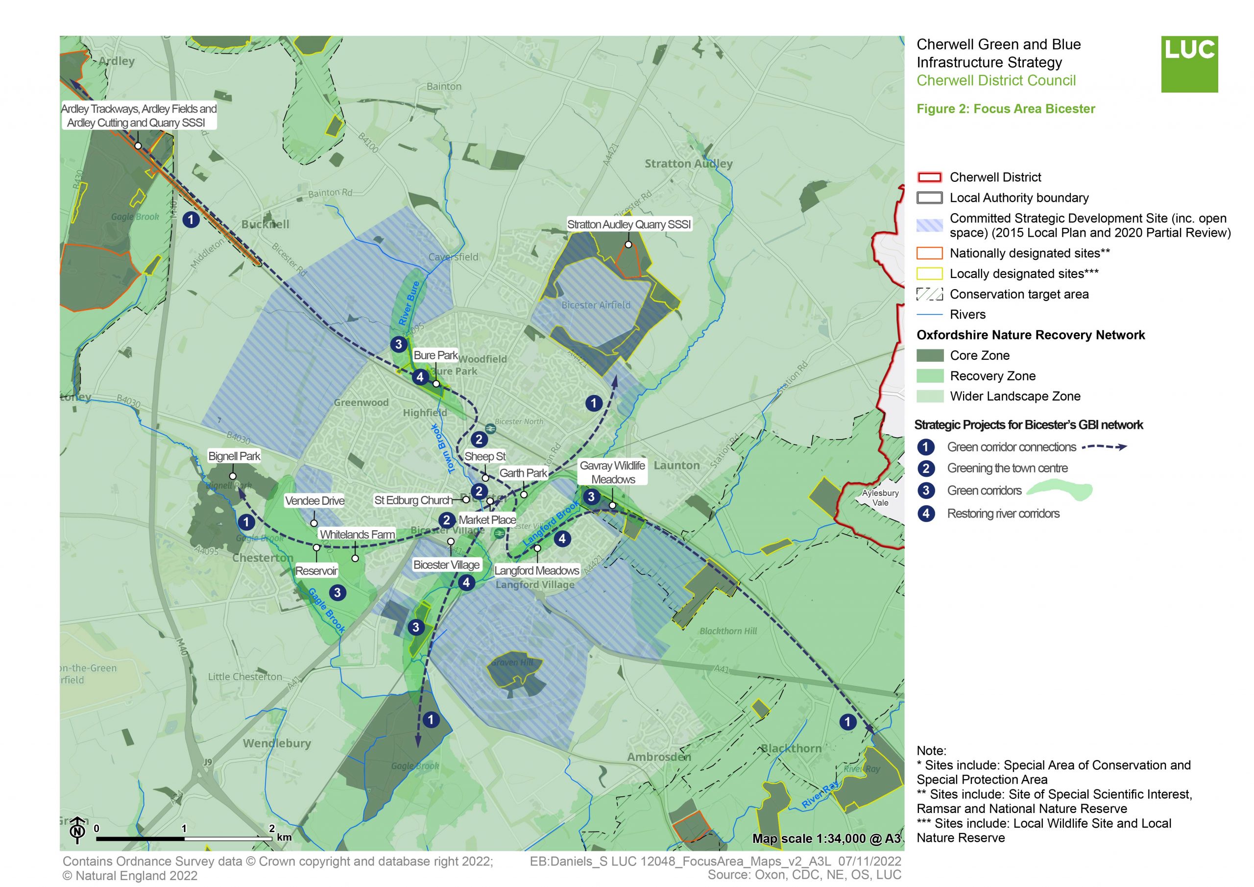
The map at the top of the page summarises the location of Strategic Projects prioritised for the Wider Bicester Area. It also illustrates how these fit in with areas highlighted as part of the Oxfordshire Nature Recovery Network.
The paragraphs below provide further commentary on those strategic projects highlighted on the map– the purpose, key components and indicative cost and time frame.
You can find a summary of the method for identifying these projects in Appendix 3.
Strategic Project 1: Connecting Bicester's greenways
Purpose
To protect, connect and enhance the existing network of greenways through the town and out to local villages – including longer distance walking and cycling routes outside of the town. This will encourage more short trips to be taken by walking, cycling and wheeling (including by wheelchairs and other means) and bring greater footfall to the town centre, other local destinations and to green and blue spaces.
Key components of opportunity
Improving local green connections from the residential areas to the town centre: These links would connect local residents by bike, foot and wheelchair to the town centre’s retail, leisure and social offer. They would also connect to local schools and workplaces and more widely via Bicester’s two central rail stations. This could work by joining up existing greenways with cycle lanes, wider pavements, and safe road crossings. This network will also connect Bicester’s residential areas to the town centre greening described in Strategic Project 2. The verges of greenways and roadside cycleways can be planted with local species of meadow grass and wildflowers – providing resources for pollinators and acting as wildlife corridors.
Improving wider connections outward from Bicester: Connecting missing links along the network of greenways and PROWs around Bicester would encourage greater use of Bicester’s wider landscape as a wellbeing resource for the town.
Existing and new walking and cycling corridors to green and blue spaces should be protected and enhanced as valuable wildlife corridors. The management, restoration and creation of key local habitats (such as grassland, wetland, meadowland, hedgerows, woodland) should be guided by Cherwell District Council’s Ecology Officer, or other ecologists. They should also be guided by the knowledge of local groups and Wild Bicester. Priority connections include:
- Connections to Ardley cutting and Quarry SSSI – There are existing sections of greenway and PROW running along the railway line towards this site. Cycling and walking connections could be extended from Bicester through this area and onwards to join up with the Oxford Canal Path – connecting to the Mid-Cherwell River Corridor Focus Area.
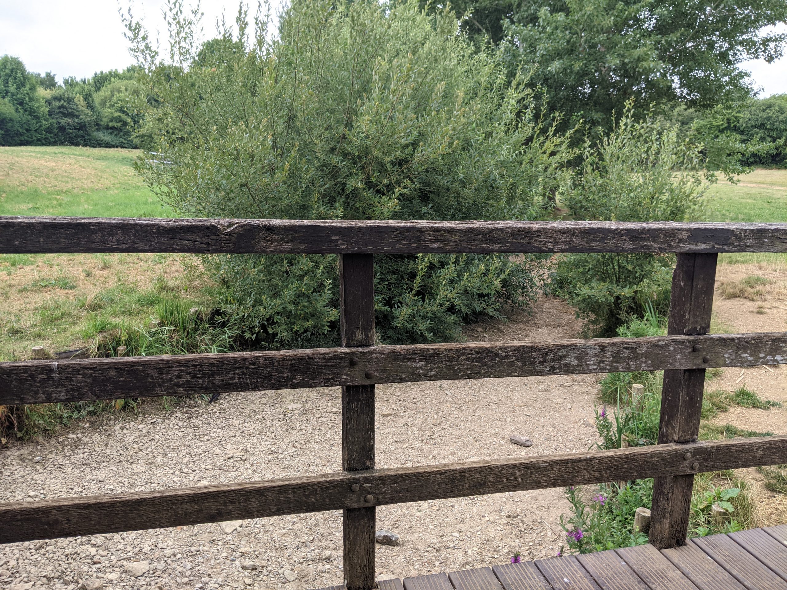
- Langford Meadows and Gavray wildlife meadows – There are off-road cycle lanes all the way through Langford Meadows to Gavray Wildlife Meadows, and on nearby roads. Footpaths should maximise biodiversity value but also be maintained to keep the path accessible to all. Cycling and walking connections could be extended from Bicester through this area and onwards to join up with Island Pond Wood, Blackthorn Hill, and the village of Ambrosden.
- Connections to Bignell Park and past the reservoir between Bicester and Chesterton – There are existing sections of greenway and PROW which could be extended to link through the village of Chesterton to this site.
- Connections to local nature sites surrounding Bicester Airfield – Existing sections of greenway and PROW could be extended to provide greater access to these sites. Design of the network will have to be done thoughtfully and in collaboration with ecologists, in order to divert visitors away from the most sensitive habitats.
- Connections to local nature sites to the south of Bicester – Existing sections of greenway and PROW could be extended.
Consistent and high quality wayfinding: There is an existing signage/wayfinding scheme which highlights key destinations within a 5 – 20 minute walk or cycle. The signage also provides information on green spaces as well as repeat signs to key destinations. This scheme should be extended out to destinations and routes on the periphery of Bicester.
Indicative cost
High (> £500,000)
Indicative time scale
Long term (+5 years)
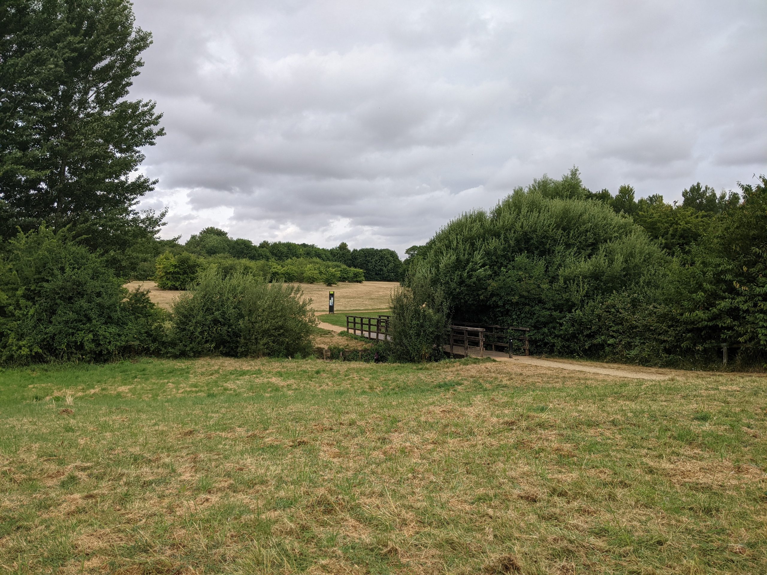
Greenway to Langford Meadows, looking from the railway crossing at Garth Park
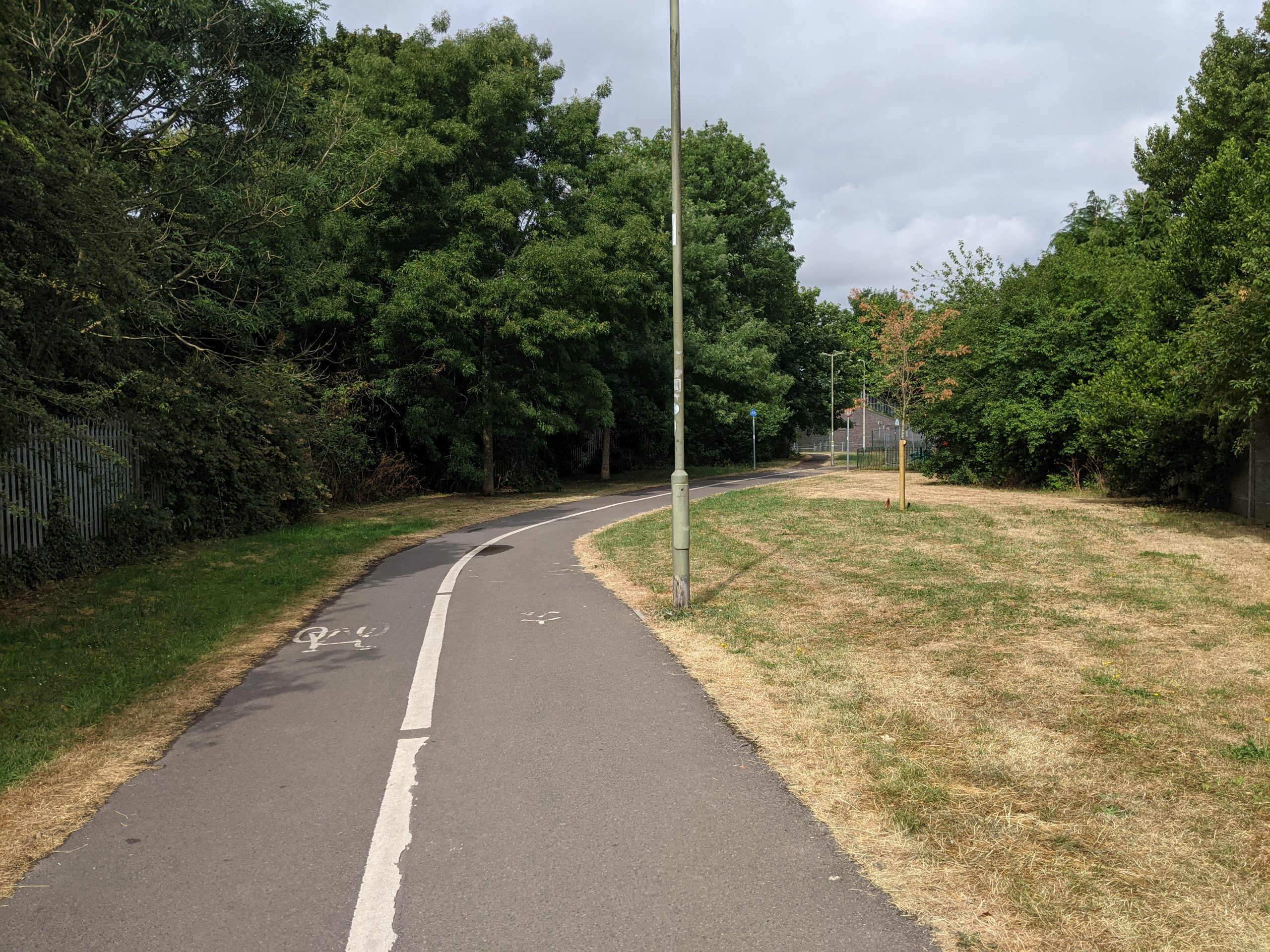
Greenway next to railway line, between Bicester North Station and Bure Park
Gavray Drive cycle lane
Strategic Project 2: Greening Bicester town centre
Purpose
Creating an attractive, green town centre would enhance Bicester’s historic assets and make a more attractive retail, leisure and social offer in the town’s centre. This would encourage footfall and enhance the town centre environment for walking and connecting with the wider community, making visiting the town centre an inviting experience (over concrete and car park dominated out of town retail parks).
It is important that greening features provided within the town are “multifunctional” and address the challenges identified by this Strategy – notably improving connectivity, tree cover, reversing biodiversity decline and alleviating flood risk.
Key components of opportunity
The pages on Key Opportunity 3 provide guidance on the kind of greening features which might be included as part of an urban greening strategy and guidance for delivering them. In Bicester in particular, green features should be prioritised at key hubs of activity in the town centre and on routes connecting these hubs. These include:
- Sheep Street – is already pedestrianised but could benefit from more structural and multifunctional planting – such as small rain gardens instead of flower planters.
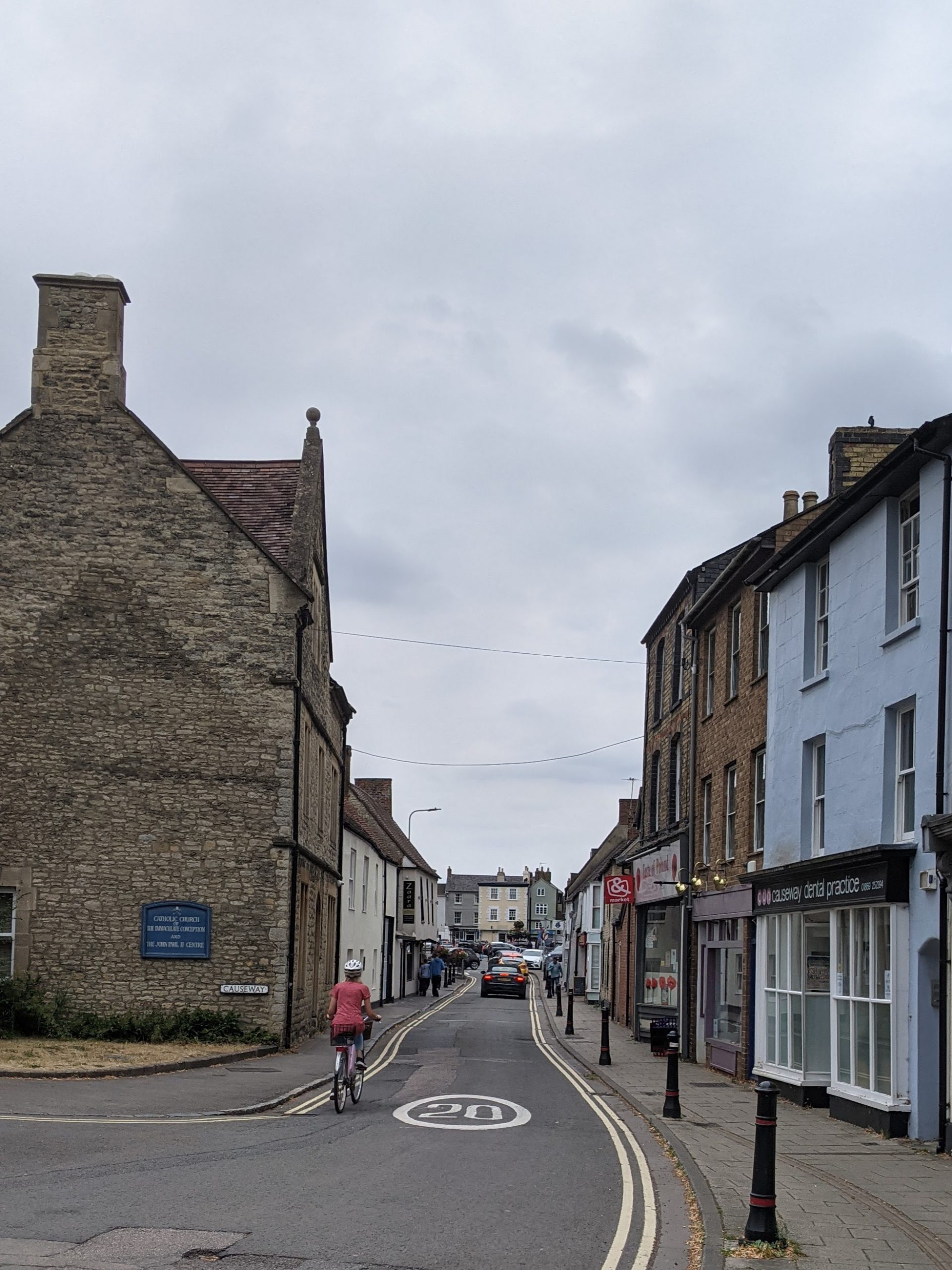
- Causeway and Church Street – street trees and planting in place of bollards, and a cycle lane, on Causeway and Church Street would create an attractive walking and cycling connection from the town centre to the historic area of the town – past St Edburg’s Church. Extending planting along Old Place Yard would create a green connection from St Edburg’s Church to Bicester Village.
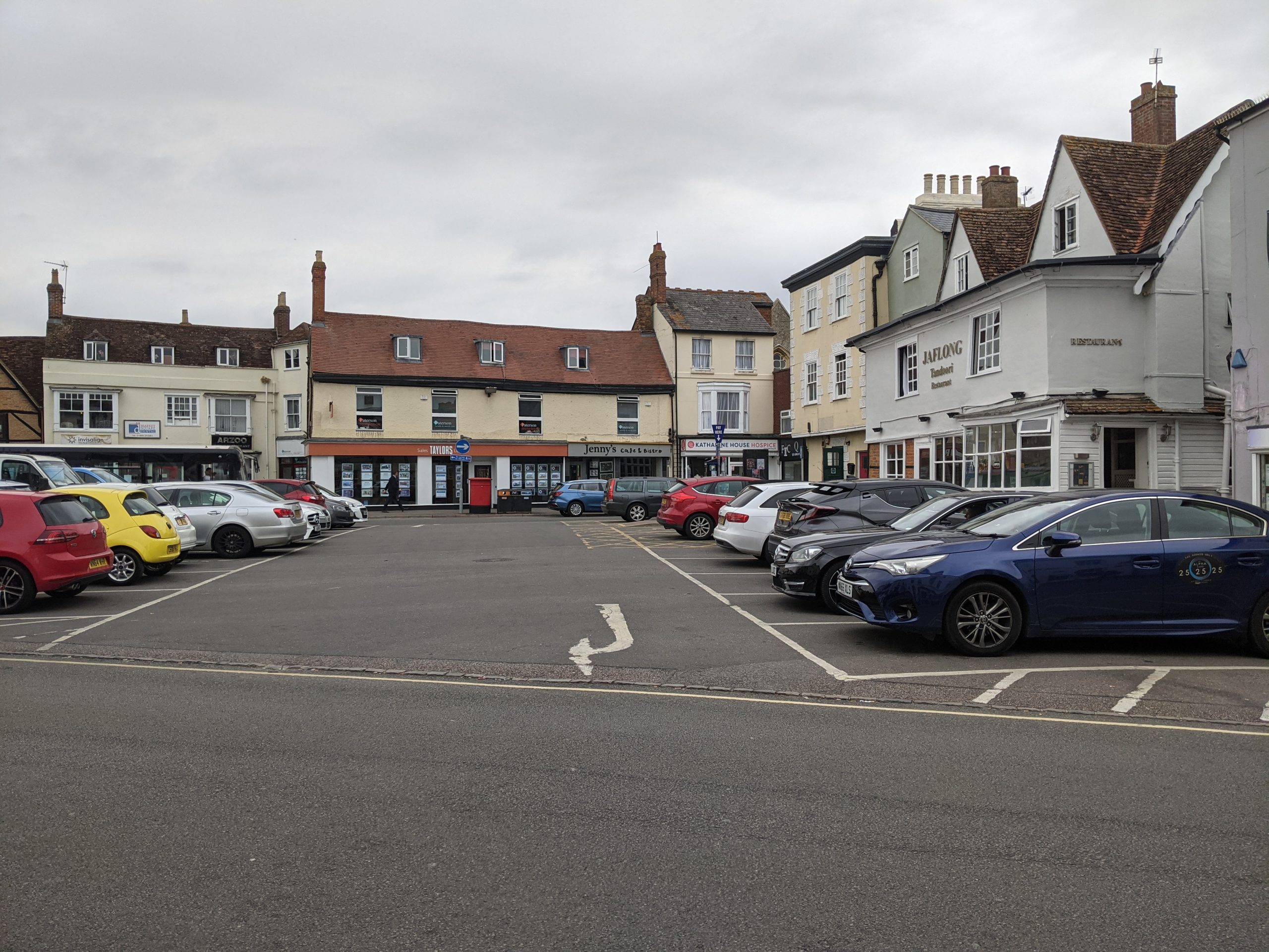
- Market Square – introducing structural, multifunctional planting along with improved crossings over Market Square Road would help to “traffic calm” the area by slowing vehicles and creating a more pedestrian friendly environment. Urban greening could be one element as part of a wider opportunity to transform a car-dominated space to a public space at the heart of the town.
- Garth Park – planting and improved pedestrian crossings could be extended along Launton Road to create a better connection to Garth Park from the town centre.
- Bicester North Station – the station is poorly connected by walking and cycling to the town centre. Urban greening and tree planting could work alongside ‘hard’ infrastructure improvements to create a safer, clearer and more attractive approach to the station. High quality wayfinding should also be provided.
- Bicester Village Station – the station is well connected to Bicester Village retail outlet but poorly connected to the town centre. Urban greening should be provided to create a stronger ‘sense of arrival’ at the station and alongside other transport interventions to along routes from the town centre – Station Approach and London Road. Connections to Garth Park should also be improved. The station car park is a large expanse of tarmac and would be suitable for rain garden planting to reduce surface water flooding and support biodiversity.
- Bicester Village – The retail outlet is a popular tourist attraction but is not well integrated with the rest of the town. The Town Council could partner with the Village to deliver multifunctional urban greening through the site – including introducing wildflowers and features through the residential area at Old Place Yard.
Indicative cost
Low (< £100,000) for individual components. Cumulatively, costs of the scheme as a whole will be higher.
Indicative time scale
Quick win (< 1 year) in the case of smaller scale features.
Medium term (1 to 5 years) in the case of more ambitious, larger-scale interventions.
Market Square
Looking from Church Street along Causeway to the town centre
Strategic Project 3: Bicester strategic green corridors
Purpose
To safeguard and enhance a series of existing and new “green corridors” (linear corridors of green space) in Bicester. These would be integrated into existing urban areas and provide a network of park spaces and green connections through new development in the town.
These corridors should reach into urban areas to provide access to high quality green spaces for all of Bicester’s residents. They should also, where possible, protect and enhance the movement of wildlife along nature-rich corridors.
Where possible, key areas of these corridors should be safeguarded as Bicester grows – particularly those areas identified as ‘core’ parts of the Nature Recovery Network. Where development is planned on a site, good quality green infrastructure should be used to protect wildlife movements through the built form.
Key components of opportunity
This profile identifies the following key green corridors to protect and enhance, as strategic development comes forward in the town:
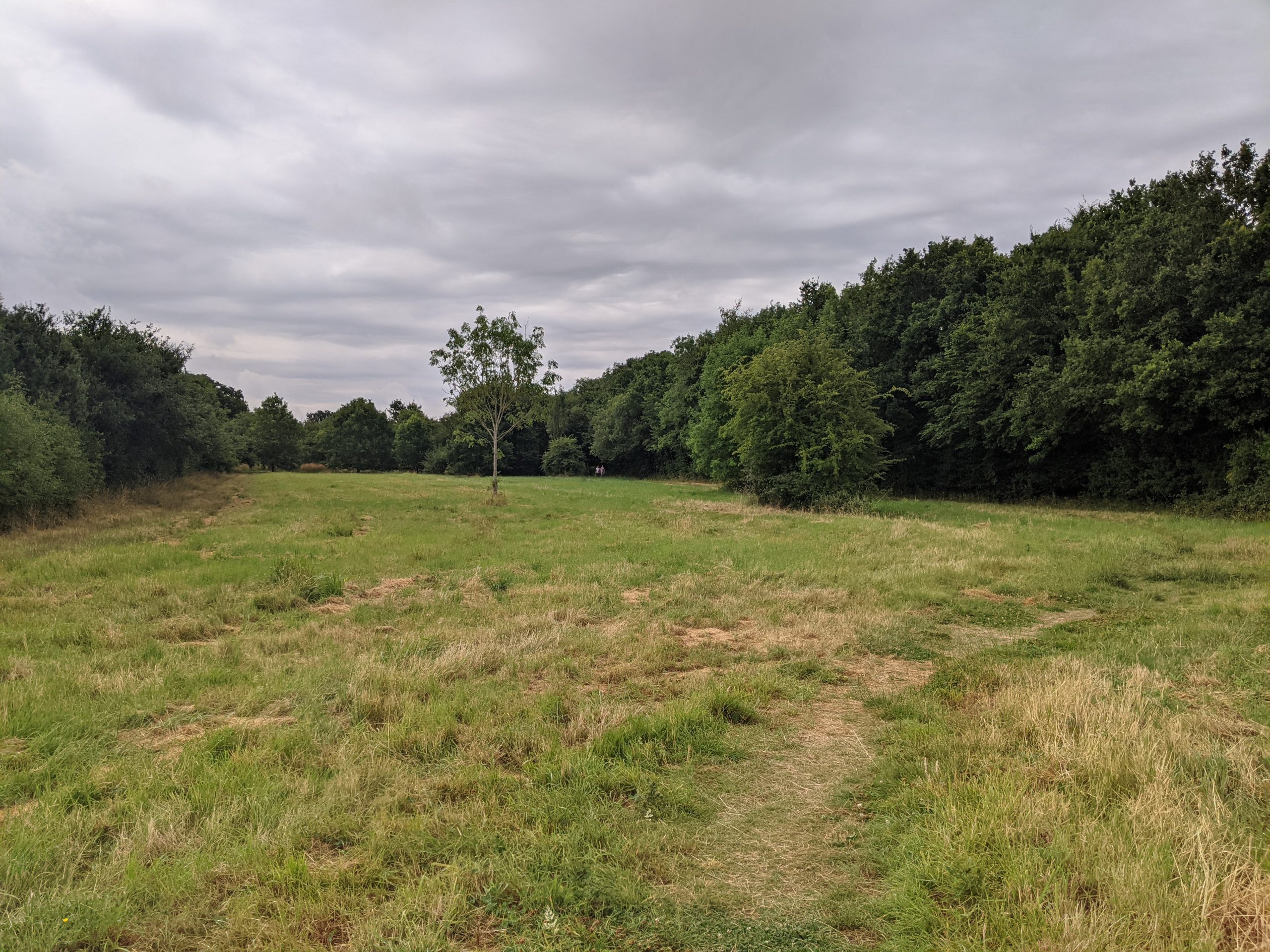
- Garth Park and green connections: This park is an important green open space and community space for the town with green connections over the railway line to residential areas in the east of the town, to Langford Park and to Gavray Wildlife Meadows. Garth Park has quiet green space, social areas, recreation space, a skate park and timber play area, located just off the town centre.
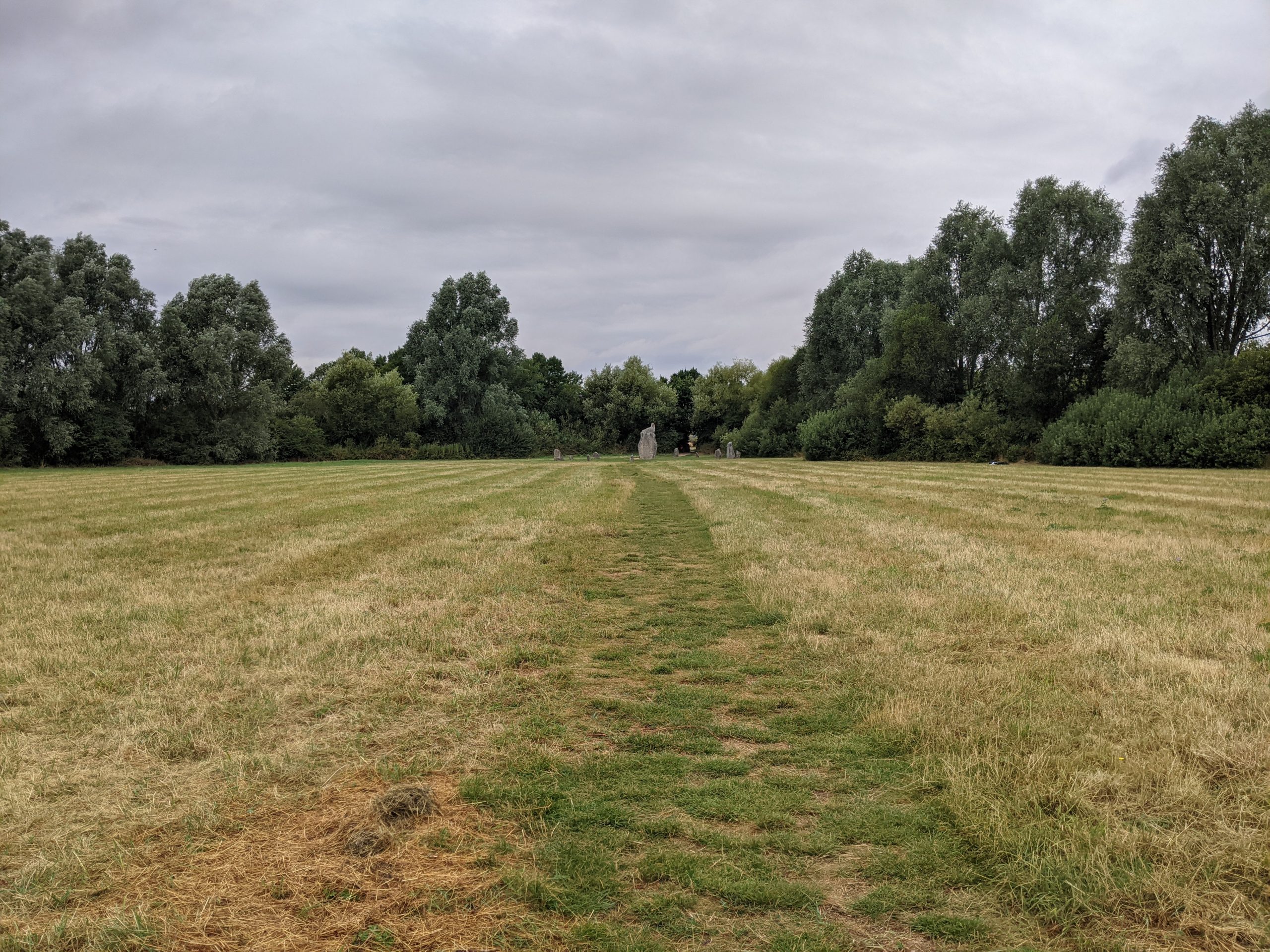
- Langford Meadows and Gavray Wildlife Meadows: These two green spaces form a large green space for Bicester and an important wildlife corridor that should be protected and improved. They provide well used green space for residents in East Bicester, the connections through Langford Meadows make the space a popular route to school and work, as well as for dog walkers and runners. The park also benefits from separated cycle and walking trails though the park, signs for cycle routes and many playful areas and stone circles in some open spaces.
- Bure Park and railway path: The greenway along the railway line is an important green corridor for wildlife in Bicester. Bure Park provides a high quality open green space with greenway connections through the site. The park was created as part of a development of new homes in 1997, on the River Bure floodplain, and now protected as a Local Nature Reserve for its woodland, wetland, river corridor, pond, hedgerow and meadow habitats.
- Vendee Drive, Reservoir and Gagle Brook: A green corridor should be protected along Vendee Drive, connecting to Whitelands Farm Recreation Area, Burnehyll Community Woodland, the reservoir and Gagle Brook, to prevent urban sprawl between the new Kingsmere housing development on the edge of Bicester, and Chesterton village. The Kingsmere housing development has brought meadow and wildflower planting, new trees and separated cycle routes along Vendee Drive. The adjacent green corridor should be protected and enhanced as a green space for new residents and to allow wildlife movement through the site. This corridor is a huge green resource and more could be done with it for people and nature, For example, wetland, woodland and meadow habitat could be created. Adding paths and boardwalks would provide walking and cycling connections through the green corridor, enhancement of the reservoir for people and nature could be explored as a ‘blue’ focus for the green corridor, and connections through the green corridor to local destinations should be explored, like Bignell Park, links into the town centre and out to Chesterton village.
- Langford Brook through South Bicester and beyond the A41: Green spaces and wildlife habitats along the river corridor should be protected in order to safeguard Langford Brook’s water quality in the long term, protect local wildlife sites and safeguard open space in the south of Bicester against future development.
- Otmoor, Bernwood and Ray Nature Recovery Area: Green corridors planned in this Focus Area, such as linking Otmoor, the River Ray and Bicester Wetland Reserve, should be extended and connected to green corridors in Bicester.
Opportunities for enhancement should be sought from Biodiversity Net Gain (BNG) receipts and in support of building the Nature Recovery Network. Ongoing maintenance would be required – this would benefit from close engagement with local volunteer groups and businesses to ensure a wide sense of ownership over the green corridors.
Indicative cost
Variable, depending on the nature of interventions and scale.
Indicative time scale
Medium (1 – 5 years).
Gavray Wildlife Meadows
Greenway running through Bure Park
Greenway, stone circle and painted activity trail running through Langford Meadows
Strategic Project 4: Restoring Bicester's river corridors
Purpose
Enhancing and re-naturalising the River Bure, Town Brook and Langford Brook as multi-functional corridors with benefits for both biodiversity and people seeking a stronger connection with the natural environment.
Key components of opportunity
As outlined above, there are concerns over water quality within the River Bure, Town Brook and Langford Brook and the aquatic ecosystems they support. The following improvements would help to restore these watercourses as multifunctional corridors:
- Re-naturalising Bicester’s river corridors: Riparian planting and removing physical modifications to the flow of water can both reduce flood risk and create more resilient ecosystems. It would also enhance the experience of local residents and visitors. See information on Key Opportunity 2 for further guidance. Priorities for river corridor restoration should include Langford Brook through South Bicester and beyond the A41 – where poor water quality has been identified.
- Enhancing the floodplain at Langford Meadows: Planting within the floodplain and in support of the existing flood mitigation structures would benefit this area. This might include the introduction of riparian planting or small-scale wetlands. While Langford Brook runs through Langford Meadows Park, there is little opportunity for the public to connect with the water environment and there is some evidence of litter and pollution in the river.
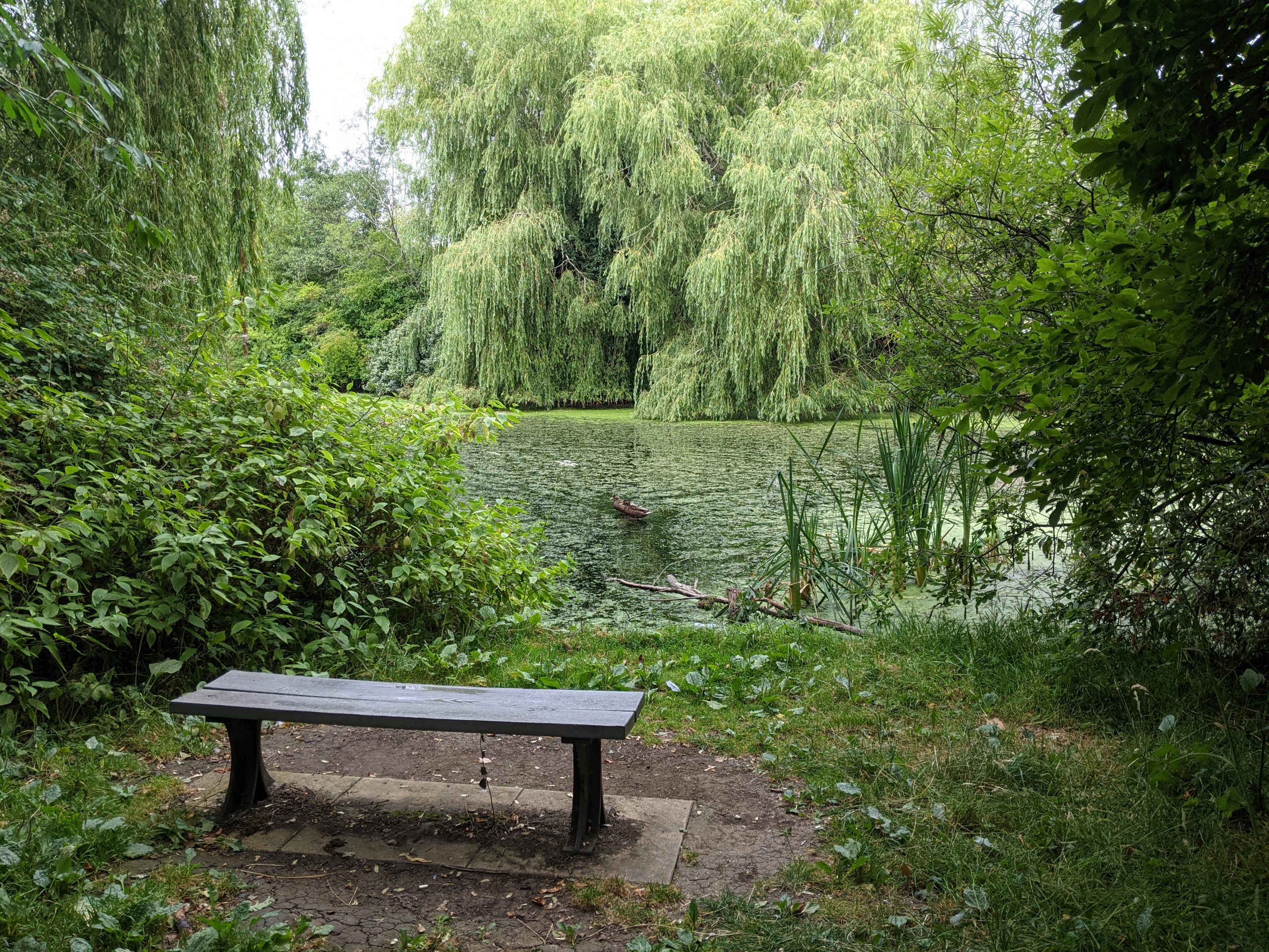
- Langford Park lake: This lake could provide a valuable blue asset for Bicester, however it is currently underperforming. The lake itself is full of algae and litter and needs restoration to allow nature to thrive. The edge requires scrub clearance and better maintenance to open up the lake to visitors to enjoy. Picnic benches and other seating would improve the space as a recreational resource.
- Enhancing the floodplain around Bure Park: Planting within the floodplain and in support of the existing flood mitigation structures would benefit this area. Further upstream of Bure Park, floodplain planting would help mitigate seasonal flooding downstream closer to the town centre and reduce the risk of annual flood damage.
Indicative cost
High (> £500,000).
Indicative time scale
Medium (1 – 5 years).
River Bure corridor dried up, Bure Park
Langford Lake, Langford Meadows