Banbury
Banbury's GBI Network today
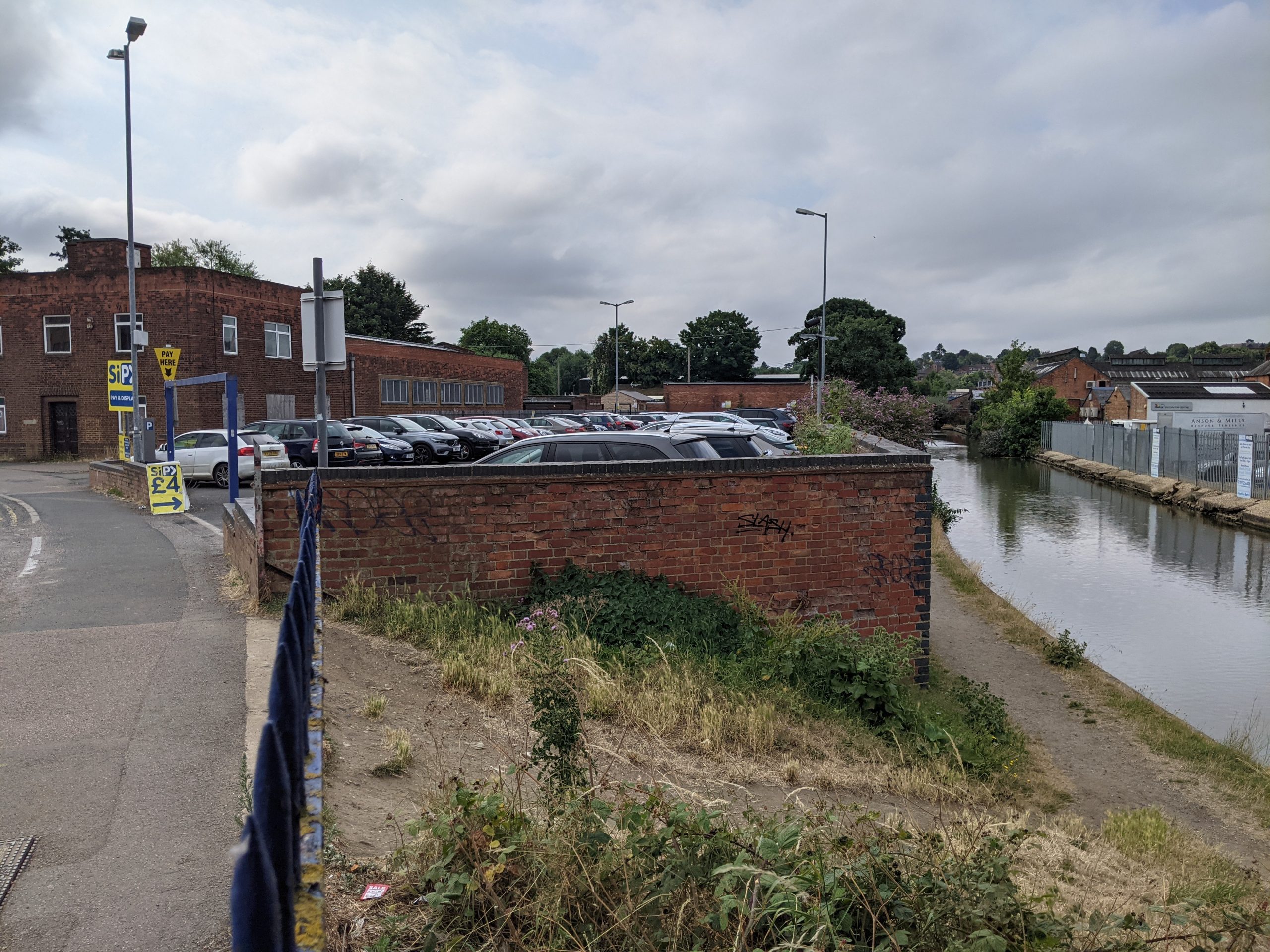
The ancient market town of Banbury is in the north of the district. The town developed along the River Cherwell and is also bisected by the Oxford Canal. From the historic core the town grew substantially in the 19th and 20th centuries, mainly on the rising slopes west of the Cherwell Valley.
Banbury is the largest settlement in the district and is well-connected, with direct access to the M40 to the east and fast rail connections to London, Oxford and Birmingham.
The River Cherwell floodplain extends north-south through the town. Both the river and canal form part of this blue-green corridor. A series of open spaces and parks lie along the meandering path of the river.
These are largely concentrated in the north of the town and include areas of priority habitat, reservoirs, and nature reserves.
However there are also smaller-scale areas to the south, including Bankside Park, the St Louis Meadow Park and the Country Park being delivered alongside development at Longford Park. The larger open areas around Crouch Hill provide access to nature at the south west edge of town.
The Banbury Fringe Walk follows public rights of way (PROW) around the edge of town. From this there are further connections to the wider landscape along PROW to the wider landscape and footpaths to the local villages of Adderbury, Bloxham, Broughton, North Newington, Wroxton, Horley, Hanwell, Chacombe, Middleton Cheney and Kings Sutton. Also, the Banbury health routes have improved wayfinding in the town.
National Cycle Route 5 passes through the south west of Banbury and out through Bodicote. It travels in sections from Reading to North Wales and provides local connections to the towns of Stratford Upon Avon, Shipston-on-Stour, Bloxham, Kidlington and the city of Oxford.
The long-distance Oxford Canal Walk, follows the canal towpath and extends into rural countryside to the north and south.
Despite these assets, Banbury’s industrial buildings and large-scale retail parks have expanded along the town’s floodplain. This limits wider connectivity with the open spaces along the river corridor.
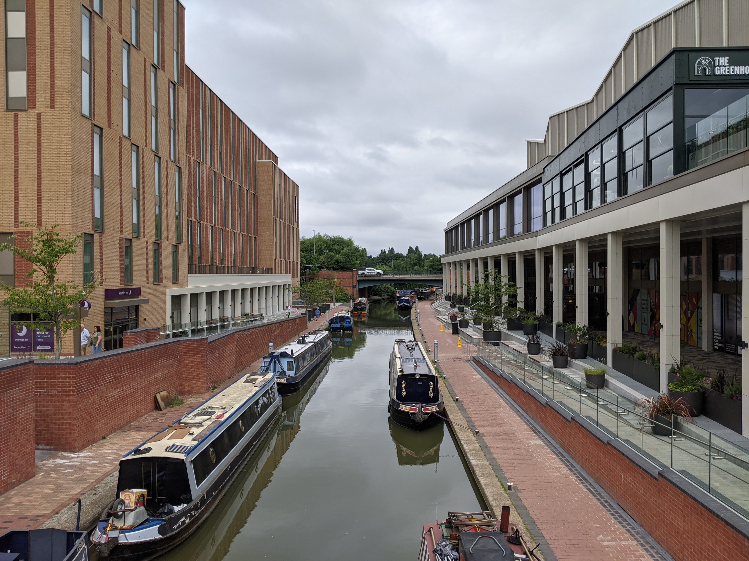
Castle Quay (Oxford Canal)
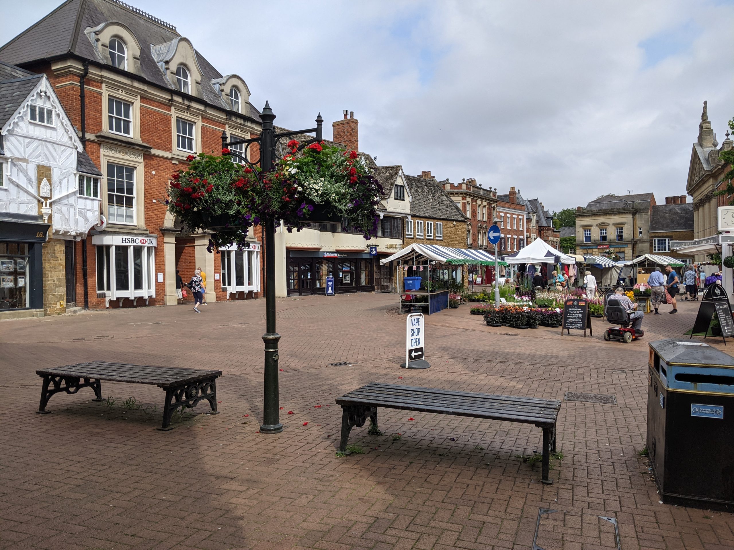
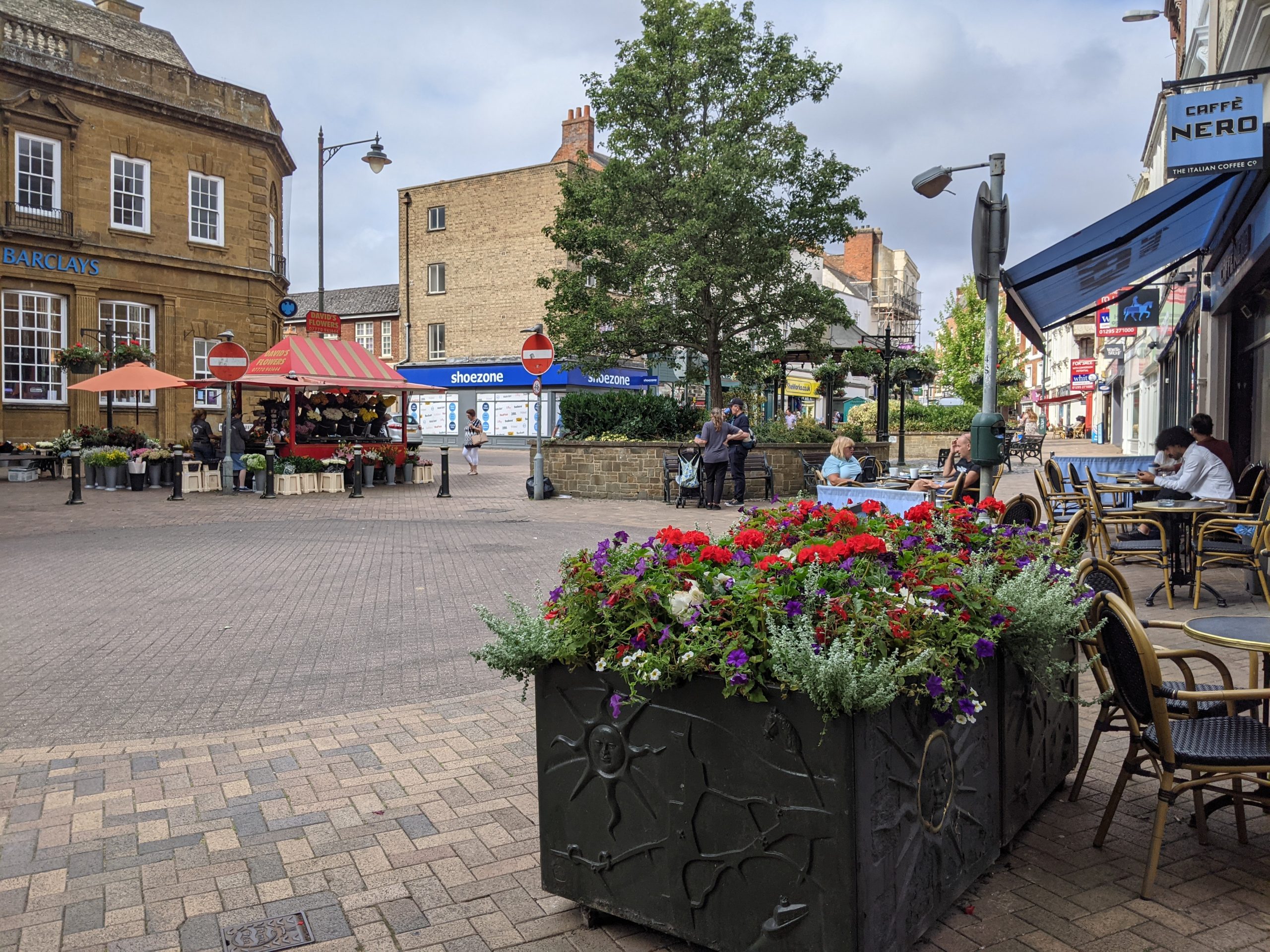
Market Place in the town centre
“When you arrive at the Banbury train or bus stations there is very little green that meets the eye”
– Stakeholder, online survey
See Appendix 2 for a summary of all stakeholder comments.
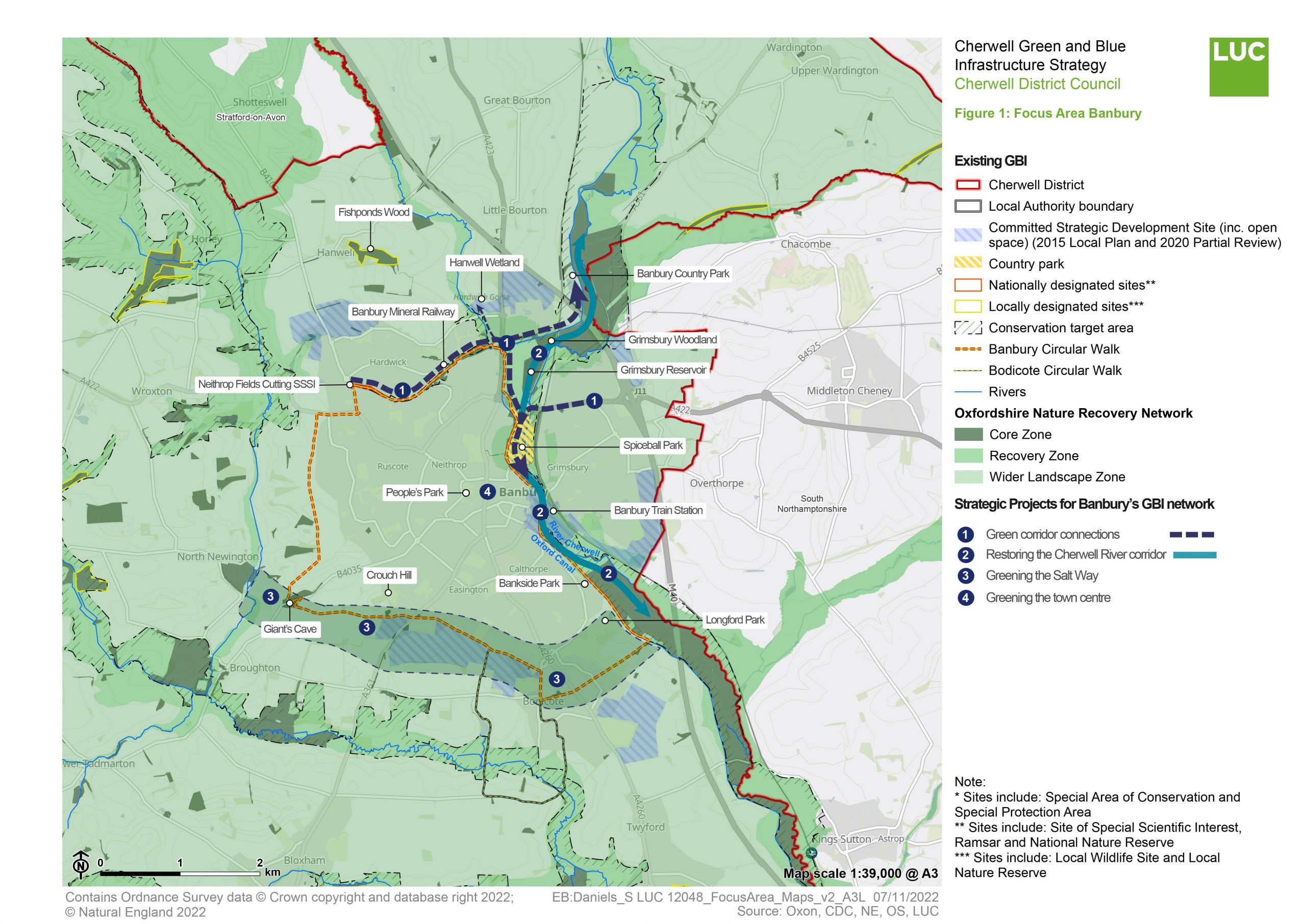
Conservation Target Areas around Banbury
There are two designated Conservation Target Areas (CTA) within and around Banbury:
- The North Cherwell CTA lies along the River Cherwell Valley, running north-south through the centre of Banbury. Key habitats include floodplain grazing marsh and lowland meadow priority habitat which are targeted for enhancement. Targets also include restoration of the river, reedbeds and ponds along the riparian corridor.
- The Northern Valleys CTA runs around the periphery of Banbury, in the valleys of Sor Brook and North Newington Stream to the west. Areas of important habitats found within this CTA primarily comprise lowland meadows and lowland mixed deciduous woodland, with smaller areas of limestone grassland and acid grassland. Areas of important habitat targets include the restoration and management of these limestone grasslands, lowland dry acid grassland, lowland meadows, and areas of fen.
Key challenges for Banbury's GBI network
Flooding – Parts of Banbury sit within the River Cherwell floodplain and have a history of severe flooding. Several areas of the town are at high risk of river flooding (see interactive map). Development along the river corridor will be high risk as climate change increases the intensity and frequency of flood events. As part of the Banbury Flood Alleviation Scheme steps have been made to mitigate this, including construction of a new embankment and flood control structures to the north of Grimsbury Reservoir. Nature-based solutions – including flood retention areas upstream and thoughtful use of floodplains – offer an opportunity to address this challenge.
Tree and woodland cover – Greenery is limited within the core of the town, with more than 80% of the area classified as hardscape or man-made. Tree cover is more extensive along the river corridor and the periphery of the town. Expanding tree cover would improve air quality, mitigate urban heat island effects, absorb carbon, and provide sheltered public spaces within the urban core. It could also help to improve connectivity by joining up green spaces to encourage walking and cycling.
Access to open space – There are few large-scale or well-connected open spaces within the town. Areas of open space are mostly found in smaller parks, play spaces, or recreational fields scattered through the residential areas of the town. Existing green corridors are concentrated to the north of the town and along the floodplain. As the settlement expands, it will be important to proactively preserve areas of open space, embedding them into areas of new development and ensuring equitable access to green space. This should ensure that all residents live within walkable distance of a network of high-quality green space.
Connectivity – Banbury has strong public right of way (PROW) connections at the edge of the town (see interactive map). These include the Banbury Fringe Walk and Oxford Canal Walk, as well as other connections out into the wider landscape. However, the PROW network is fragmented within the town. Access points to the canal and river are limited and not well marked. Generally, green spaces within the town are poorly connected by footpaths or cycle routes.
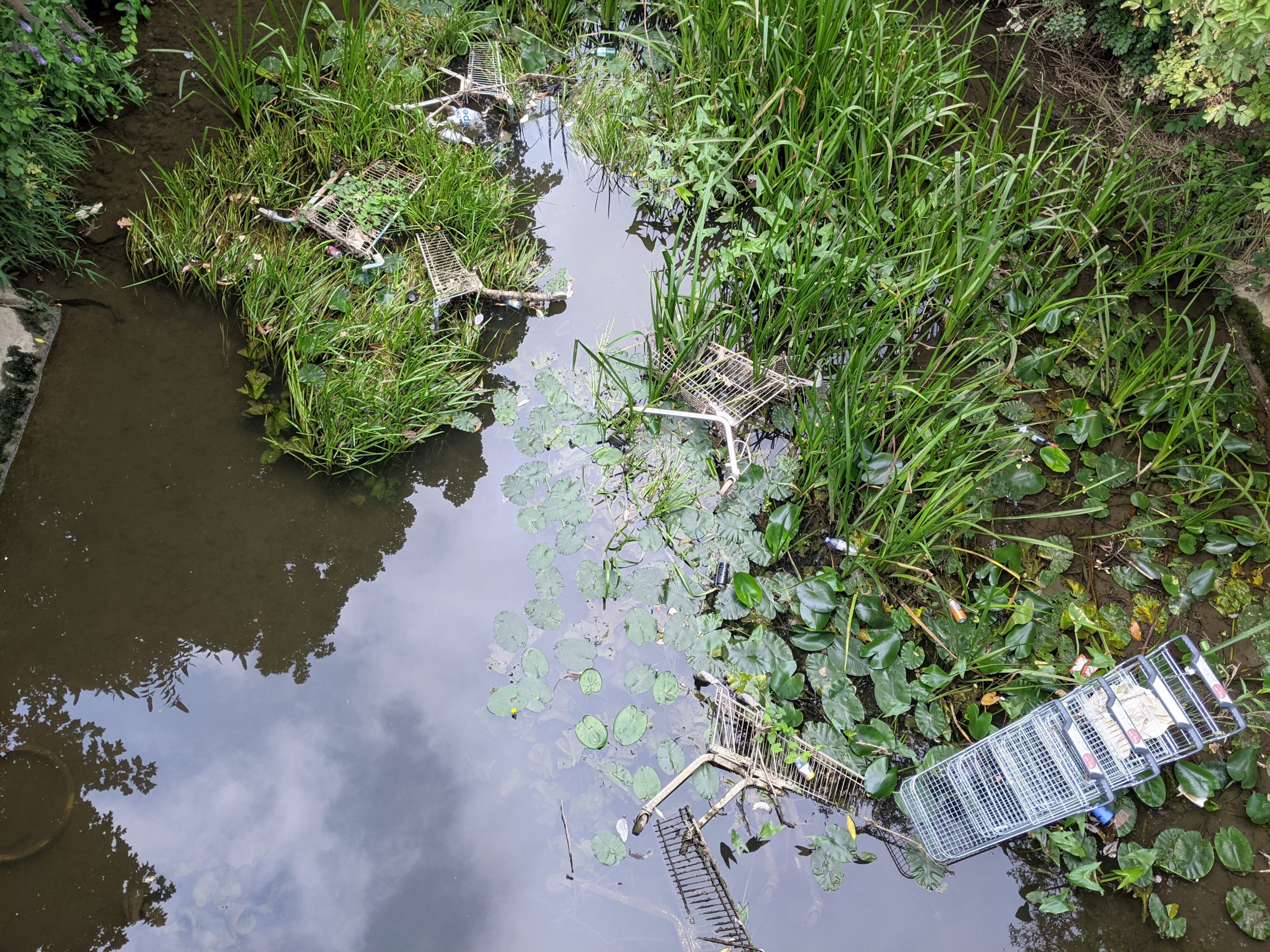
Water quality – The River Cherwell currently retains ‘moderate’ ecological status (as determined by the Environment Agency). The major drivers of this are: intensive agricultural land uses to the north and south of Banbury, sewage and water treatment inputs, physical alterations to water flow, and urban runoff. However, the river has seen improvements over the past decade, with its ecological status improving from its previous ‘poor’ quality assessment.
Key local delivery partners in Banbury
- Oxfordshire County Council
- Banbury Town Council
- Cherwell District Council
- Wild Banbury (Berks, Bucks, and Oxon Wildlife Trust)
- Salt Way Activity Group
- Banbury Ornithological Society
- Thames Water (owners of Grimsbury Woodland Reserve and Grimsbury Reservoir)
- Cherwell and Ray Catchment Partnership (hosted by BBOWT)
- Canal and River Trust
- Banbury Community Action Group (CAG)
- Local businesses and developers
Strategic projects for improving Banbury's GBI network
The map at the top of this page summarises the location of the following Strategic Projects prioritised for the Wider Banbury Area. It also illustrates how these fit in with areas highlighted as part of the Oxfordshire Nature Recovery Network.
The paragraphs below provide further commentary on those strategic projects highlighted on the map – the purpose, key components and brief delivery guidance.
You can find a summary of the method for identifying these projects in Appendix 3.
Strategic Project 1: Green corridor connections
Purpose
Enhancing a series of key connections between open spaces within and around Banbury to address fragmentation. This will improve the experience of the town for walkers and cyclists and create greater opportunities for engagement with the natural environment. The project seeks to link up the station area, key open spaces, existing green and blue corridors, and nature reserves.
Bankside Park
Desire line from Oxford Canal Path to the Train Station
Key components of opportunity
Improving pedestrian and cycling routes between Banbury’s riverside parks and open spaces: This would connect walkers and cyclists to the riverfront and provide an important wellbeing resource for the town. Creating clear and safe access points to the existing green corridors and parks with signage, paving, and plantings will increase use and provide more opportunities for local residents and visitors to engage with their local landscape.
Widening and upgrading the Oxford Canal towpath:
The following interventions would create a safer active travel route and increase use:
- Interpretation resources would help to provide a connection to the story behind this blue corridor and enhance sense of place.
- Extending and joining up existing footpaths along the Oxford Canal and Mineral Railway Path would provide residents with interconnected open spaces, access to nature, and help to reduce dependence on the private car.
- Both corridors are classified as part of Oxfordshire’s Nature Recovery Network Core and Recovery Zone. As such, opportunities to protect and enhance habitat along the routes should be maximised.
Spiceball Park – Grimsbury Reservoir – Grimsbury Woodland:
- Improving the connection from Spiceball Park up through Grimsbury Reservoir and to the Grimsbury Woodland Nature Reserve.
- Providing stronger ecological connectivity to the Hanwell Brook Wetland from the Mineral Railway Path would strengthen the existing nature network.
- Opportunities for health, wellbeing and access to nature can be supported by creating an improved ‘gateway’ to the River Cherwell or small park at Banbury Station – which would enhance the arrival experience into Banbury by train. Existing desire lines to the canal towpath from the train station could be formalised and offer an opportunity to provide greenery around the station.
- The existing Bankside Park could also be enhanced with a footbridge over the canal, connecting the park and nearby residential neighbourhoods to the canal towpath and up into the town centre and train station. This would assist in helping the town better engage with its river and canal corridor – there remains a significant sense of disconnection as part of the current urban form.
- Recognising and addressing recreational pressure along this corridor and balancing this with access. Selected areas should be designed to minimise disturbance, where design should prioritise quiet engagement with nature – particularly around Grimsbury Woodland, given its status as an important bird area.
Addressing connectivity around road infrastructure:
- Creating safe pedestrian crossings over busy roads like Southam Rd/A423 would improve connectivity for walkers and cyclists.
- Introducing clear and consistent signage and wayfinding, to maximise use.
- In the longer term, this should include enhancements to the Banbury Fringe Walk.
It is important that each of these components is delivered in line with a clear wider vision for the network in Banbury as a whole.
Improving wider connections outward from Banbury:
Connecting missing links along the network of greenways and PROWs around Banbury would encourage greater use of Banbury’s wider landscape as a wellbeing resource for the town.
Existing and new walking and cycling corridors to green and blue spaces should be protected and enhanced as valuable wildlife corridors. The management, restoration and creation of key local habitats (such as grassland, wetland, meadowland, hedgerows, woodland) should be guided by the objectives of Oxfordshire’s Conservation Target Areas (CTAs). The design of these corridors should also be guided by the knowledge of local groups such as Wild Banbury.
Priority connections include improving footpaths and cycling routes to Bodicote, Adderbury, Hanwell, Drayton, Bloxham, Broughton, North Newington, Wroxton, Horley, Chacombe, Middleton Cheney and Kings Sutton.
Indicative cost
High (> £500,000).
Indicative time scale
Long term (5+ years)
Strategic Project 2: Restoring the Cherwell River Corridor
Purpose
Enhancing and re-naturalising the Cherwell River as a multi-functional corridor with benefits for both biodiversity and people seeking a closer engagement with the town’s blue corridors.
River Cherwell, outside the Train Station
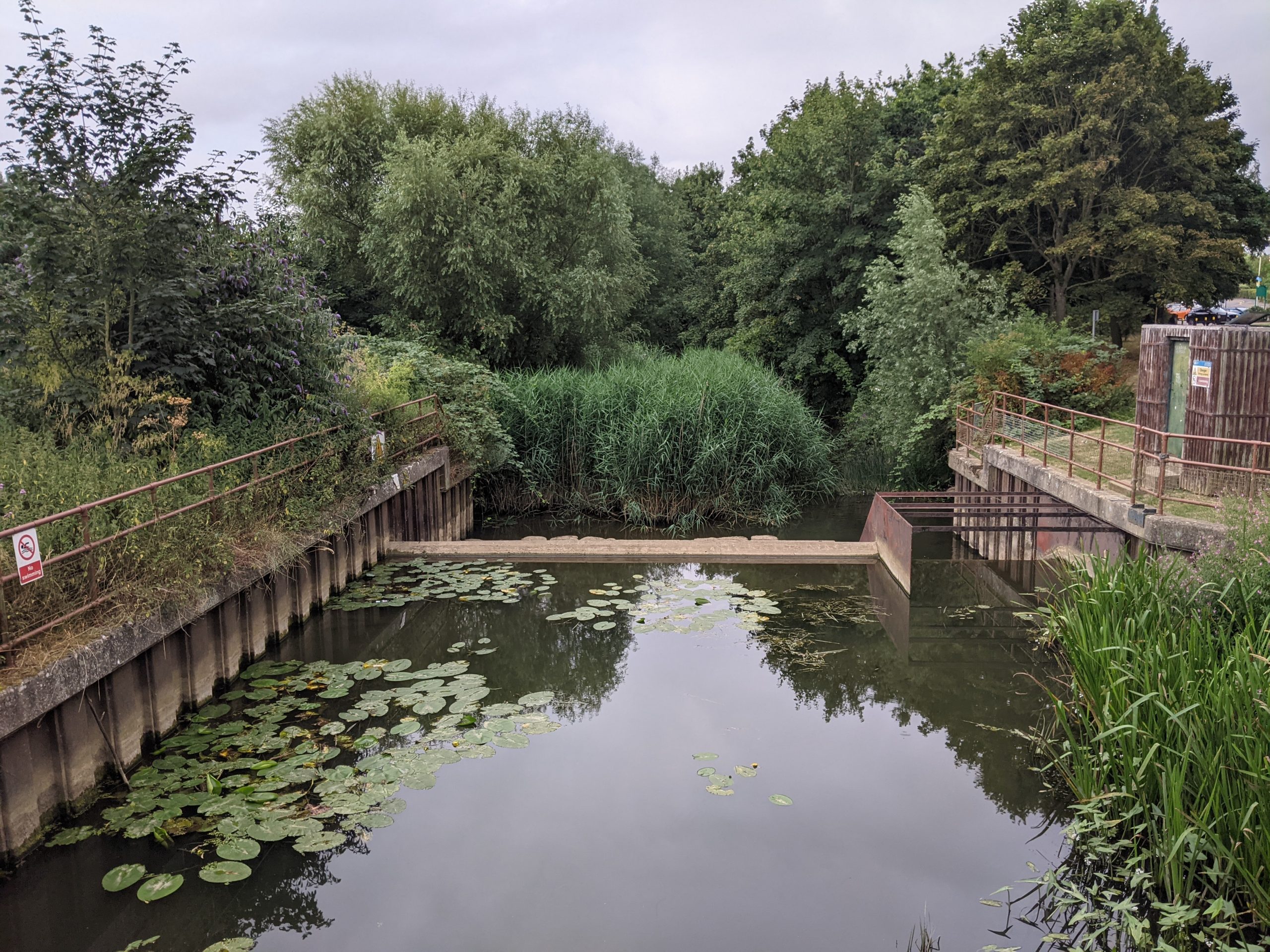
Weir in River Cherwell, running through Spiceball Park
Key components of opportunity
As outlined above, there are concerns over water quality within the River Cherwell, with knock-on effects on aquatic habitats and biodiversity. The following improvements would help to restore the river as a multifunctional corridor:
Re-naturalising the river through habitat creation:
- Riparian planting and removing physical modifications to hydrological flows can both reduce flood risk and enhance the natural environment.
- Riverside and floodplain plantings would help to restore habitats, supporting priority species such as otter and water voles, and build natural water retention capacity. It would also enhance the experience of local residents and visitors. Wild Banbury has carried out work in this area – planting areas of Spiceball Park and Hanwell Wetland with appropriate riparian species and undertaking maintenance works.
- Providing enhanced planting within an expanded corridor of open space within newly allocated sites along the canal to mitigate impacts of new development on the watercourse, improve habitat connectivity along the canal, and increase residential access to an important well-being asset (see Guidance for new development).
- Additional planting along the canal and river would also help to reduce silting and runoff. This would reduce nutrients downstream, improve water quality and would improve the overall ecological health of the watercourses.
- Wildlife and ecological education opportunities should be taken at these sites, with interpretation features and information boards.
Removing barriers:
- There are a number of weirs and sluices along the River Cherwell to the north and south of Banbury. Physical modifications to the natural state of a river can adversely impact the natural state and function of the river, affecting overall ecological health, ability to support wildlife, and recreational opportunities. They can occasionally increase flood risk downstream.
- The nearby Williamscott Dam (2.5km north of Banbury) was removed and the river naturalised – it is now referenced in the North Cherwell CTA as a notable hydrological feature that has benefited local habitat and wildlife. Opportunities such as this to naturalise the river where possible should be explored.
Enhancements around Grimsbury Woodland Nature Reserve:
- Planting within the floodplain and in support of the existing flood mitigation structures would benefit this area. Context-appropriate species should be selected, to ensure maximum benefits for biodiversity and enhanced habitat.
- Further upstream, planting would help mitigate seasonal flooding downstream closer to the town centre and reduce the risk of annual flood damage.
Indicative cost
Medium (£100k – 500k)
Indicative time scale
Medium (1 – 5 years)
Strategic Project 3: Greening the Salt Way
Purpose
The safeguarding and enhancing of a corridor of nature-rich green spaces centred on the “Salt Way” historic route on the southern edge of Banbury.
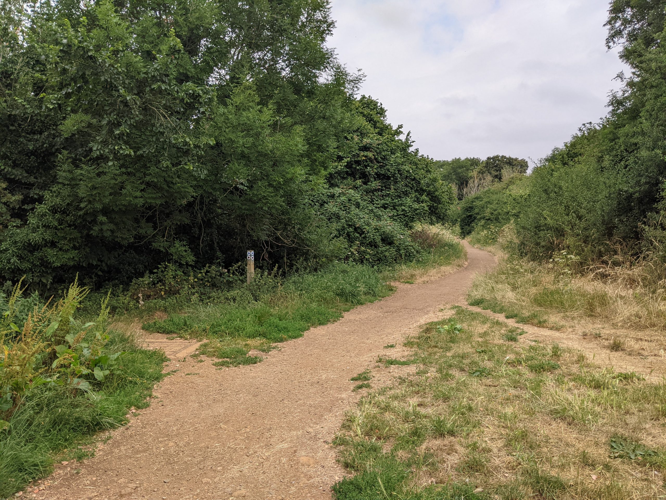
The Salt Way
Key components of opportunity
Safeguarding and enhancing a linear corridor of green spaces along the southern edge of Banbury would both increase access to open space and prevent coalescence with the neighbouring settlement of Bodicote. Neighbourhoods in the south of Banbury experience lower levels of access to existing green corridors or parks than surrounding areas when compared to Natural England Accessible Natural Greenspace Standard (ANGSt) standards.
An existing footpath and bridleway forms the spine of this corridor – the “Salt Way”. This is a former Roman route used to take salt to towns in the South Midlands and on to the Chilterns and forms part of the “core zone” of the Oxfordshire Nature Recovery Network. It provides easy access to potential new green spaces and is part of the larger Banbury Fringe Walk and Bodicote Circular Walk, ensuring access to the wider landscape and town.
Priorities should include:
- The development of new nature-rich parks, woodlands, or nature reserves along this route – providing green links between Sor Brook to the west and the River Cherwell/Oxford Canal to the east. These should connect and strengthen already secured areas of open space as part of new housing allocations south of the Salt Way. New footpaths should be established to better integrate developments with the existing recreational route.
- Partnering with volunteer organisations such as The Salt Way Activity Group, which is already committed to caring for the footpath and green spaces along the route’s length.
- Recreational and ecological connections between the North Cherwell CTA and Northern Valleys CTA would be supported as a result.
- Opportunities for habitat restoration and tree planting as part of new developments along the route in support of Biodiversity Net Gain (BNG), climate change mitigation and the Nature Recovery Network.
- Greater species and structural diversity (such as wildflower meadows), to offer more resilient habitats for wildlife within this corridor. The area has previously been a Site of Nature Conservation Interest.
- The Salt Way is a District Wildlife Site and efforts should be made to enhance and re-establish important habitats.
Indicative cost
Variable, depending on the nature of interventions and scale.
Indicative time scale
Medium (1 – 5 years)
Strategic project 4: Greening Banbury town centre
Purpose
Enhancing the experience of Banbury town centre by providing a range of multifunctional ‘urban greening’ features. This should focus on key areas of need in terms of place quality, air quality and flood risk.
High Street, Town centre
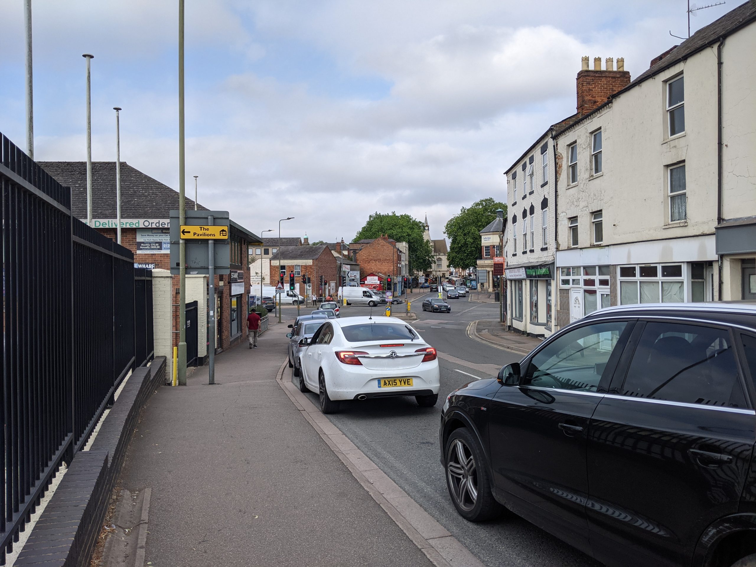
Connection from Train Station to Town centre, looking toward the A4260 crossing
Key components of opportunity
Cherwell is a compact market town, with limited greenery or pedestrian-friendly features within its core. This is especially true of walkways along North/South Bar Street, an Air Quality Management Area (AQMA), as well as Castle Street and along the Hennef Way AQMA. High Street is pedestrianised and forms a key central link.
It is important that greening features provided within the town go beyond merely ornamental features. Instead, they should be truly “multifunctional” and address the challenges identified by this strategy – notably biodiversity decline and flood risk.
The following improvements should be prioritised:
- Existing footpaths passing People’s Park and Saint Mary’s Church could be enhanced, extended and better connected with popular attractions in Market Place and the public plaza and retail at Castle Quay. They could also provide stronger walking, cycling and wheeling connection to Spiceball Park and the Oxford Canal.
- Improved pedestrian links and signage across the town centre.
- Street trees and pocket parks.
- Green walls and roofs.
- Integrating more seating and bike storage into the public realm – combining with green features where possible.
- Targeting nature-rich Sustainable Urban Drainage (SuDS) features (such as “rain gardens”) in priority locations where drainage data points to increased risk of surface water flooding (See Key Opportunity 1.)
Combined, these features will contribute to a more cohesive, walkable town centre. They will encourage locals and visitors alike to use alternate modes of transit and reduce dependence on the private car. Increasing tree cover and seating and more “walkable” environments will also create more people-friendly public spaces and improve localised air quality. Urban greening in Banbury will also encourage visitors to linger in the area, increasing revenue for local retailers.
Indicative cost
Low (< £100k) – for individual components. Cumulatively, costs will be higher. Costings should include arrangement for ongoing maintenance of urban plantings such as green walls, street trees and SuDS features.
Indicative time scale
Quick win (less than 1 year) – in the case of smaller scale features.
Medium term (1 to 5 years) – in the case of more ambitious, larger-scale interventions.