Kidlington
Kidlington's GBI Network today
The large village of Kidlington is located in the south of the district, only two kilometres north of Oxford. It is surrounded by Green Belt and is strategically located in proximity to both amenities and expansive areas of GBI in its immediate surroundings.
Over the past two centuries, rail connections have linked the settlement to both Oxford and London. These connections have driven the expansion of Kidlington’s boundaries, with modern housing estates growing on either side of the main road (A4260) that bisects the village.
Now one of the largest villages in England, Kidlington is connected to the wider region via the Oxford Parkway rail station and the A34/A40.
The River Cherwell runs to the east of the village. Development at the edge of the settlement sits on its floodplain. The river is largely naturalised along this stretch and large-scale open spaces are dotted along its length. The river corridor is part of the Oxfordshire Nature Recovery Network “core zone”, as well as forming part of the Lower Cherwell CTA.
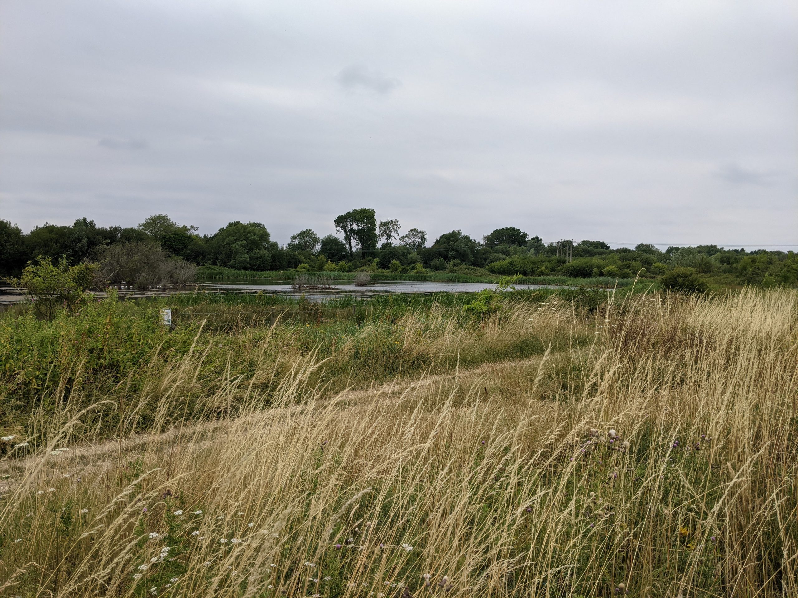
The Oxford Canal forms a boundary on the western edge of the village and is flanked by a number of green spaces and the long-distance Oxford Canal Walk. The Stratfield Brake – a woodland and wetland area important for local bird populations – lies immediately south of the village along the canal.
Sitting in between the Oxford Canal and the River Thames to the west, the Oxford Meadows Special Area of Conservation (SAC) provides a large expanse of meadows and valuable areas of habitat just south of the Stratfield Brake.
Within the village itself, large recreational play fields, small green spaces and play parks are relatively evenly dispersed. However, there are limited green connections and footpaths between these spaces and into the wider landscape.
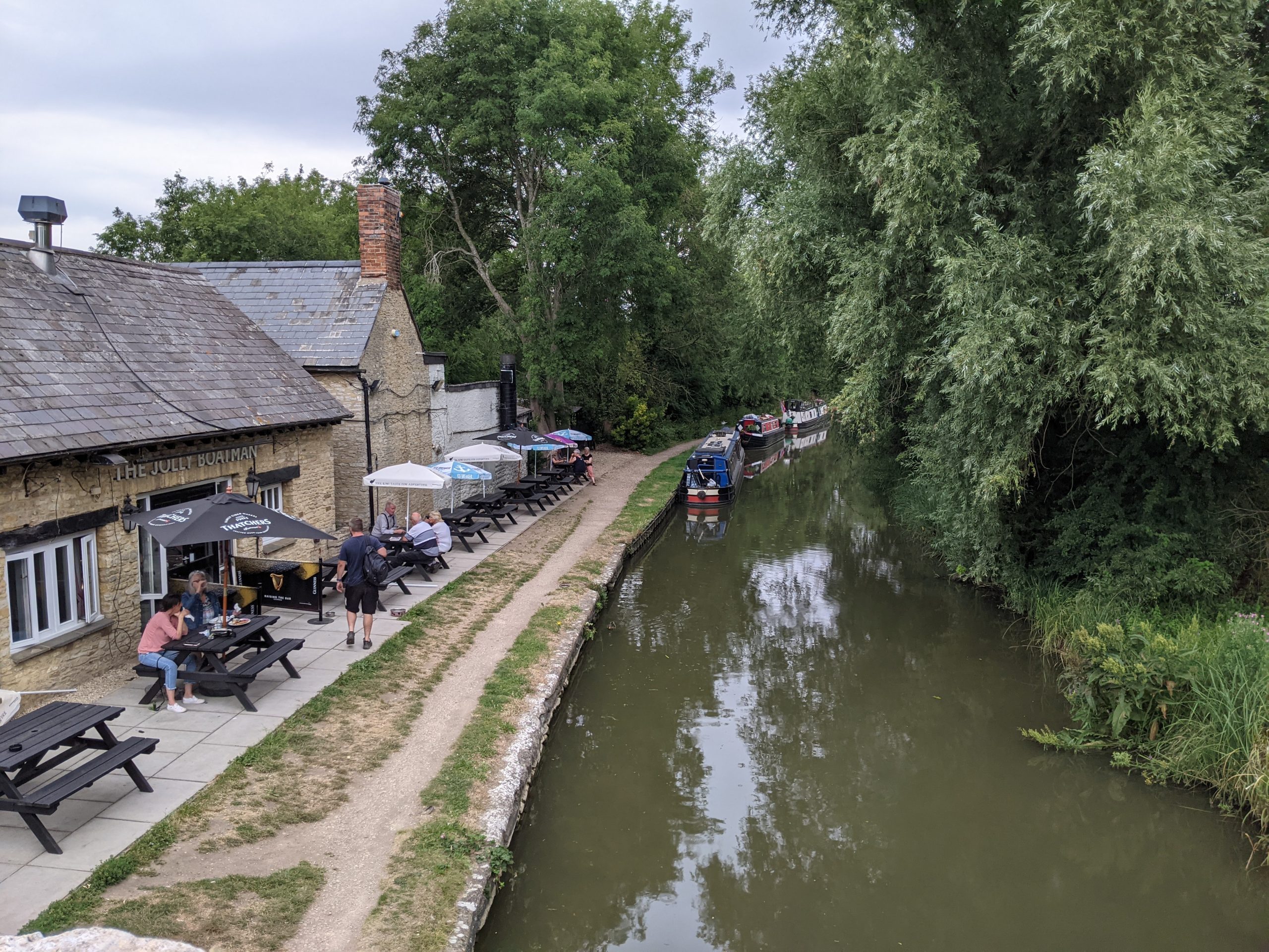
The Jolly Boatman pub on the Oxford Canal Path
Important wetland at Stratfield Brake
“The canal is currently a wasted asset in Kidlington”
– Stakeholder, online survey
“It’s the civic centre and High Street that need rethinking in terms of its social, physical, cultural and green identity”
– Stakeholder, online survey
See Appendix 2 for a summary of all stakeholder comments.
Conservation Target Areas around Kidlington
There are two designated Conservation Target Areas (CTA) within and around Kidlington:
- The Lower Cherwell Valley CTA follows the River Cherwell Valley. Key habitats include lowland fens and swamp, lowland meadows and grazing marsh, areas of limestone grasslands, and reedbeds. Oxfordshire CTA targets include the restoration, creation and management of floodplain grazing marsh, reedbeds, and the restoration of lowland fens and the river corridor.
- The Oxford Meadows and Farmoor CTA follows the Thames Valley to the south west of Kidlington and west of Oxford. It includes large areas of lowland meadows, floodplain grazing marsh, fen and swamp, reedbeds and wet woodlands.
Key challenges for Kidlington's GBI network
Protecting areas of high natural capital value within the landscape around Kidlington: Much of the green space surrounding Kidlington has high natural capital and nature recovery value. The Kidlington Masterplan SPD has a strong focus on this wider landscape setting, much of which is designated as Green Belt. Aside from Green Belt purposes of separation and openness, parts of this area provide numerous GBI functions. In particular it acts as a “buffer” for important wildlife sites along the canal and river. It is important that the most valuable areas of this gap (in terms of natural capital value and the Nature Recovery Network) are safeguarded.
Flooding: Kidlington is heavily influenced by the River Cherwell floodplain and has a history of both fluvial and groundwater flooding. Areas in the east of the village are at particular risk of river flooding (see interactive map). Development along the river and canal corridors will be at higher risk as climate change increases the intensity and frequency of flood events.
Blue corridor connectivity: Kidlington has existing green and blue assets along the two watercourses that run to the east and west of the village. The Kidlington Masterplan SPD places a strong emphasis on the river and canal corridors as attractive walking, cycling and recreational assets. Creating greater connectivity along these corridors would enable increased community engagement with the natural environment and create attractive walking routes. This would help to support the integrity of designated sites in the wider area – including the Oxford Meadows SAC and the Rushy Meadows SSSI.
Limited walking and cycling opportunities: More than 40% of daily commutes from the village of Kidlington end in Oxford. Frequent bus routes between the two urban areas reduce individual vehicle use. However, the Kidlington Local Cycling and Walking Infrastructure Plan LCWIP intends to see a further 25% reduction in commuting by car. While the Zoo Trails project have improved footpaths within the village, the main cycle route through the village is poorly marked and requires improvement. Existing footpaths within the village core are fragmented, with limited wayfinding and overgrown paths.
Water quality: The section of the River Cherwell near Kidlington currently has been assessed as having ‘moderate’ ecological status (as determined by the Environment Agency). Drivers of poor water quality include various pollutants and physical modifications. Further south, closer to Oxford, the ecological status of the river is ‘poor’.
Key local delivery partners in Kidlington
- Oxfordshire County Council
- Canal and River Trust
- Kidlington Parish Council
- Cherwell District Council
- Thames Water
- Cherwell and Ray Catchment Partnership (hosted by BBOWT)
- Oxford Conservation Volunteers
- Local businesses and developers
- Local community groups and volunteers
- Wild Oxfordshire
- Kidlington Eco Group
Strategic Projects for improving Kidlington's GBI network
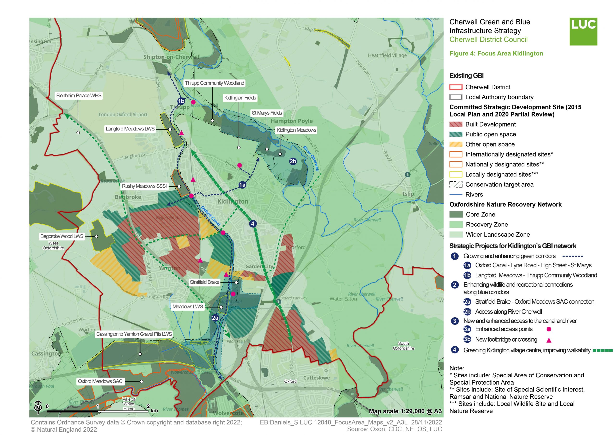
The map at the top of this page summarises the location of Strategic Projects prioritised for the Wider Kidlington Area. It also illustrates how these fit in with areas highlighted as part of the Oxfordshire Nature Recovery Network.
The paragraphs below provide further commentary on those strategic projects highlighted on the map– the purpose, key components and indicative cost and time frame.
You can find a summary of the method for identifying these projects in Appendix 3 of this report.
Strategic Project 1: Expanding and enhancing Kidlington's network of footpaths and trails
Purpose
To enhance existing green corridors within and around Kidlington and improve connectivity between existing open spaces and GBI assets. This will provide opportunities for walking and cycling and create opportunities to engage with the existing natural spaces around Kidlington.
By drawing pedestrian and cyclist movement through the centre of the village, the GBI network can increase activity along High Street and contribute to the village’s plans for an expanded retail core.
Expanding this network will also improve connections to surrounding villages and anchor Kidlington as a central node in an expanded cyclist network.
See Figure 4 to see these corridors on a map.
Key components of opportunity
Looking from High Street to Lyne Road
Looking over at Langford Meadows from footbridge at the Jolly Boatman
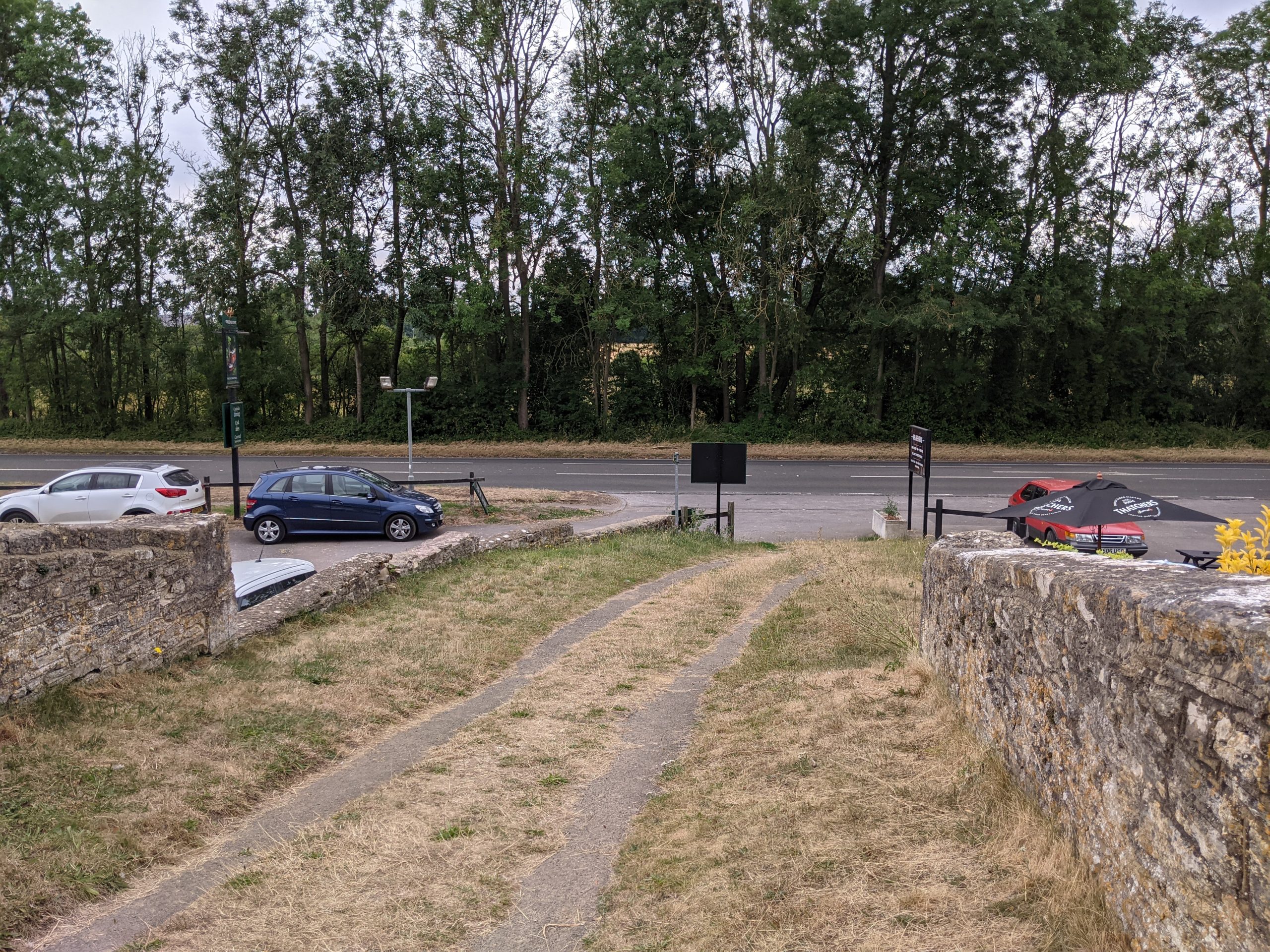
Improving access and wayfinding along Lyne Road – High Street:
This route would create a high quality connection for walkers and cyclists between the Oxford Canal Walk, the village core (along High Street) and the River Cherwell. Creating a unified pedestrian and cyclist experience along Lyne Road through to High Street and Church Street would create a strong east-west connection through the village, reducing dependence on private vehicles. Key priorities should include:
- Improved access to the canal at Partridge Place, clearing overgrown paths and widening/resurfacing the towpath.
- Habitat creation and restoration along routes – as part of the Nature Recovery Network “core zone”.
- Other improvements in line with Cherwell’s towpath improvement commitments (Adopted Local Plan, Policy ESD16).
Rushy Meadows SSSI – Langford Meadows – Oxford Canal – Thrupp Community Woodland:
Improving footpaths and access points along this corridor would enhance east-west connections through Kidlington and link together open spaces along the watercourses. Key priorities should include:
- Better maintained paths, nature-rich planting and pedestrian/cycling infrastructure.
- Improvements to access along Begbroke Lane (and from the strategic development site at Begbroke).
- Opportunities to use areas of open space along this corridor for habitat creation and flood mitigation.
Further work will be needed to explore the feasibility of these enhancements – in particular investigating land ownership along these corridors and assembling appropriate delivery partners.
Indicative cost
High (> £500k)
Indicative time scale
Medium (1 – 5 years)
Strategic Project 2: Enhancing the Oxford Canal and River Cherwell blue corridors
Purpose
To enhance and better connect habitats and open spaces along the Oxford Canal and the River Cherwell. This will create a multi-functional GBI corridor with benefits for both biodiversity and people seeking a closer engagement with the village’s blue corridors. As a nature-based solution, it can also help to hold water in the landscape and reduce local flood risk.
See Figure 4 to see these corridors on a map.
Key components of opportunity
The River Cherwell where it meets Thrupp Community Woodland
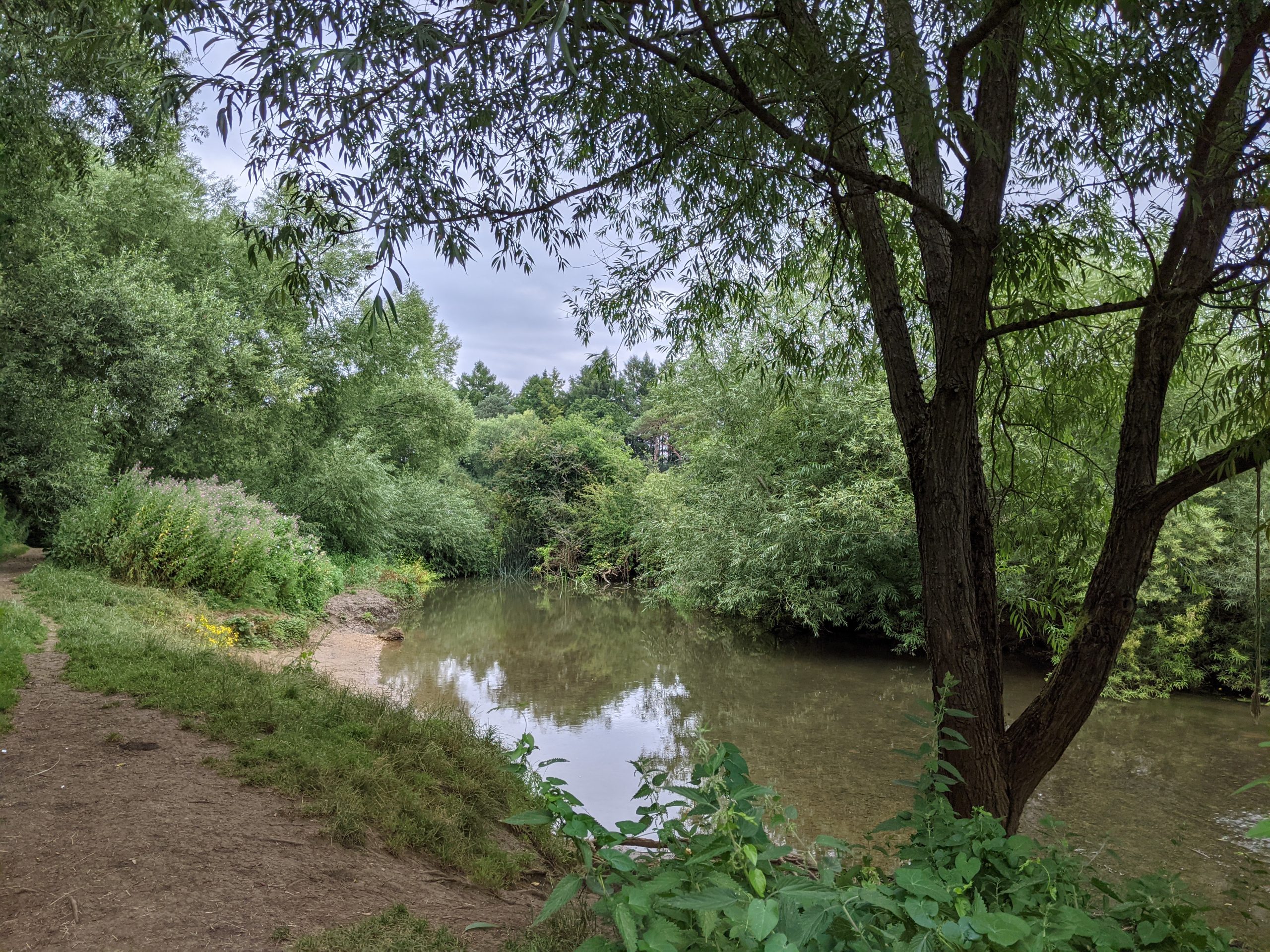
Corridor 2a: Stratfield Brake – Oxford Meadows SAC connection:
This connection seeks to protect and enhance existing access along the Oxford Canal Walk from the wildlife-rich Stratfield Brake to the ancient and ecologically valued meadows at Oxford Meadows and the River Thames. The following features would improve access and encourage use:
- Supporting and making more accessible recreational opportunities such as swimming and kayaking – through improved footpaths.
- Maintaining overgrown vegetation.
- Creating or refreshing wayfinding resources.
- Providing additional seating.
- Widening and/or resurfacing the towpath, where possible. Recently the towpath to the north has been resurfaced and widened (to 2 metres wide) in partnership with the Canal and River Trust Opportunities for extending this initiative up past Stratfield Brake and other open spaces along the canal through Kidlington should be explored.
Identifying spaces for habitat creation and new canal-side green spaces should also be pursued. Two Conservation Target Areas (CTAs) meet south of Stratfield Brake – this link could be strengthened through additional habitat creation and enhancement along the canal corridor. This might include floating reed beds or riparian planting along the canal corridor.
Design of these spaces should be thoughtful and should prioritise quiet engagement with nature – particularly around Stratfield Brake and Oxford Meadows SAC, given the sensitivity of flora and fauna found on both sites.
Finally, plans for a new golf course near Stratfield Brake should ensure that any pesticide use and its ‘drift’ do not impact local ecosystems in this area and should help to enhance and expand local habitats.
Corridor 2b: Access along River Cherwell (Oxford Canal – Thrupp Woodland – St Mary’s Fields – Kidlington Meadows):
The River Cherwell is relatively naturalised along this stretch, with mature deciduous woodlands and riparian planting along its meandering banks. Paths exist through the area but are overgrown, unmarked, uneven and narrow in places.
Key areas for enhancement include:
- Increasing access from the popular Annie’s Tea Room on the canal – this would support the use of this existing community asset. This should include improved wayfinding.
- Improving paths along the river through the woodland (including the use of boardwalks where appropriate) and connecting to St Mary’s Fields Reserve. This would enable easier recreational access to the river and would create a circular path connected to Kidlington. Opportunities to extend this connection further south east to connect with the pedestrian and cycle path along Bicester Road should be explored.
- Habitat creation and new river-side park spaces – in line with the targets for the Lower Cherwell Valley CTA and the Nature Recovery Network “core zone”.
- Thrupp Community Woodland could be extended along the river corridor in partnership with The Forestry Commission. The community would receive well-being benefits from improved access to the tranquil spaces along the river. Design should emphasise quiet and educational engagement with nature, given the important bird and riparian habitats found in the area.
Further guidance on river corridor restoration and why it is important for Cherwell can be found under information on Key Opportunity 2.
Indicative cost
High (>£500k)
Indicative time scale
Medium (1 – 5 years)
Strategic Project 3: New and enhanced access to the canal and river
Purpose
To improve access to the natural environment and landscape surrounding Kidlington – by clarifying and improving existing access points to footpaths and developing new crossings along the canal, railway and river.
See Figure 4 to see these corridors on a map.
Key components of opportunity
Oxford Canal where it joins Partridge Place
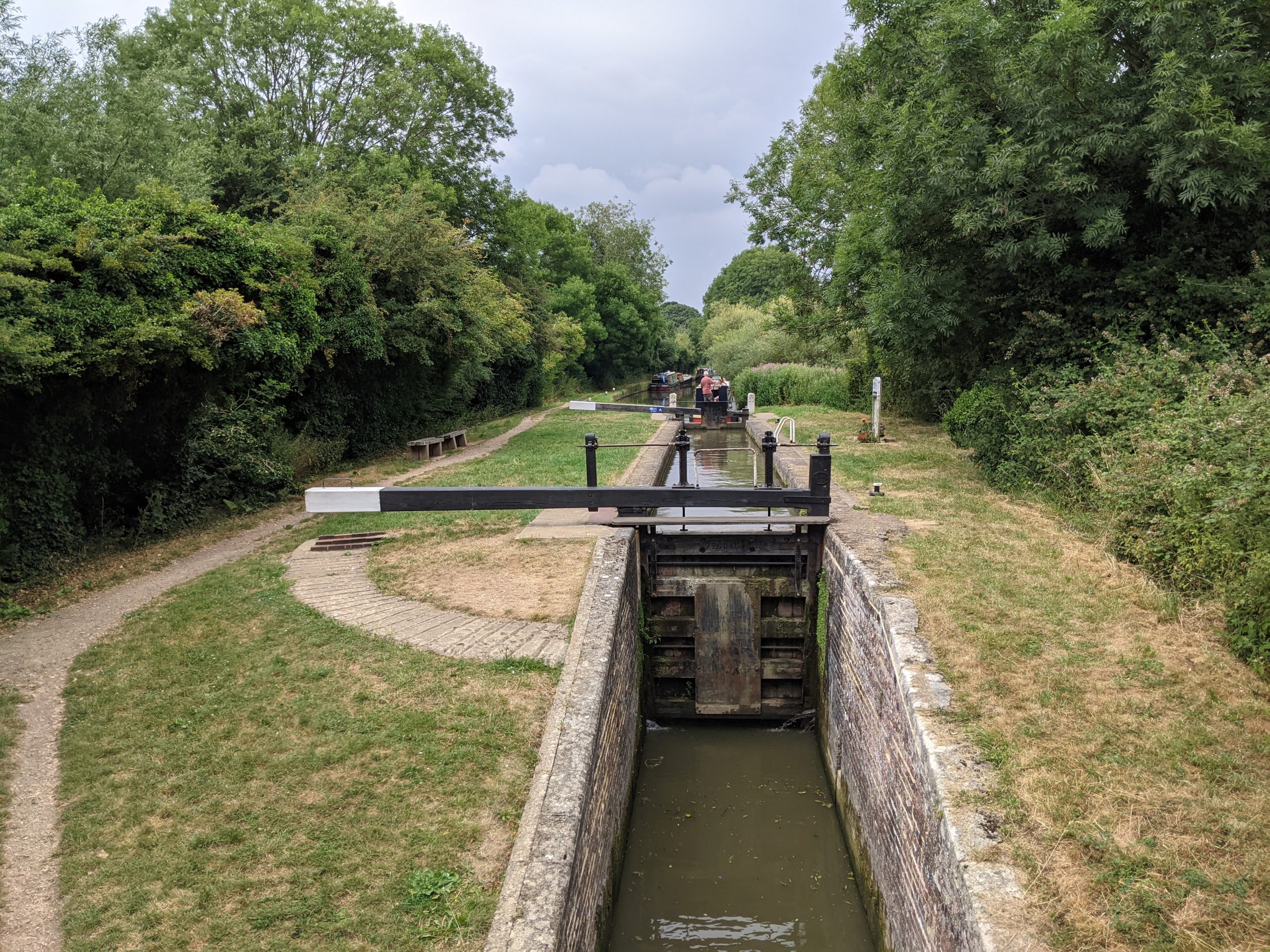
The River Cherwell from the Thrupp Canal Cruising Club
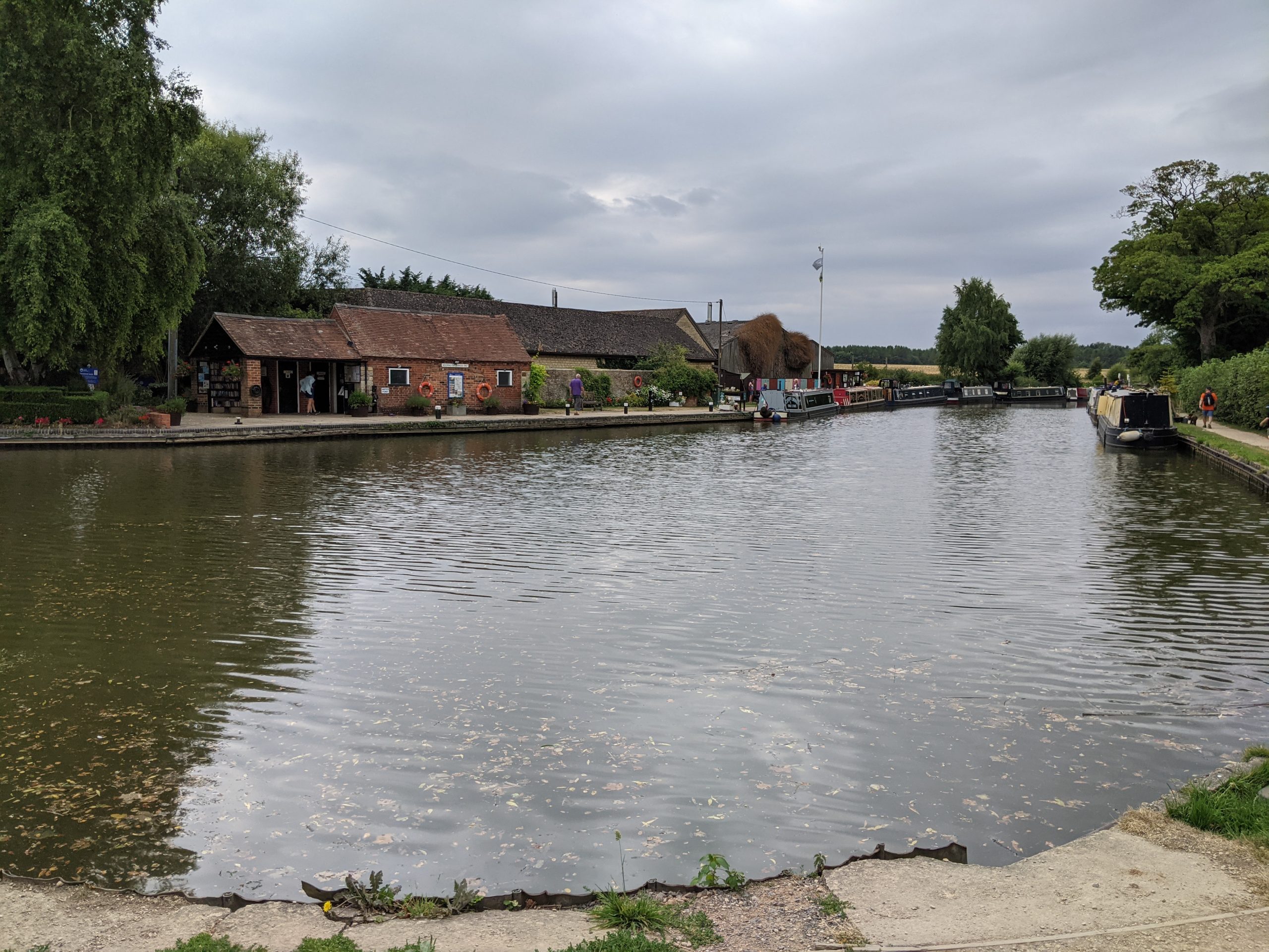
3a: Enhanced access points:
Kidlington’s existing footpath connections are relatively intact but are limited. There is an opportunity to enhance or clarify existing access points along the routes to create a better integrated network. Focus points should be:
- Connection from Stratfield Brake to Oxford Canal Walk: This access point is overgrown with limited wayfinding. By formalising and maintaining planting at this point, the green space would direct more movement along the canal. It would create improved pedestrian connections up through Kidlington.
- Connection from The Moors to PROW heading toward Thrupp: The path here is similarly overgrown and lacks signage. Enhancing this access point would better integrate longer distance trails north of Kidlington into the existing inter-village footpath network that is being developed in partnership with K5 Better Together.
- Connection from Oxford Canal to Thrupp Community Woodland: Access from the stretch of canal near the Thrupp Canal Cruising Club to Thrupp Community Woodland could be improved. This would draw people from the popular canal section through to the natural spaces along the river. The existing path runs under the railway, with opportunities to make access more user-friendly.
- Enhanced pedestrian connection over existing bridge at Partridge Place/Begbroke Lane: This route crosses both the canal and railway at different locations. The canal crossing is narrow and does not leave space for cyclists or pedestrians, and could be widened or the footpath separated.
3b: New footbridge or crossing:
New crossings and footbridges would link across the canal and other barriers at strategic locations. This would lead to a more interconnected series of open spaces with easier access for pedestrians, cyclists, and wheelchair users. Priority locations include:
- Langford Meadows to Oxford Canal: Clearly delineated and protected pedestrian/cycle crossing to the existing footbridge near the Jolly Boatman.
- New footbridge from Lyne Green Playing Field to Oxford Canal: A crossing or footbridge over the railway line, connecting the existing park to a potential new wildlife site across the canal from Rushy Meadows SSSI, and with a connection to the footpath along Begbroke Lane.
- Stratfield Brake to Yarnton: New crossings at the northern end of Stratfield Brake over the Oxford Canal and at Sandy Lane over the railway. This would connect with a new footpath into Yarnton, and would support the expectations outlined for the south of Kidlington (in the LP Partial Review) for better connectivity at the local and district-wide scale.
Indicative cost
Low (< £100k) for smaller individual components and maintenance.
High (> £500k) for new footbridges or crossings.
Indicative time scale
Quick win (less than 1 year) in the case of smaller scale initiatives.
Medium term (1 to 5 years) in the case of more ambitious, larger-scale interventions.
Strategic Project 4: Greening Kidlington village centre and supporting walking and cycling
Purpose
To improve the sense of place through Kidlington village centre using urban greening features and to encourage walking, cycling and wheeling through the creation of protected bike lanes, rain gardens and wildflower verges.
Key components of opportunity
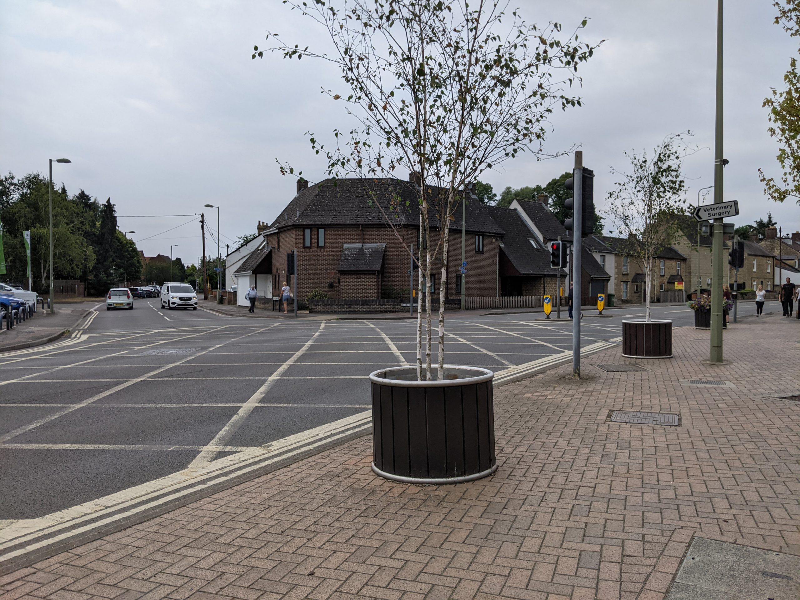
Within Kidlington, the Banbury/Oxford Road (A4260) is the main arterial route, linking north to Shipton on Cherwell and Thrupp, and connecting directly to Oxford. As the main road to Oxford it is heavily used in daily commuting with frequent traffic congestion. It is also the route with the highest occurrence of daily cyclist use in the village.
Sections of the route are marked with a dedicated cycle lane. However the link is fragmented and would benefit from further separation from vehicular traffic. Creating safe pedestrian crossings over busy roads like Banbury/Oxford Road would improve connectivity for walkers and cyclists.
There are also opportunities to enhance cycling connections east-west through the village and onward to new developments in Yarnton and Begbroke, as noted in Strategic Project 1. This would also support Kidlington’s wider transport aims. A clear and consistent wayfinding strategy will be important in order to maximise use.
River and canalside areas of these routes which are at risk of flooding could be addressed by using well-integrated rain gardens or strategically removed areas of paving. These would also serve to create a cohesive palette of planting, bolster biodiversity, and enhance the green corridors along the new cycling connections.
Banbury Road benefits from being lined with street trees. However, the grassy lawn verge along these strips is frequently mowed and as a result offers few biodiversity benefits. Seeding this verge with wildflowers, or reducing mowing regimes, would both enhance the sense of place and support biodiversity and pollinator corridors within Kidlington’s core. In collaboration with local transport planning, the following features should be prioritised as part of the GBI network:
- Safe and secure bike lanes with clear crossings over busy roads.
- Consistent re-design of side street crossings (including raised crossings), in particular to support those street users with lower mobility and cater for an ageing population. In line with guidance in Manual for Streets guidance and the Oxfordshire Street Design Guide.
- Wildflower verges along roads and biodiversity-rich pockets within the village centre – including making use of additional non-highway space where built-out kerbs are used as part of transport interventions.
- Integrating more seating and bike storage into the public realm – combining with green features where possible.
- Incorporating nature-rich Sustainable Urban Drainage (SuDS) features such as “rain gardens” and removing paving in priority locations where drainage data points to increased risk of surface water flooding. See further information under Key Opportunity 1.
When brought together, these features will contribute to a more cohesive, walkable town centre. This will include an enhanced central cycling arterial connecting the village north-south. They will support Kidlington’s target of 25% reduction in personal vehicle use.
Increasing tree cover and seating and more “walkable” environments will also create more people-friendly public spaces and address localised air quality challenges. Urban greening in Kidlington will also encourage visitors to linger in the area, increasing revenue for local retailers.
Indicative cost
Low (< £100k) for individual components. Cumulatively, costs will be higher.
Indicative time scale
Quick win (less than 1 year) in the case of smaller scale features.
Medium term (1 to 5 years) in the case of more ambitious, larger-scale interventions.