Nature
Why is GBI important for nature in Cherwell?
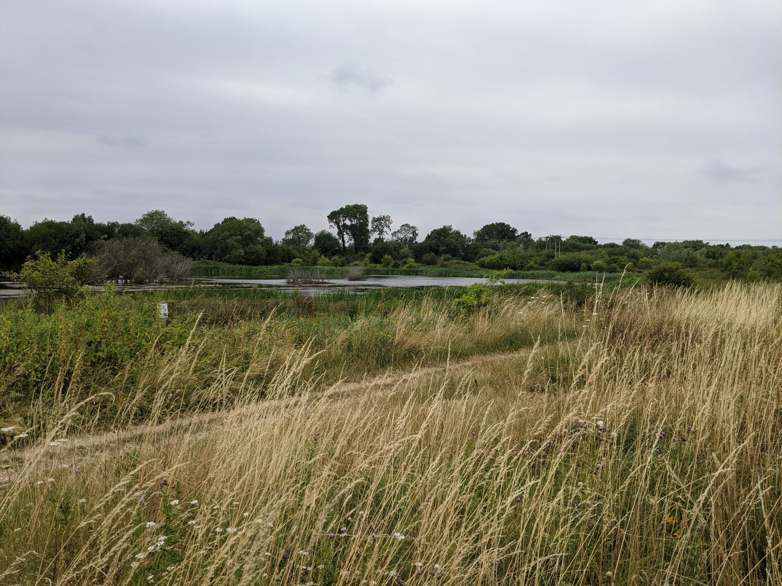
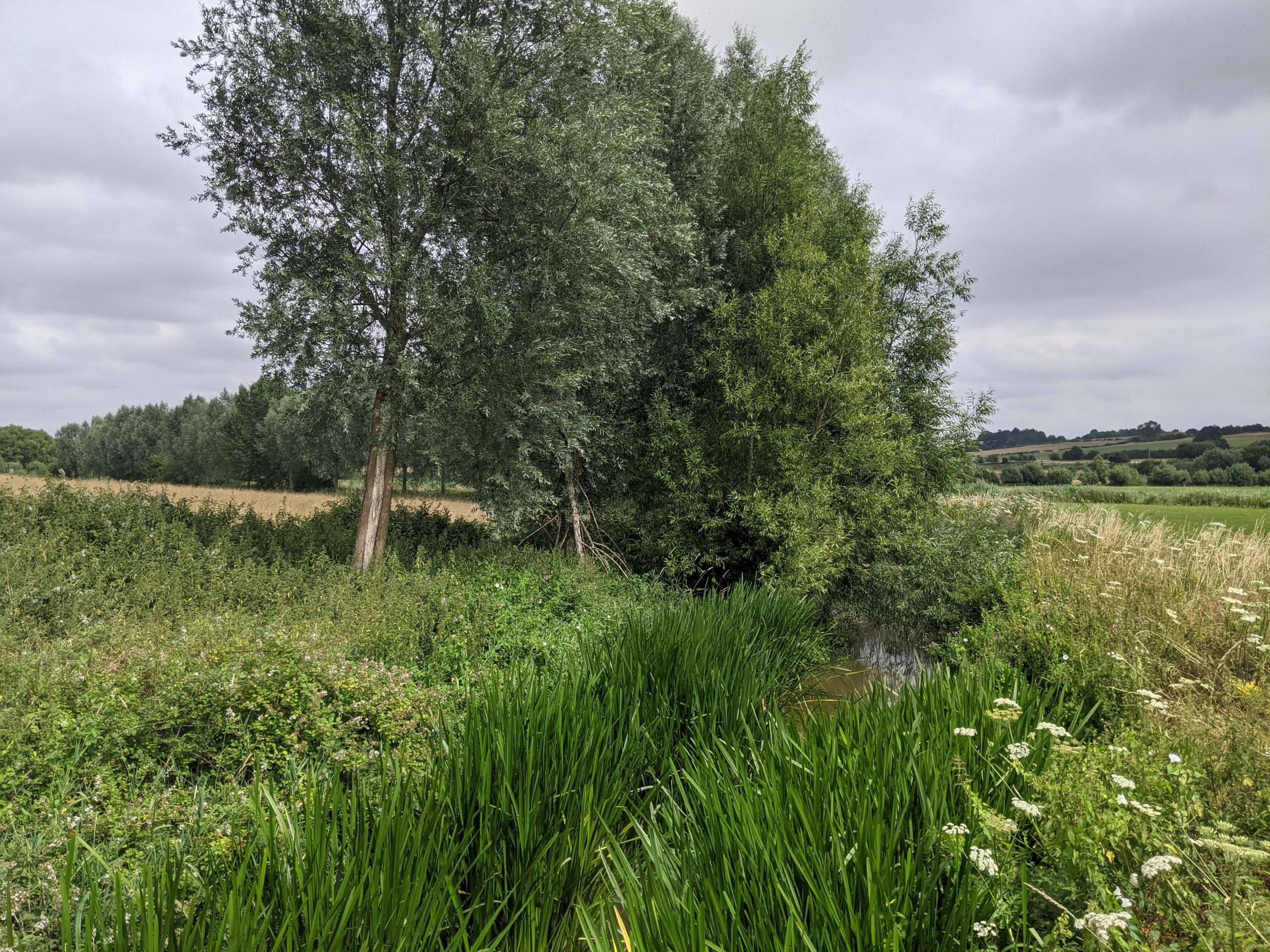
Wetland at Stratfield Brake
The UK government’s landmark Dasgupta Review highlights that our economies, livelihoods and wellbeing all depend on natural assets. It goes on to explain how biodiversity enables nature to be productive, resilient and adaptable.
Just as diversity within a portfolio of financial assets reduces risk and uncertainty, so diversity within a portfolio of natural assets increases nature’s resilience to shocks.
Globally, biodiversity is declining faster than at any time in human history. Indeed, the 2019 State of Nature report for the UK highlighted dramatic losses of biodiversity – noting a decline in ‘species abundances’ of 13% since 1970, a trend which appears to be accelerating. This is being driven by issues including agricultural management, climate change, urbanisation, pollution, hydrological change, invasive species and a lack of woodland management.
Bees and other pollinators in particular are declining. According to nature charity Buglife, over 97% of all flower-rich grasslands have been lost in England since the 1930s, reducing pollen and nectar sources and leading to a serious decline in bees, butterflies and hoverflies. This has led to concerns in the long term over the UK’s ability to grow food crops, which rely on pollination as an ‘ecosystem service’.
Climate change is also likely to have a range of impacts on habitats and species as conditions become unsuitable for them to thrive. Without good Green and Blue Infrastructure alongside increasingly urban and managed landscapes, we undermine nature’s ability to be productive, resilient and adapt to a changing climate.
However, there are signs of hope – legislation such as the UK’s Environment Act (2021) is providing momentum for efforts to build a nationwide Nature Recovery Network. Cherwell benefits from being part of initial Nature Recovery Network mapping at the County scale.
What does national policy say?
One of the key targets of the UK government’s 25 Year Environment Plan (25YEP) is to “achieve a growing and resilient network of land, water and sea that is richer in plants and wildlife”. This includes targets to restore 75% of protected terrestrial sites to favourable condition, as well as creating or restoring 500,000 hectares of wildlife-rich habitat outside this protected network.
Another target focuses on improving at least three quarters of the UK’s waters to close to their natural state as soon as practicable.
The subsequent Environment Act (2021) sets the 25YEP on a statutory footing. It includes a number of legally binding environmental targets – notably the provision of mandatory 10% Biodiversity Net Gain (BNG) and the mapping and maintenance of national and local Nature Recovery Networks (NRNs).
In 2020, the UK government committed to protecting 30% of land for nature conservation by 2030.
The National Planning Policy Framework (2021) emphasises that Local Plan policies should set out an overall strategy that makes sufficient provision for the conservation and enhancement of green infrastructure (Paragraph 20). Planning should enhance natural capital at a catchment or landscape scale across local authority boundaries.
The management of agricultural land lies outside of the planning process. However, the new Environmental Land Management Schemes are currently being developed to support the 25YEP. This offers valuable opportunities for improving the existing agricultural landscape to shift toward a more biodiverse, multi-purpose land management approach.
What does sub-regional policy say?
A set of 5 Environmental Principles has been developed for the Oxford-Cambridge Arc area. One of those principles is to protect, restore, enhance and create new nature areas and natural capital assets. This includes a flagship target to ‘double nature’ – meaning doubling the area of land managed for nature within the Arc.
The quality of water in local watercourses is a crucial part of the health of wider ecosystems. The Ox-Cam Local Natural Capital Plan calculates that across the Arc, natural assets provide £507 million in value for £747 million of value for water quality and supply.
The State of Nature in Oxfordshire report (2017) sets out 37 Conservation Target Areas (CTAs) across the wider County. 12 of these CTAs lie completely within Cherwell and they form an important starting point for this Strategy.
The CTAs cover just over 20% of the County by area (see interactive map to view these areas). They provide a focus for coordinated delivery of biodiversity work, agri-environment schemes and biodiversity enhancements through the planning system.
This focus is now being integrated with a Nature Recovery Network (NRN) approach, which identifies opportunities for recovering or enhancing biodiversity. Cherwell District Council’s biodiversity partner Wild Oxfordshire coordinates both the CTA and NRN projects. The mapping they carry out takes a lead from the so-called ‘Lawton principles’ of creating “bigger, better, more and joined up” habitats.
What does local policy say?
The existing Local Plan policy (ESD10: Protection and enhancement of biodiversity and natural environment) requires development proposals to demonstrate how they will not result in significant adverse effects on the integrity of any nature sites of international importance. Biodiversity Net Gain (BNG) should be sought and trees should be protected. The plan also contains a policy (ESD 9) specific for the protection of the Oxford Meadows SAC.
The Cherwell Corporate Biodiversity Action Plan (2016-2018) was designed to comply with the Council’s legislative obligations relating to important wildlife sites, habitats and species. The report highlighted that nature conservation has traditionally focused on the protection of special sites (such as SSSIs and Local Wildlife Sites). However, isolated reserves are unlikely to be able to sustain wildlife in the long term and connectivity is crucial.
Cherwell also produced a Community Nature Plan in 2018, the most recent version being the 2020-2022 publication. Its main purpose has been to demonstrate how the Council has fulfilled its statutory biodiversity duty under the National Environment and Rural Communities Act 2006. Connectivity is crucial. Sites will need to be buffered, extended and linked if wildlife is to be able to adapt to climate change. It highlights that the Conservation Target Areas (CTAs) will form an important component of the GBI network in Cherwell.
The delivery of the Community Nature Plan has always been dependent on close partnership working with key, trusted organisations as well as the contribution of a network of local conservation and community groups. These include TVERC, BBOWT, Wild Oxfordshire, RSPB Otmoor, Warriner School Farm and the Cherwell Swift Conservation Project.
What are the challenges and pressures in Cherwell?
Otmoor SSSI and RSPB site (Image source: RSPB)
There are very few nationally and locally designated sites in Cherwell. Indeed, many of the SSSIs are designated for their geological interest rather than nature conservation (see interactive map). This places an increased reliance on the locally designated site network to conserve and protect the District’s most important habitats and species.
However, Cherwell’s network of Local Nature Reserves, District Wildlife Sites (DWS) and Local Wildlife Sites (LWS) are small and sparse compared to other areas of the country. This limits their ability to underpin healthy ecosystems – as vital building blocks in landscape-scale conservation projects. Notable gaps in the network are north and south of Banbury and the central western spine of the District (see interactive map).
Despite Cherwell’s semi-rural nature and relative abundance of open space, many of those landscapes are failing to provide an environment in which biodiversity can thrive.
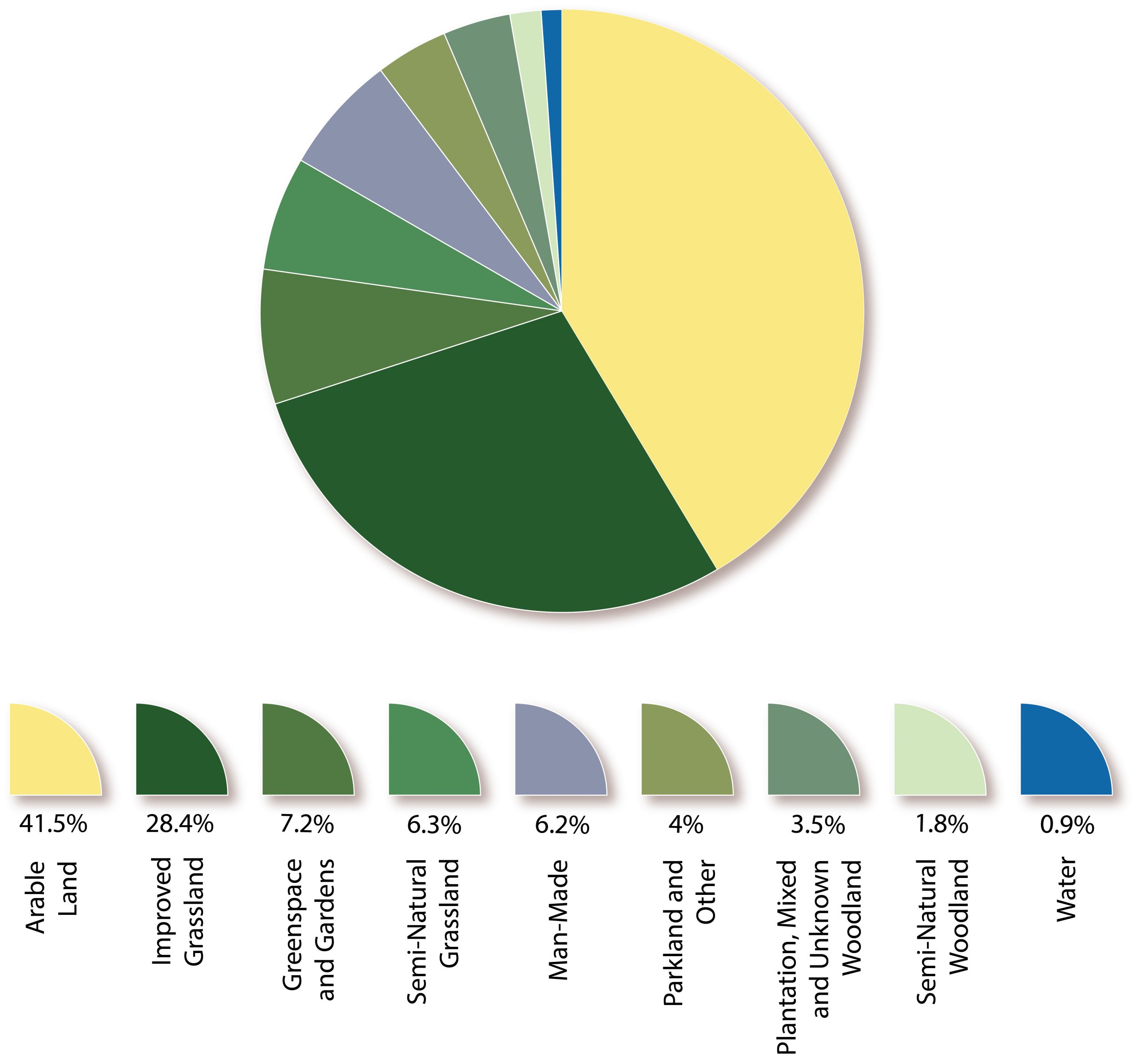
According to the Cherwell District Natural Capital report, 70% of the District is used for intensive agriculture, with only around 15% semi-natural habitat.
Figure: Data from Cherwell's Natural Capital report summarising dominant land uses across the District
The fragmented nature of Cherwell’s habitat network is a key concern, as highlighted by stakeholders engaged for this Strategy. New connections are needed to create wildlife corridors.
Indeed, mapping of Cherwell’s Nature Recovery Network (NRN) highlights the importance of key ‘core’ corridors lying along the District’s watercourses – notably the River Cherwell and its tributaries. Other areas highlighted for their importance include designated habitats in the south of the District and the links between them – notably the Otmoor SSSI/RSPB site and the cross-boundary Oxford Meadows SAC.
As habitat networks do not respect administrative boundaries, the mapping also highlights the importance of cross-boundary links. These include links to the Shabbington Woods, Waterperry Wood and Rushbeds Wood SSSIs to the south.
Large areas of the north of the District are designated within the NRN as the ‘wider landscape zone’. This recognises the important contribution that agricultural and urban landscapes beyond the Recovery zone can make to nature’s recovery and wider connectivity.
Population and housing growth over the next decade within Cherwell will be primarily directed to Banbury, Bicester and Kidlington areas. This increased growth will put pressure on the natural environment and existing greenspaces within and around each of these places.
Grimsbury Reservoir District Wildlife Site, Banbury
The most recent assessment in 2021 – 2022 found that only 49% of Local Wildlife Sites (LWS) in Cherwell were in ‘good condition’ which is only a 2% increase since the LWS were assessed in 2018 – 2019. If implemented, the 11 new proposed LWS and 3 proposed extensions would help make the nature network bigger and better.
“Recreational pressure” on fragile sites is another concern. This refers to the impact on ecosystems from disturbance and trampling by visitors, including the impact of dogs. Stakeholders engaged for this Strategy highlighted key concerns at Stoke Wood LWS, the Grimsbury Reservoir and Woodland District Wildlife Site and the Otmoor RSPB site.
River Cherwell corridor flowing through rural landscape
Stakeholders engaged for this Strategy highlighted concerns over water quality in Cherwell – a significant challenge in watercourses across the UK and one of the foremost challenges for nature recovery and resilience.
Cherwell District lies within the Thames River Basin and largely aligns with the Cherwell and Ray management catchment. The River Cherwell and its tributaries frequently flow through heavily urbanised areas, where there is little room for a semi-natural riparian zone. The Cherwell River has also been significantly modified for industrial purposes and to facilitate land drainage.
According to Environment Agency data, only 1 of 35 water bodies in Cherwell achieve ‘good’ ecological status. All other 34 bodies achieved ‘moderate’ or worse, and none achieved good chemical status.
One key factor leading to this is the impact of sewerage treatment works (STWs). A number of improvements to STWs are planned in the Thames Water Asset Management Plan for 2020-25.
Another key contributing factor is diffuse pollution from agriculture and rural land management. As the Cherwell catchment is dominated by clay, 80% of the catchment is of very low permeability. The dominance of agricultural land, combined with the high volume of surface run-off, increases the risk of fertilisers and pesticides entering the river.
The entire Oxon Ray catchment and Upper Cherwell catchment have been designated by Defra as a water quality high priority area for Catchment Sensitive Farming advice.
Cherwell’s Natural Capital mapping highlights challenges across the District in terms of the ability of habitats to support flood regulation, water quality regulation, carbon storage, air quality regulation, cooling and shading, and noise regulation. Some of the low scores for ‘regulating and cultural’ ecosystem service reflect the dominance of farmland and built-up areas.
Nature: Summary of key issues
Agricultural management and natural capital: Dominance of intensive agriculture is causing fragmentation of habitat networks and poor water quality, which limits Cherwell’s natural capital value. This includes resources for pollinators.
Few designated sites: Particularly in the north, there are relatively few sites designated for their nature value.
Woodland cover: Cherwell has low levels of woodland cover compared to regional averages.
Water quality: A significant concern in Cherwell’s river corridors – as a result of drivers including agricultural runoff, urbanisation and the impact of sewage treatment works. The District’s river corridors lie at the heart of Cherwell’s mapped Nature Recovery Network.
Need for partnership: Delivery of the Nature Recovery Network in Cherwell will need to be a multi-partner approach.
Projected growth: Significant projected development around Cherwell’s urban areas will need to seriously consider the needs of the surrounding GBI network, particularly habitat connectivity.