Ammanford and Cross Hands
A green-blue portrait of Ammanford and Cross Hands
Image: Afon Clydach at Black Mountain
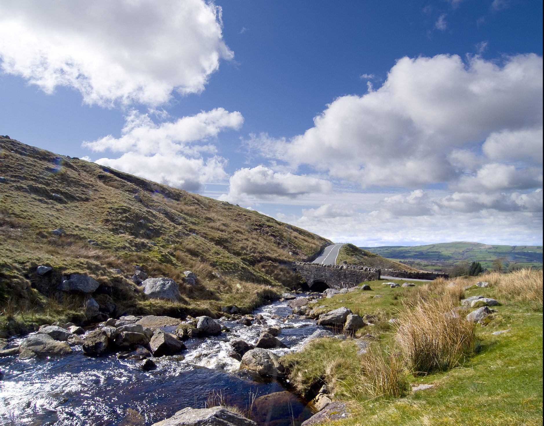
Ammanford town and Cross Hands village are located in a former mining area with a rich heritage – surrounded by the attractive landscape of the Loughor valley. The settlements cross undulating lowland with some incised valleys.
The River Gwili and River Loughor form a network of rivers and tributaries through the area. On the edges of the two towns, land is largely used for grazing livestock, with some wooded areas and small villages. There are some small, localised patches of peat on higher ground. The SSSI of Gweunydd Glan-y-glasnant, lies just outside Cross Hands and is notable for its rare grassland.
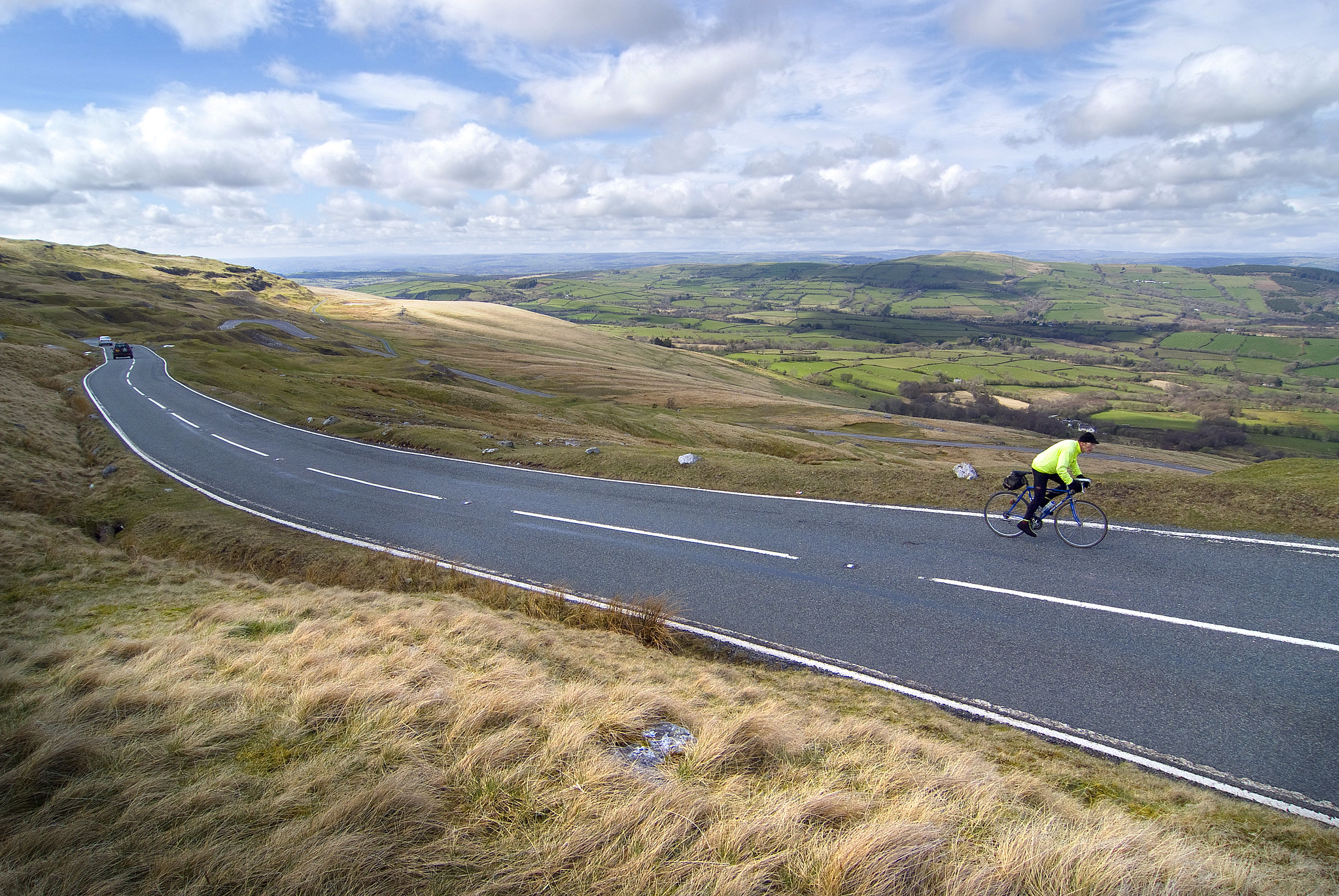
Ammanford has grown its reputation as a stopping off point along local and National Cycle Routes. The Wales Coast Path is accessible to the south of the town.
Ammanford also boasts several popular tourist and local attractions and the Friday street market brings lots of visitors to the town.
The cluster of heritage assets, the riverside frontage and access to parks including Betws Park and Ammanford Park all provide an important GBI context to the town.
Image: Cycling through the Ammanford Countryside
“There are plenty of parks around Ammanford town but not enough consistency in their maintenance… and very little to offer tourists”
– Stakeholders, online survey
See Appendix A for a summary of all stakeholder comments.
What are the key challenges facing Ammanford and Cross Hands?
Flooding
Natural Resources Wales identified Ammanford as one of the towns most at risk from flooding in Wales. There is a floodplain corridor along the floor of the Loughor valley to the east of Ammanford and Afon Marlas valley to its west.
A smaller area of Cross Hands is at risk of river flooding and there is surface water flood risk in low lying areas between these settlements.
Significant areas of impermeable ground cover are concentrated both in the older core of the two settlements and within the commercial/industrial units in Cross Hands.
Economy and public realm
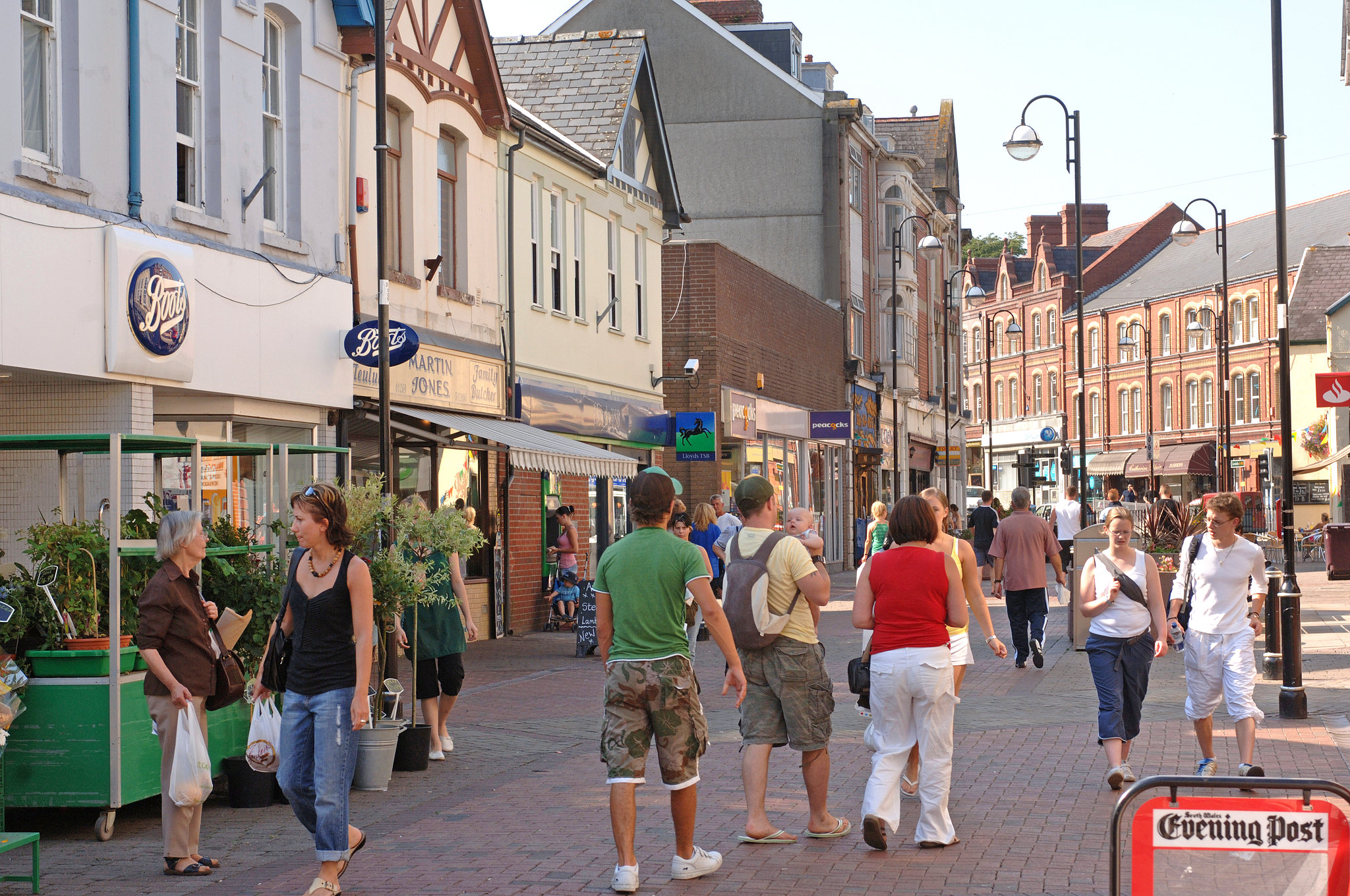
The centre of Ammanford and Cross Hands are made up largely of independent businesses and the Friday Street Market brings lots of visitors to Ammanford town centre.
However, existing areas of the town are disjointed and heavily dominated by cars. The village of Cross Hands is now largely dominated by the Cross Hands Business Park and Food Park, as well as the A48 running through it.
In both cases, poorly maintained spaces are detracting from attractiveness of the town and village.
Image: Ammanford Town Centre
Population
Parts of Ammanford and Cross Hands benefit from a vibrant and active local community. As elsewhere, the GBI network will need to respond to the needs of an ageing population.
The social and economic status across most of this area is around the average for Wales. However, parts of the centre of Ammanford are among the more deprived areas in Wales (see interactive map). This should be a focus for improved access to high quality open space and well-being resources.
Welsh language
Welsh speaking in Ammanford and Cross Hands remains above the average for both Carmarthenshire and Wales. In Cross Hands, recent efforts have ensured that the use of Welsh on signage has been expanded, making Welsh more prevalent.
Access to green space
Carmarthenshire’s Open Space Assessment (2020) shows that Cross Hands meets nearly all benchmarks for provision and access to natural green space.
However, the assessment highlighted a deficit in Ammanford in provision for young people and public open space. Improving the quality and quantity of open spaces for play and leisure will be a key way of improving the GBI network of both the town and village.
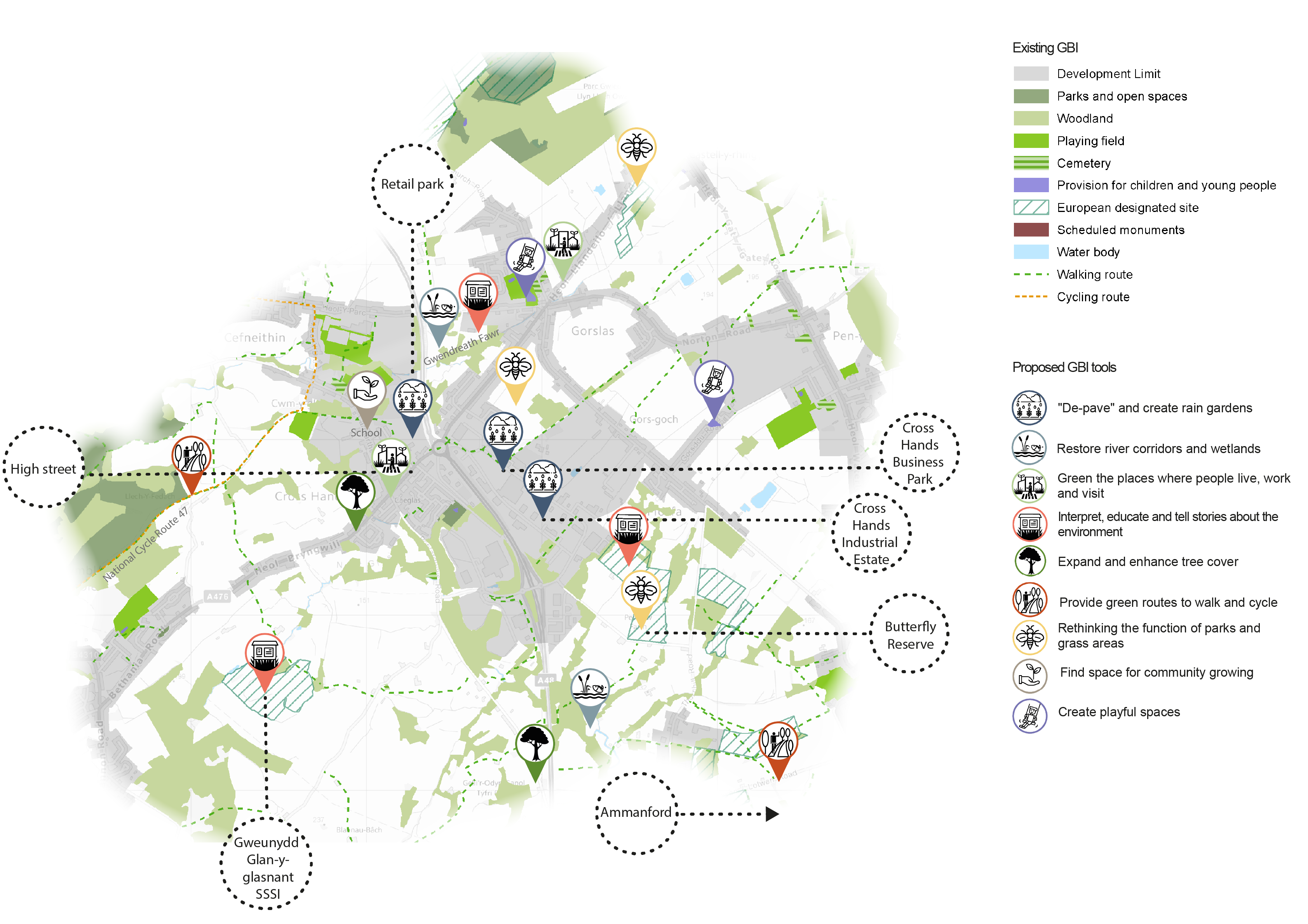
Map of key opportunities in Ammanford and Cross Hands
Ammanford Opportunity Map - Download image
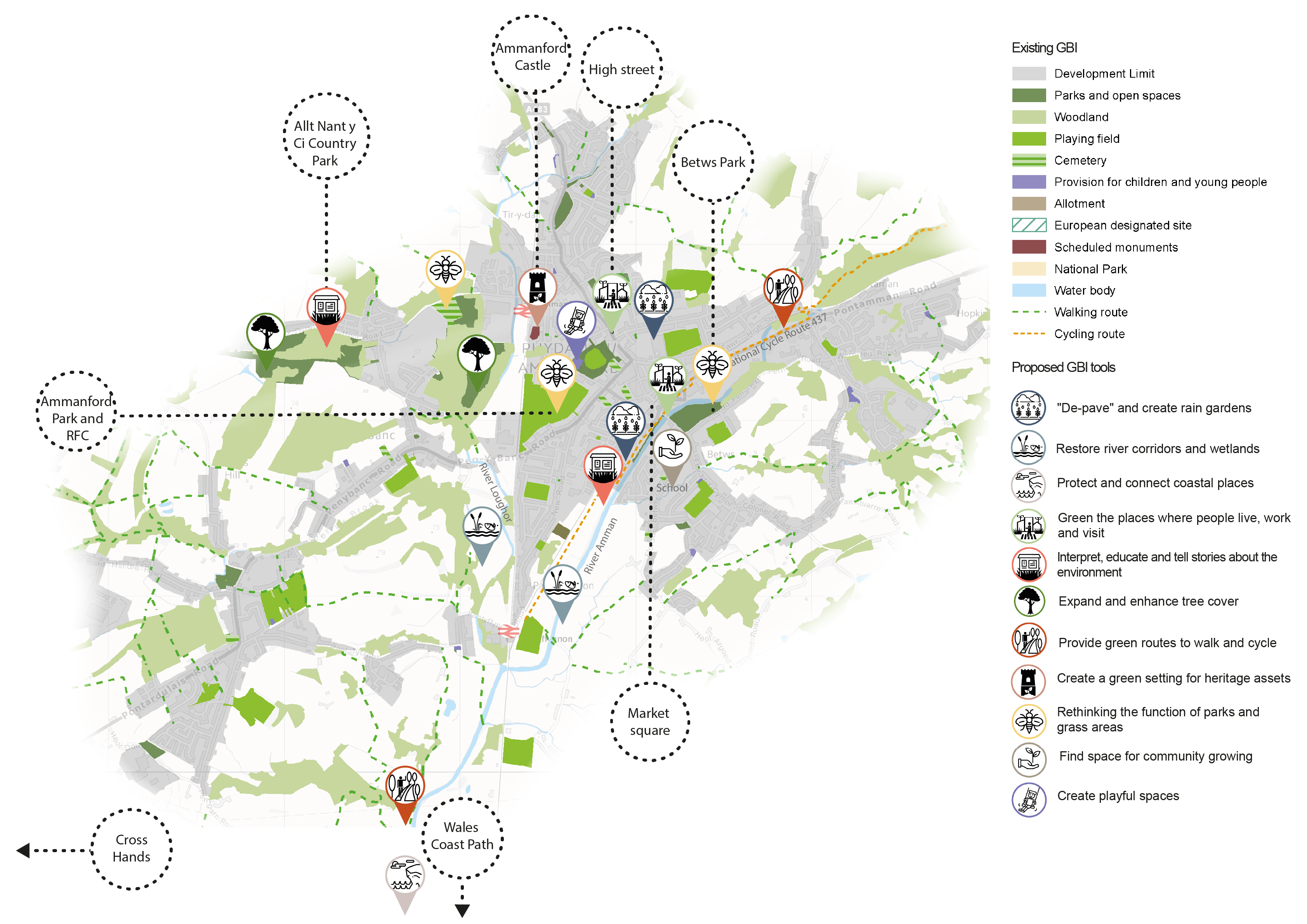
Cross Hands Opportunity Map - Download image
View the full GBI toolbox, learn how to use the toolbox for each town/ village and explore the map of green and blue infrastructure assets in Carmarthenshire in more detail.
Overview of key opportunities for Ammanford and Cross Hands’ GBI network
The paragraphs below provide further commentary on the GBI opportunities highlighted in the map above.

'Depave' and create rain gardens
Residential areas and key roads along the Loughor and Afon Marlas valley should be prioritised for protection against river flooding.
There are opportunities for depaving or increasing permeability at the extensive car parks, paved and heavily built-up areas in the towns – this would reduce the risk of surface water flooding.
The rain garden project at Carregaman Car Park (Ammanford) should be supported and replicated across the town at targeted locations.
Restore river corridors and wetland
Natural Resources Wales identified areas along the River Amman and River Loughor where planting additional floodplain and riparian woodland would aid Natural Flood Management (NFM). Areas for planting additional riparian woodland were also identified along the Gwendreath Fawr in Cross Hands.
Restoring habitats along the town’s key river corridors would help to provide important aquatic habitats. Key sites with potential for these improvements include: south of Cefneithin Road, the peatland south of Penygroes Rd, areas surrounding the Nant Glas where it intersects with out-of-town shopping area, and south of Foundry Road by the River Amman.
The river in Betws Park is already popular for recreation and could be further enhanced with more wildflower areas, shelters, hides and facilities.

Protect and connect coastal places
The Wales Coast Path can be accessed from the south of the town. Connecting the town to this key route along green walking and cycling routes would strengthen its link to Carmarthen Bay.
Green the places where people live, work and visit
The Recovery Masterplan for Ammanford and Sustainable Economic Growth Plan for Cross Hands both highlight opportunities for using the towns’ GBI to enhance the town centres and create green links between the local towns. A key objective is to create a stronger sense of place and to attract younger families.
Opportunities for improving the visitor environment would include the use of traffic calming measures alongside street trees, rain gardens, pocket parks and high quality green paved areas. Green walls could enhance the market square and green routes could connect the schools and the Arcade with the town centre.

Interpret, educate and tell stories about the environment
Educational and interpretation boards should be prioritised around the town’s rivers and green spaces – highlighting bird watching opportunities and providing information on local habitats and species.
Improving the signage at All Nant y Ci Country Park would help to better promote its natural assets to the local community.

Expand and enhance tree cover
The town would benefit from introducing street trees along key corridors. The reconfiguration of some parking spaces will also help to create space for street trees in the public realm.
Wider woodland planting in the surrounding landscape will help to address wider resilience of the natural environment. Parks could be enhanced for people and nature by expanding and managing planting in Mynydd mawr Woodland Park, All Nant y Ci Country Park and the woodland south of Tir-y-dail Cemetery.

Provide green routes to walk and cycle
Safe and attractive green routes should provide connections to key destinations including the Wales Coast Path, the Amman Valley, Betws Park and the National Cycle Route.
The riverside will be a key focus for improving footpaths. In Ammanford, this should connect the riverside walk with the Coastal Path and improve the pedestrian route across Wind Street and the railway. High quality wayfinding will be important for supporting tourism.

Create a green setting for heritage assets
Enhancing and greening the surrounding area of the remains of Ammanford Castle would promote the castle as a heritage asset – this could include areas of wildflower.
The “greening” of walking routes between Ammanford Castle and the high street would also create an important connection.

Rethink the functions of parks and grass areas
Opportunities for providing multiple functions in green spaces can be found in Betws Park, the site north of Cross Hands business park and the Butterfly Conservation Reserve site south of the business park. Additional potential focus areas include Tir-y-dail Cemetery, Ammanford Park and Recreation Ground, Ammanford car park and the River Amman cycle path.
Interventions could include habitat creation, wildflower planting and creating a ‘wilder’, less managed landscape. The existing successful Caeau Mynydd Mawr Marsh Fritillary Project in Cross Hands could also be expanded as part of these interventions.
Wildflower planting along mown grass verges should be focussed at key “gateways” to the town – including along the new link road from Cross Hands and along the railway corridor. Ammanford’s close connection with coal could be further recognised by safeguarding examples of colliery land which have been naturally reclaimed by a rich flora.

Find space for community growing
Growing spaces established in the grounds of Ammanford and Cross Hands schools could also function as outdoor classrooms. Within these grounds, living walls and rain gardens features would also reduce surface water run-off and combat air pollution.
Other disused areas of open space should be explored for potential transfer to community groups as community gardens.

Create playful spaces
This might take the form of greening existing playful spaces, such as Ammanford Park and recreation Ground. Alternatively, it might include the delivery of new incidental play features (such as landscaping or public art) along river corridors and coastal paths.
This would make both towns more inviting and sensory to explore on foot and would attract visitors as part of wider tourism initiatives.
Key challenges in Ammanford and Cross Hands beyond GBI include boosting the local economy and high street. This is discussed in the Recovery Masterplan for Ammanford and Sustainable Economic Growth Plan for Cross Hands.