St Clears Action Plan
A green-blue portrait of St Clears
Image: the riverside setting for St Clears
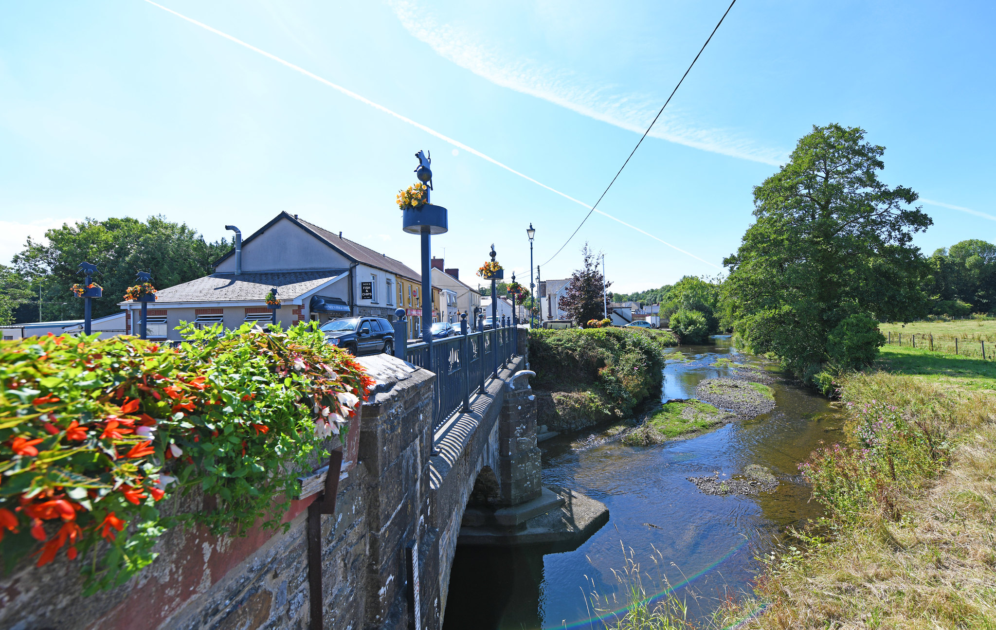
St Clears lies on the confluence of three rivers – the Taf, the Dewi Fawr and the Cynin. They join and flow into the western arm of the Three Rivers Estuary.
The settlement sits on an area of higher ground between the Taf and Cynin rivers. The surrounding landscape is rolling hills. However, woodland is sparse. Former saltmarsh in the area has been reclaimed for agriculture.
St Clears links to the south of the town to the Wales Coast Path and features as part of the circular cycling route connecting with Laugharne and Whitland. The proximity to the coast also gives it an important role as a tourist centre.
The river flowing through the town is tidal and there are recreation opportunities on the riverside for walking. The motte and bailey remains of St Clears Castle overlook the river.
However, despite St Clear’s riverside location and setting, the town centre lacks a strong connection to the river corridor and to its wider natural environment.
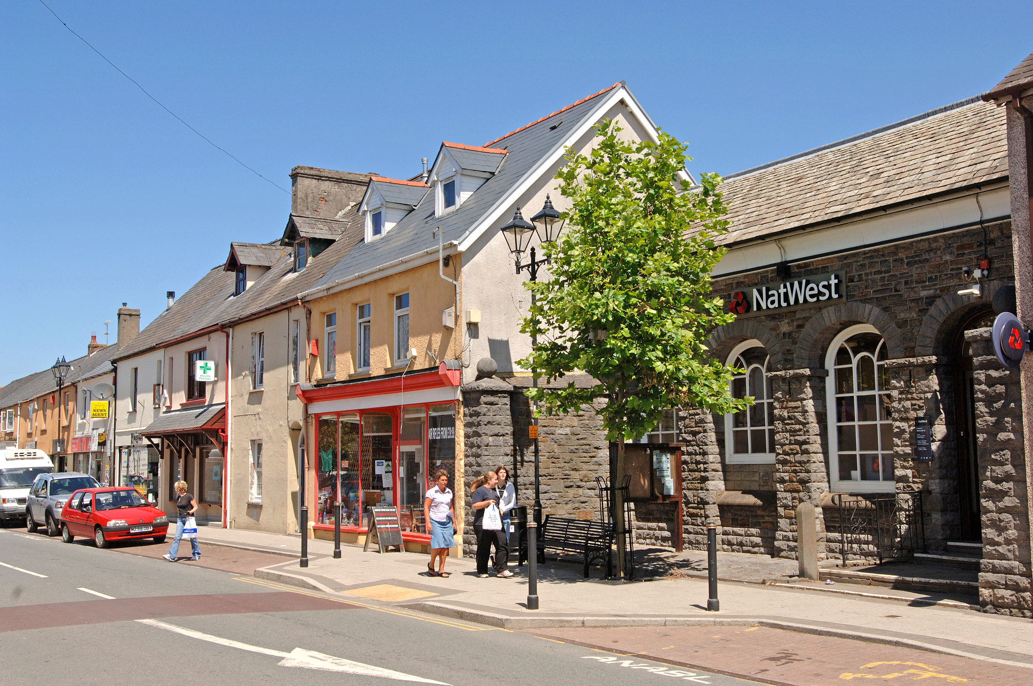
Image: St Clears town centre
“The riverside path is an important amenity, with scope for adapting to tidal erosion and enhancement for local community and nature.”
– Stakeholder, online survey
See Appendix A for a summary of all stakeholder comments.
What are the key challenges facing St Clears?
Flooding
Most of the settlement lies outside of the floodplain, other than a small section either side of the Afon Cynin – which benefits from flood defences. However, climate change is also expected to gradually increase the intensity of rainfall, further increasing flood risk.
Data from Welsh Water highlights particular areas with high levels of impermeable surfaces, which focus on the village centre, along with some small outlying areas.
Economy and public realm
Agriculture, light industry, services and retail are the backbone of St Clears’ economy. Easy access to Carmarthen and the A40 has encouraged the growth of areas throughout the town. However, the town centre is small and mostly serving the need of the local community. The visitor economy is also relatively under-developed.
A large number of vacant and poorly maintained town centre buildings and spaces detract from an otherwise attractive town centre. Making more of St Clear’s natural environment, cycling offer and promoting the visitor economy could support the growth of the tourism industry locally.
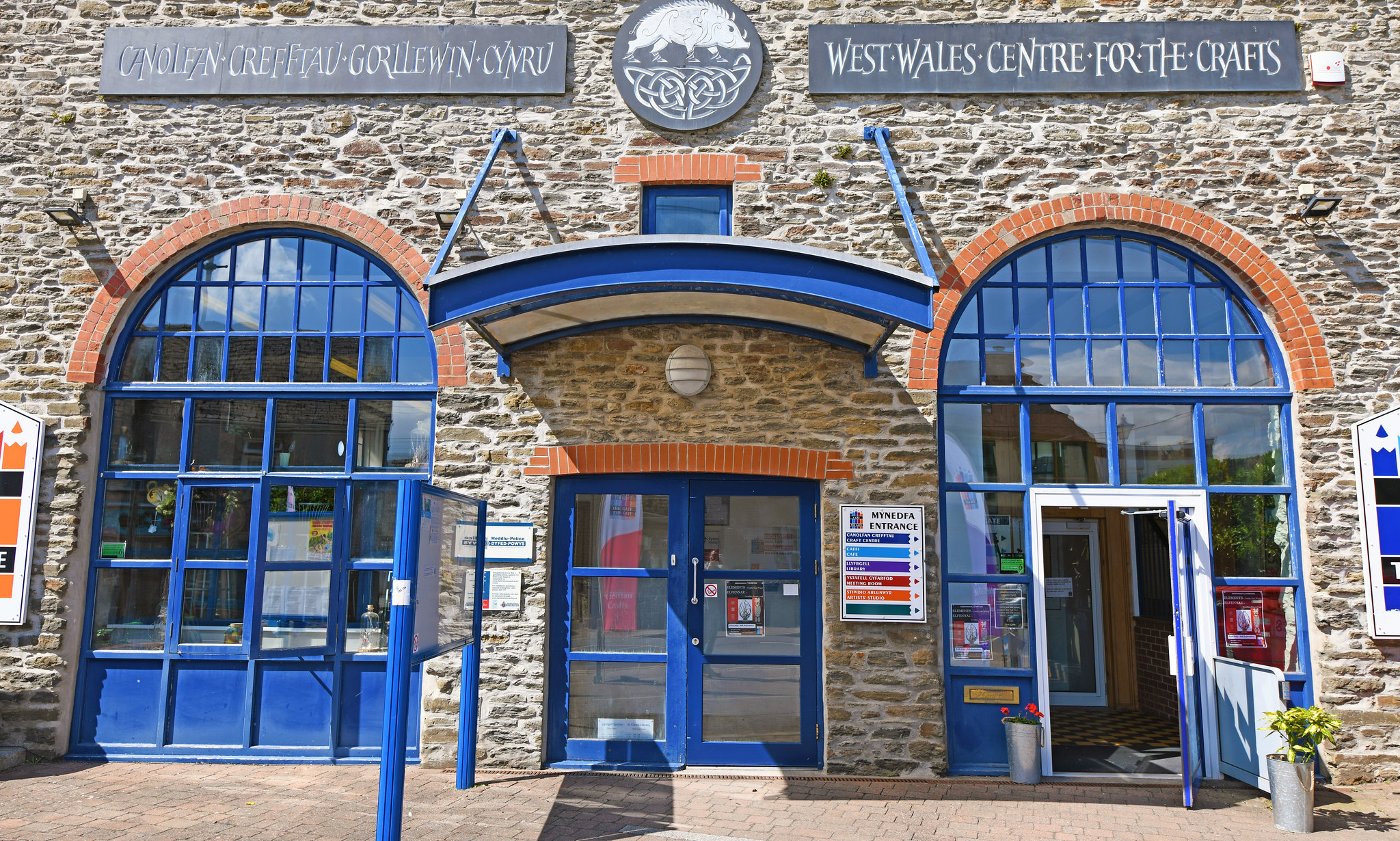
Image: West Wales Centre for the Crafts
Population
St Clears is seeing modest population growth in its local community. As elsewhere, the GBI network will need to respond to the needs of an ageing population. The social and economic status of St Clears residents is around the average for Wales for most areas of the town. Improved access to a high quality GBI network across the town would be a valuable resource to enhance well-being.
Welsh language
Consultees reported little visual use of Welsh and Welsh speaking staff in the town, or Welsh speakers establishing their own businesses in St Clears. However, Welsh speaking in St Clears remains above the average for both Carmarthenshire and Wales.
Access to green space
Carmarthenshire’s Open Space Assessment (2020) highlights a deficit in provision or access to public open space, such as formal parks and gardens. It also shows a deficit in provision for children and young people.
Map of key opportunities in St Clears
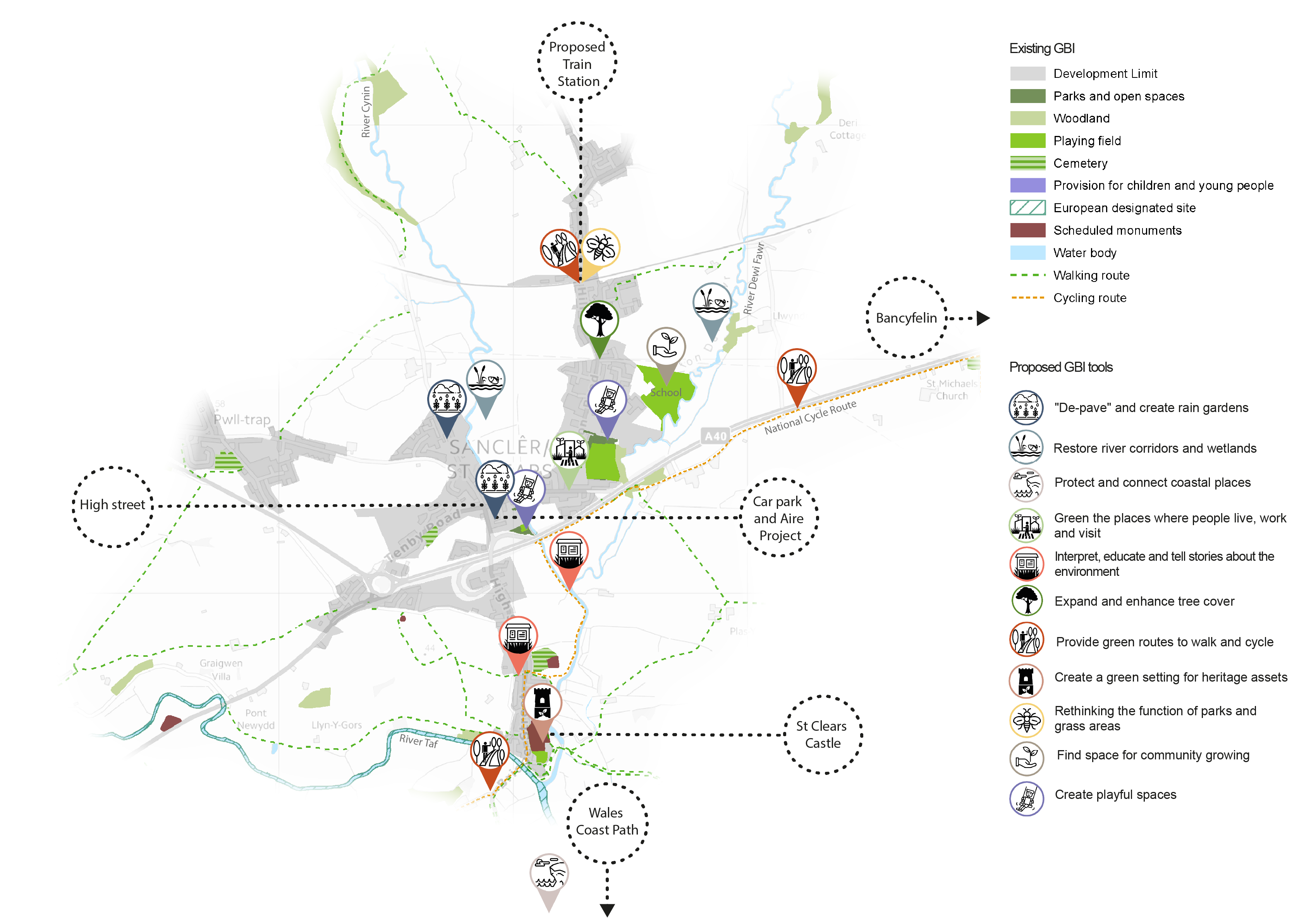
View the full GBI toolbox, learn how to use the toolbox with each town and explore the map of green and blue infrastructure assets in Carmarthenshire in more detail.
Overview of key opportunities for St Clears’ GBI network
The paragraphs below provide further commentary on the GBI opportunities highlighted in the map above.

'Depave' and create rain gardens
Residential areas either side of the Afon Cynin, and key roads such as High Street and Pentre Road, should be prioritised for protection against river and sea flooding.
There are opportunities for depaving or increasing permeability at the extensive car parks, paved and heavily built-up areas in the town. This would reduce the risk of surface water flooding.
Targeted rain gardens and SuDS could be introduced in the car parks of St Clears as part of the Aire Project to improve the car park for overnight camping. SuDS features should also be prioritised in significant new proposed developments such as St Clear’s Business Park.
Restore river corridors and wetlands
Natural Resources Wales has identified areas along the Afon Cynin and Dewi Fawr where planting additional floodplain and riparian woodland would aid Natural Flood Management (NFM). Restoring habitats and creating riparian tree cover along the town’s key river corridors would also help to provide important aquatic and terrestrial habitats.
Sections of the river in the centre of town, such as where the river meets Pentre Road, could be further enhanced for both wildlife and people with more areas of habitat, hides and access to the river. Control of Himalayan Balsam and other invasives may be needed in order to help native flowers flourish.

Protect and connect coastal places
The Wales Coast Path can be reached south of St Clears. Improved connections between the town to the Wales coast path along green walking and cycling routes would strengthen its link to Carmarthen Bay.
Green the places where people live, work and visit
The St Clears Economic Growth Plan seeks opportunities to improve pedestrian movements with wider pavements, larger public spaces and opportunities for new green landscape features. It explores opportunities to use planting and seating to create a clearer town centre with attractive outdoor space for music and performance. It is important that these improvements create value for people, nature and place simultaneously, as well as addressing surface water flooding. Opportunities should also focus on the riverside area, on Pentre Road and Bridge and on Station Road.

Interpret, educate and tell stories about the environment
Interpretation boards around the town’s rivers and green spaces should highlight bird watching opportunities and provide information on local habitats and species.
Improving the signage on natural features around assets like the mott and bailey, and on routes that link to the Wales Coast Path, may encourage visitors to stay longer and explore the town. More could be made of the town’s association with the Rebecca Riots with improved visitor information and road signage.

Expand and enhance tree cover
Key corridors where street trees can be targeted include the walking route between the new railway station and the town and the high street. While narrow streets make street trees more challenging, the reconfiguration of some parking spaces can help make space for street trees in the public realm.
Wider woodland planting in the surrounding landscape will be important to improve wider environmental resilience beyond the town.

Provide green routes to walk and cycle
Key destinations that should be better linked by green routes include the Wales Coast Path, the town centre and along the National Cycle Route to Bancyfelin. The circular cycle route connecting with Laugharne and Whitland could be a further focus area for greening.
Footpaths should be improved through the town and on routes connecting the riverside walk with the Coastal Path. These must be protected against tidal erosion. High quality wayfinding will be important, particularly to encourage tourism within the town.
GBI features should be an integral part of plans for the proposed new train station and transport hub – including both green routes and urban greening features which provide an attractive ‘gateway’ to the town.

Create a green setting for heritage assets
Creating green places where visitors and locals can enjoy St Clear’s heritage assets would increase the attractiveness of the town.

Rethink the functions of parks and grass areas
Opportunities to provide multiple functions within existing green spaces should be delivered in local parks and at the proposed new train station and transport hub. This could include wildflower planting and the shaping of a ‘wilder’, less managed landscape.
In addition, wildflower planting should be pursued along mown grass verges, particularly at the “gateways” to the town and along the railway corridor, to provide valuable linear habitats.

Find space for community growing
Growing spaces established in the grounds of St Clears’ schools could also function as outdoor classrooms. Within these grounds, living walls and rain gardens features would also reduce surface water run-off and combat air pollution.
Other disused areas of open space should be explored for potential transfer to community groups as community gardens.

Create playful spaces
Existing play spaces in St Clears offer opportunities for enhancement to create more scope for nature-based, imaginative play which also benefits biodiversity – including at the play space at the rear of the St Clears car park.
However, there is also an opportunity to weave “playful spaces” throughout the town’s GBI network, by providing incidental play features (such as landscaping or public art) along river corridors and elsewhere. This would make St Clears a more inviting and sensory place to explore on foot at all ages.
Key opportunities in St Clears beyond GBI include boosting the local economy and high street and retaining and attracting working-age population by improving services and boosting the local business and visitor economy. This is discussed further in the Economic Growth Plan for St Clears.